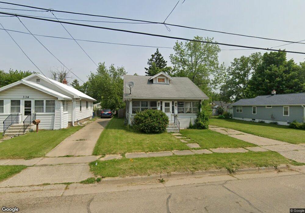
330 Surby Ave Battle Creek, MI 49015
Central Battle Creek NeighborhoodEstimated Value: $135,168 - $176,000
2
Beds
1
Bath
845
Sq Ft
$178/Sq Ft
Est. Value
About This Home
This home is located at 330 Surby Ave, Battle Creek, MI 49015 and is currently estimated at $150,792, approximately $178 per square foot. 330 Surby Ave is a home located in Calhoun County with nearby schools including Lakeview Middle School, Lakeview High School, and Arbor Academy.
Ownership History
Date
Name
Owned For
Owner Type
Purchase Details
Closed on
Jan 21, 2021
Sold by
Miller Eric and Miller Rachel
Bought by
Weenum Rustin
Current Estimated Value
Home Financials for this Owner
Home Financials are based on the most recent Mortgage that was taken out on this home.
Original Mortgage
$88,369
Outstanding Balance
$78,814
Interest Rate
2.67%
Mortgage Type
FHA
Estimated Equity
$71,978
Purchase Details
Closed on
Mar 5, 1999
Sold by
Franck Co-Trustees
Bought by
Hunt
Create a Home Valuation Report for This Property
The Home Valuation Report is an in-depth analysis detailing your home's value as well as a comparison with similar homes in the area
Home Values in the Area
Average Home Value in this Area
Purchase History
| Date | Buyer | Sale Price | Title Company |
|---|---|---|---|
| Weenum Rustin | $90,000 | Ata National Title Group Llc | |
| Hunt | $60,200 | -- |
Source: Public Records
Mortgage History
| Date | Status | Borrower | Loan Amount |
|---|---|---|---|
| Open | Weenum Rustin | $88,369 |
Source: Public Records
Tax History Compared to Growth
Tax History
| Year | Tax Paid | Tax Assessment Tax Assessment Total Assessment is a certain percentage of the fair market value that is determined by local assessors to be the total taxable value of land and additions on the property. | Land | Improvement |
|---|---|---|---|---|
| 2025 | -- | $59,000 | $0 | $0 |
| 2024 | $1,583 | $55,057 | $0 | $0 |
| 2023 | $1,853 | $46,886 | $0 | $0 |
| 2022 | $1,480 | $38,002 | $0 | $0 |
| 2021 | $1,411 | $35,630 | $0 | $0 |
| 2020 | $1,887 | $34,890 | $0 | $0 |
| 2019 | $1,887 | $32,950 | $0 | $0 |
| 2018 | $1,887 | $31,793 | $3,899 | $27,894 |
| 2017 | $1,830 | $30,184 | $0 | $0 |
| 2016 | $1,825 | $27,269 | $0 | $0 |
| 2015 | $1,762 | $27,055 | $3,930 | $23,125 |
| 2014 | $1,762 | $28,011 | $3,930 | $24,081 |
Source: Public Records
Map
Nearby Homes
- 329 Surby Ave
- 348 Lakeview Ave
- 235 Fairfield Ave
- 251 Columbia Ave W Unit 1
- 225 Columbia Ave W Unit 2
- 137 Fairfield Ave
- 547 Wentworth Ave
- 127 W Territorial Rd
- 1 Hiawatha Cove Trail Unit 23
- 184 Territorial Rd W
- 32 Territorial Rd E
- 20 Hiawatha Dr
- 41 Randolph St
- 1 Grand Blvd
- 179 Eldred St
- 77 Leitch Dr
- 143 Waupakisco Beach
- 100 Eldred St
- 296 Meachem Ave
- 35 Eldred St
- 320 Surby Ave
- 336 Surby Ave
- 340 Surby Ave
- 314 Surby Ave
- 323 Iroquois Ave
- 329 Iroquois Ave
- 319 Iroquois Ave
- 335 Iroquois Ave
- 350 Surby Ave
- 313 Iroquois Ave
- 339 Iroquois Ave
- 306 Surby Ave
- 323 Surby Ave
- 335 Surby Ave
- 319 Surby Ave
- 345 Iroquois Ave
- 313 Surby Ave
- 309 Surby Ave
- 343 Surby Ave
- 309 Iroquois Ave