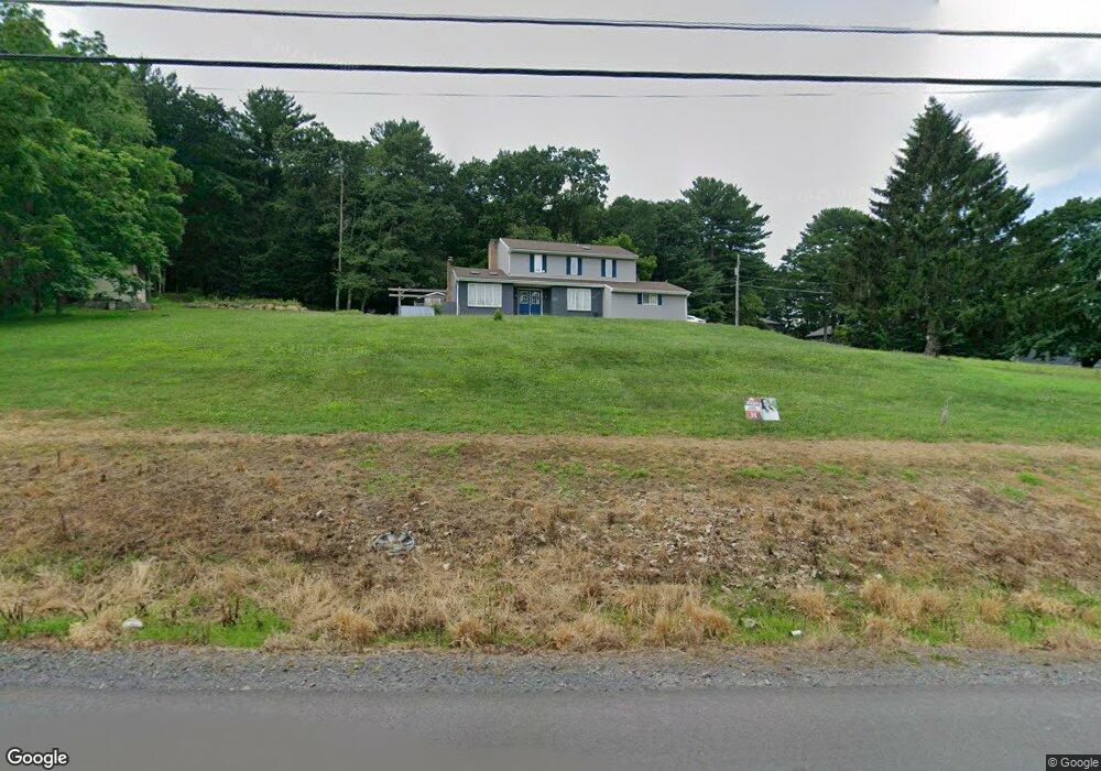
330 Turkey Path Rd Sugarloaf, PA 18249
Estimated Value: $338,788 - $395,000
--
Bed
--
Bath
2,100
Sq Ft
$173/Sq Ft
Est. Value
About This Home
This home is located at 330 Turkey Path Rd, Sugarloaf, PA 18249 and is currently estimated at $362,447, approximately $172 per square foot. 330 Turkey Path Rd is a home with nearby schools including Hazleton Area High School.
Ownership History
Date
Name
Owned For
Owner Type
Purchase Details
Closed on
Apr 25, 2014
Sold by
Goliath Properties Inc
Bought by
Provanzo Joseph Michael and Uliano Alysia Marie
Current Estimated Value
Home Financials for this Owner
Home Financials are based on the most recent Mortgage that was taken out on this home.
Original Mortgage
$207,668
Outstanding Balance
$157,792
Interest Rate
4.25%
Mortgage Type
FHA
Estimated Equity
$204,655
Purchase Details
Closed on
Nov 13, 2013
Sold by
Lazo Edward and Lazo Mary Alice
Bought by
Goliath Properties Inc
Create a Home Valuation Report for This Property
The Home Valuation Report is an in-depth analysis detailing your home's value as well as a comparison with similar homes in the area
Home Values in the Area
Average Home Value in this Area
Purchase History
| Date | Buyer | Sale Price | Title Company |
|---|---|---|---|
| Provanzo Joseph Michael | $211,500 | None Available | |
| Goliath Properties Inc | $127,200 | None Available |
Source: Public Records
Mortgage History
| Date | Status | Borrower | Loan Amount |
|---|---|---|---|
| Open | Provanzo Joseph Michael | $207,668 |
Source: Public Records
Tax History Compared to Growth
Tax History
| Year | Tax Paid | Tax Assessment Tax Assessment Total Assessment is a certain percentage of the fair market value that is determined by local assessors to be the total taxable value of land and additions on the property. | Land | Improvement |
|---|---|---|---|---|
| 2025 | $4,804 | $215,700 | $42,100 | $173,600 |
| 2024 | $4,582 | $215,700 | $42,100 | $173,600 |
| 2023 | $4,499 | $215,700 | $42,100 | $173,600 |
| 2022 | $4,459 | $215,700 | $42,100 | $173,600 |
| 2021 | $4,205 | $215,700 | $42,100 | $173,600 |
| 2020 | $4,134 | $215,700 | $42,100 | $173,600 |
| 2019 | $3,857 | $215,700 | $42,100 | $173,600 |
| 2018 | $3,716 | $215,700 | $42,100 | $173,600 |
| 2017 | $3,638 | $215,700 | $42,100 | $173,600 |
| 2016 | -- | $215,700 | $42,100 | $173,600 |
| 2015 | -- | $215,700 | $42,100 | $173,600 |
| 2014 | -- | $215,700 | $42,100 | $173,600 |
Source: Public Records
Map
Nearby Homes
- 708 N Main St
- 61 Rhedwood Ave
- 10 E County Rd
- 11-B Park Cir
- 31 Mountain Side Dr
- 0 Mountain Ridge Rd
- 5 Short Ln
- 16 Cindy Dr
- 254 Buck Mountain Blvd
- 0 Buck Mountain Blvd Unit 25-3888
- 0 Buck Mountain Blvd Unit 762442
- 0 Mountain Rd
- Lot 194 Buck Mountain Blvd
- 10 Rear Old Berwick (Burma Rd) Rd
- 6 Sydney Way
- 291 Stoney Mountain Dr
- MV-073 Stony Mountain Dr
- MVII.028 Stoney Mountain Dr
- 0 Hawk Mountain Dr
- 145 Mountain Rd
- 326 Turkey Path Rd
- 336 Turkey Path Rd
- 331 Turkey Path Rd
- 320 Turkey Path Rd
- 325 Turkey Path Rd
- 0 Turkey Path Rd
- 353 Turkey Path Rd
- 319 Turkey Path Rd
- 316 Turkey Path Rd
- 4 Westfield Cir
- 2 Westfield Cir
- 313 Turkey Path Rd
- 350 Turkey Path Rd
- 337 Turkey Path Rd
- 162 Lakeview Trail
- 308 Turkey Path Rd
- 309 Turkey Path Rd
- 126 Brookhill Rd
- 130 Brookhill Rd
- 118 Brookhill Rd