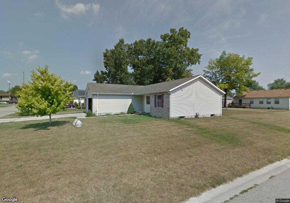
3302 Ashland Ct Port Huron, MI 48060
Estimated Value: $179,000 - $217,000
3
Beds
2
Baths
1,347
Sq Ft
$148/Sq Ft
Est. Value
About This Home
This home is located at 3302 Ashland Ct, Port Huron, MI 48060 and is currently estimated at $199,935, approximately $148 per square foot. 3302 Ashland Ct is a home located in St. Clair County with nearby schools including Cleveland Elementary School, Central Middle School, and Port Huron High School.
Ownership History
Date
Name
Owned For
Owner Type
Purchase Details
Closed on
Jul 30, 2025
Sold by
Klais Gregory M
Bought by
Reed Heather
Current Estimated Value
Purchase Details
Closed on
Jul 16, 2010
Sold by
Federal National Mortgage Association
Bought by
Klais Gregory M
Home Financials for this Owner
Home Financials are based on the most recent Mortgage that was taken out on this home.
Original Mortgage
$60,790
Interest Rate
4.63%
Mortgage Type
FHA
Purchase Details
Closed on
Jul 27, 2009
Sold by
Wells Fargo Bank Na
Bought by
Federal National Mortgage Association
Purchase Details
Closed on
Jul 23, 2009
Sold by
Metcalfe Michelle
Bought by
Wells Fargo Bank Na
Create a Home Valuation Report for This Property
The Home Valuation Report is an in-depth analysis detailing your home's value as well as a comparison with similar homes in the area
Home Values in the Area
Average Home Value in this Area
Purchase History
| Date | Buyer | Sale Price | Title Company |
|---|---|---|---|
| Reed Heather | -- | None Listed On Document | |
| Reed Heather | -- | None Listed On Document | |
| Klais Gregory M | $61,610 | Attorneys Title Agency Llc | |
| Federal National Mortgage Association | -- | None Available | |
| Wells Fargo Bank Na | $81,333 | None Available |
Source: Public Records
Mortgage History
| Date | Status | Borrower | Loan Amount |
|---|---|---|---|
| Previous Owner | Klais Gregory M | $60,790 |
Source: Public Records
Tax History Compared to Growth
Tax History
| Year | Tax Paid | Tax Assessment Tax Assessment Total Assessment is a certain percentage of the fair market value that is determined by local assessors to be the total taxable value of land and additions on the property. | Land | Improvement |
|---|---|---|---|---|
| 2025 | $3,095 | $98,000 | $0 | $0 |
| 2024 | $2,760 | $95,700 | $0 | $0 |
| 2023 | $2,614 | $84,800 | $0 | $0 |
| 2022 | $2,668 | $72,900 | $0 | $0 |
| 2021 | $2,547 | $61,300 | $0 | $0 |
| 2020 | $2,557 | $58,400 | $58,400 | $0 |
| 2019 | $2,511 | $42,200 | $0 | $0 |
| 2018 | $2,454 | $42,200 | $0 | $0 |
| 2017 | $2,252 | $38,300 | $0 | $0 |
| 2016 | $2,013 | $38,300 | $0 | $0 |
| 2015 | $1,975 | $38,500 | $38,500 | $0 |
| 2014 | $1,975 | $37,000 | $37,000 | $0 |
| 2013 | -- | $36,100 | $0 | $0 |
Source: Public Records
Map
Nearby Homes
- 3230 Ashland Ct
- 2506 Vanness St
- 2511 Vanness St
- 2513 Vanness St
- 2600 Vanness St
- 2702 Vanness St
- 9999 Cleveland Ave
- 3830 Military St
- 3136 Military St
- 000 Gratiot Blvd
- 00 Gratiot Blvd
- 3104 Sturges St
- 2627 24th St
- 69 Gratiot Blvd
- 0 Dove Rd Unit G31368528
- 105 Gratiot Blvd
- 3548 Cleveland St
- 3333 Ravenswood Rd Unit 4A
- 3333 Ravenswood Rd
- 9999 24th St
- 3303 Avondale St
- 3220 Ashland Ct
- 2316 Ashland Ct
- 3233 Avondale St
- 3231 Ashland Ct
- 2310 Ashland Ct
- 2328 Ashland Ct
- 3305 Ashland Ct
- 3223 Ashland Ct
- 3321 Ashland Ct
- 2334 Ashland Ct
- 2302 Ashland Ct
- 3210 Ashland Ct
- 3215 Ashland Ct
- 3219 Avondale St
- 3300 24th St
- 3300 24th St
- 3300 24th St
- 3300 24th St
- 3207 Avondale St