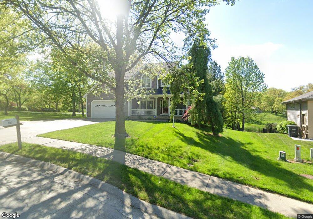
3302 E Devonshire Dr Saint Joseph, MO 64506
East Saint Joseph NeighborhoodEstimated Value: $431,566 - $448,000
Studio
--
Bath
1,821
Sq Ft
$242/Sq Ft
Est. Value
About This Home
This home is located at 3302 E Devonshire Dr, Saint Joseph, MO 64506 and is currently estimated at $439,892, approximately $241 per square foot. 3302 E Devonshire Dr is a home located in Buchanan County with nearby schools including Oak Grove Elementary School, Bode Middle School, and Central High School.
Ownership History
Date
Name
Owned For
Owner Type
Purchase Details
Closed on
Jul 11, 2018
Sold by
Baber Deborah and Wright Diane
Bought by
Baber Deborah and Wright Diana
Current Estimated Value
Purchase Details
Closed on
Oct 30, 2009
Sold by
Carter Luans S and Carter Jimmie D
Bought by
Purvis Timothy R and Purvis Dimple E
Home Financials for this Owner
Home Financials are based on the most recent Mortgage that was taken out on this home.
Original Mortgage
$200,000
Outstanding Balance
$129,866
Interest Rate
5.05%
Mortgage Type
New Conventional
Estimated Equity
$310,026
Purchase Details
Closed on
Aug 28, 2005
Sold by
Ts Jimmie D Carter Revocable Trust and Ts Luan S Carter Revocable Trust
Bought by
Carter Jimmie D and Carter Luana S
Create a Home Valuation Report for This Property
The Home Valuation Report is an in-depth analysis detailing your home's value as well as a comparison with similar homes in the area
Home Values in the Area
Average Home Value in this Area
Purchase History
| Date | Buyer | Sale Price | Title Company |
|---|---|---|---|
| Baber Deborah | -- | None Available | |
| Purvis Timothy R | -- | First American Title | |
| Purvis Timothy R | -- | First American Title | |
| Carter Jimmie D | -- | Hall Abstract & Title Co Inc |
Source: Public Records
Mortgage History
| Date | Status | Borrower | Loan Amount |
|---|---|---|---|
| Open | Purvis Timothy R | $200,000 | |
| Closed | Purvis Timothy R | $200,000 |
Source: Public Records
Tax History
| Year | Tax Paid | Tax Assessment Tax Assessment Total Assessment is a certain percentage of the fair market value that is determined by local assessors to be the total taxable value of land and additions on the property. | Land | Improvement |
|---|---|---|---|---|
| 2025 | $3,429 | $55,310 | $9,500 | $45,810 |
| 2024 | $3,339 | $47,440 | $9,500 | $37,940 |
| 2023 | $3,339 | $47,440 | $9,500 | $37,940 |
| 2022 | $3,093 | $47,440 | $9,500 | $37,940 |
| 2021 | $3,107 | $47,440 | $9,500 | $37,940 |
| 2020 | $3,089 | $47,440 | $9,500 | $37,940 |
| 2019 | $2,981 | $47,440 | $9,500 | $37,940 |
| 2018 | $2,688 | $47,440 | $9,500 | $37,940 |
| 2017 | $2,663 | $47,440 | $0 | $0 |
| 2015 | $1 | $47,440 | $0 | $0 |
| 2014 | $2,925 | $47,440 | $0 | $0 |
Source: Public Records
Map
Nearby Homes
- 0 N Pointe Dr
- 5411 N Pointe Dr
- 5408 N Pointe Dr
- 2 N Pointe Dr
- 5415 N Pointe Dr
- 5418 N Pointe Dr
- 4303 Leighton Ct
- 4007 Bennington Dr
- 4802 Corinth Dr
- 4704 Donnelly Dr
- 4514 Alpha Ln
- 4216 Gene Field Rd
- 4113 Hidden Valley Dr
- 2607 Ashmat Ln
- 4311 Hidden Valley Dr
- 3904 Remington Ct
- 4109 Hidden Valley Dr
- 4313 Hidden Valley Dr
- 2805 Quail Dr
- 4207 Hidden Valley Dr
- 3304 E Devonshire Dr
- 3306 E Devonshire Dr
- 3301 E Devonshire Dr
- 4310 Karnes Rd
- 4301 Karnes Rd
- 3303 E Devonshire Dr
- 3308 E Devonshire Dr
- 4404 Windsor Ct
- 3310 E Devonshire Dr
- 4302 Karnes Rd
- 4401 Windsor Ct
- 4406 Windsor Ct
- 3312 E Devonshire Dr
- 4403 Windsor Ct
- 4408 Windsor Ct
- 4230 Karnes Rd
- 3404 Waterford Ct
- 4216 Kensington Dr
- 3406 Waterford Ct
- 4214 Kensington Dr
Your Personal Tour Guide
Ask me questions while you tour the home.