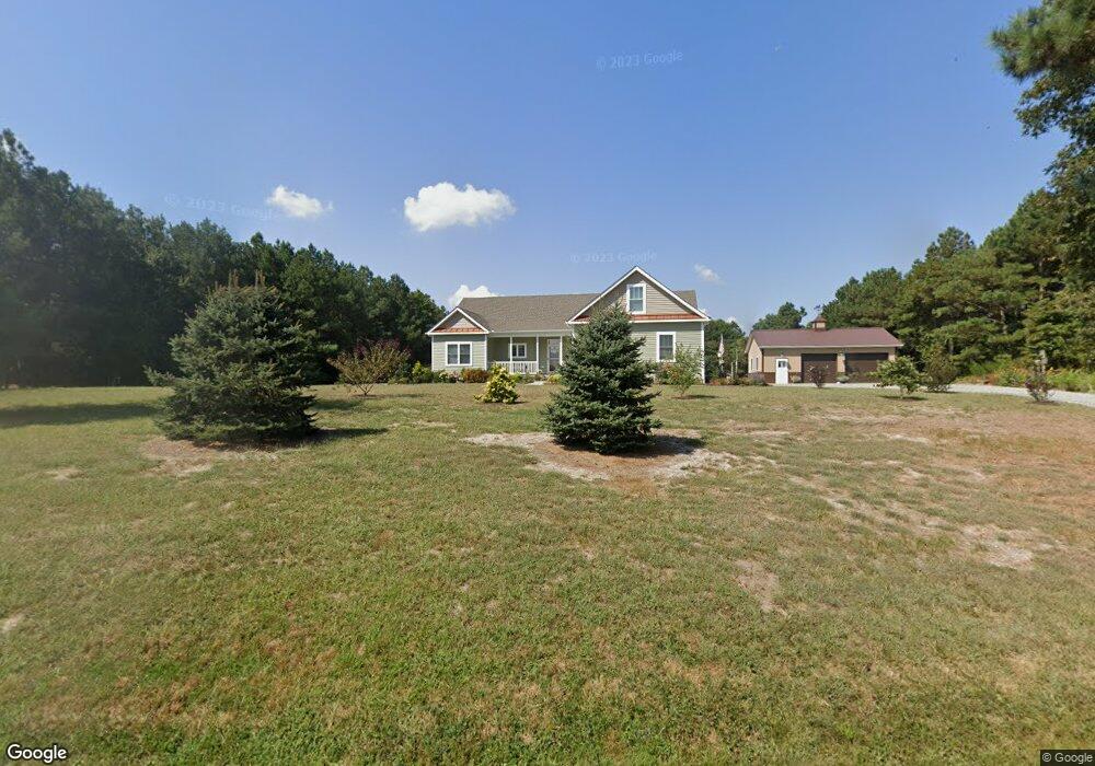
33030 Pear Tree Rd Millsboro, DE 19966
Estimated Value: $440,000 - $502,249
3
Beds
--
Bath
2,024
Sq Ft
$233/Sq Ft
Est. Value
About This Home
This home is located at 33030 Pear Tree Rd, Millsboro, DE 19966 and is currently estimated at $471,312, approximately $232 per square foot. 33030 Pear Tree Rd is a home with nearby schools including North Laurel Elementary School, Laurel Elementary School, and Laurel Intermediate Middle School.
Ownership History
Date
Name
Owned For
Owner Type
Purchase Details
Closed on
Jan 10, 2020
Sold by
Anderson Philip L and Anderson Rachel S
Bought by
Sellers Ronald I and Sellers Debra A
Current Estimated Value
Home Financials for this Owner
Home Financials are based on the most recent Mortgage that was taken out on this home.
Original Mortgage
$315,280
Outstanding Balance
$278,562
Interest Rate
3.6%
Mortgage Type
New Conventional
Estimated Equity
$192,750
Create a Home Valuation Report for This Property
The Home Valuation Report is an in-depth analysis detailing your home's value as well as a comparison with similar homes in the area
Home Values in the Area
Average Home Value in this Area
Purchase History
| Date | Buyer | Sale Price | Title Company |
|---|---|---|---|
| Sellers Ronald I | $75,000 | None Available |
Source: Public Records
Mortgage History
| Date | Status | Borrower | Loan Amount |
|---|---|---|---|
| Open | Sellers Ronald I | $315,280 |
Source: Public Records
Tax History Compared to Growth
Tax History
| Year | Tax Paid | Tax Assessment Tax Assessment Total Assessment is a certain percentage of the fair market value that is determined by local assessors to be the total taxable value of land and additions on the property. | Land | Improvement |
|---|---|---|---|---|
| 2025 | $1,123 | $2,700 | $2,700 | $0 |
| 2024 | $627 | $2,700 | $2,700 | $0 |
| 2023 | $697 | $2,700 | $2,700 | $0 |
| 2022 | $610 | $2,700 | $2,700 | $0 |
| 2021 | $896 | $2,700 | $2,700 | $0 |
| 2020 | $918 | $2,700 | $2,700 | $0 |
| 2019 | $139 | $2,700 | $2,700 | $0 |
| 2018 | $152 | $2,700 | $0 | $0 |
| 2017 | $147 | $2,700 | $0 | $0 |
| 2016 | $157 | $2,700 | $0 | $0 |
| 2015 | $135 | $2,700 | $0 | $0 |
| 2014 | $120 | $2,700 | $0 | $0 |
Source: Public Records
Map
Nearby Homes
- 32655 Millsboro Hwy
- 0 Laurel Rd Unit DESU2099790
- Lot 1 Pear Tree Rd
- 31492 Careys Dr
- 31419 Collins Ct
- 31417 Collins Dr
- 31415 Collins Dr
- 22240 Good Flocking Way
- 32542 Curley Dr
- 34280 Graham Cir
- 36265 Pear Tree Rd
- 26010 Hayfield Lane - Lot #42
- 26002 Hayfield Ln Unit 44
- 26022 Hayfield Ln Unit 39
- 26029 Hayfield Lane - Lot #26
- 26026 Hayfield Lane - Lot #38
- 26034 Hayfield Lane - Lot #36
- 63 Beacon Cir
- 26040 Hayfield Ln Unit 34
- 30480 Oak Ridge Dr
- 33045 Pear Tree Rd
- 32968 Pear Tree Rd
- 32961 Pear Tree Rd
- 32950 Pear Tree Rd
- 32950 Pear Tree Rd
- 21137 Lone Cypress Rd
- 21111 Lone Cypress Rd
- 32924 Pear Tree Rd
- 21099 Lone Cypress Rd
- 21081 Lone Cypress Rd
- 33202 Pear Tree Rd
- 21067 Lone Cypress Rd
- 32871 Pear Tree Rd
- 33243 Pear Tree Rd
- 0 NW Corner of Rt 24 (Laurel) & Pear Tree Unit 2 1001027324
- 32836 Pear Tree Rd
- 33846 Hopkins Branch
- 21044 Laurel Rd
- 32794 Pear Tree Rd
- 33460 Cowhouse Branch Rd