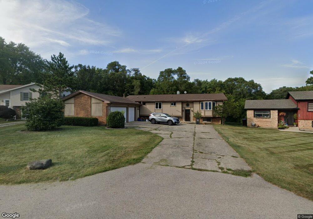
3304 Carol Cir Island Lake, IL 60042
East Island Lake NeighborhoodEstimated Value: $348,000 - $412,284
5
Beds
3
Baths
2,800
Sq Ft
$136/Sq Ft
Est. Value
About This Home
This home is located at 3304 Carol Cir, Island Lake, IL 60042 and is currently estimated at $379,571, approximately $135 per square foot. 3304 Carol Cir is a home located in Lake County with nearby schools including Cotton Creek School, Matthews Middle School, and Wauconda High School.
Ownership History
Date
Name
Owned For
Owner Type
Purchase Details
Closed on
Oct 19, 2017
Sold by
Chicago Title Land Trust Co
Bought by
Santori Joseph
Current Estimated Value
Home Financials for this Owner
Home Financials are based on the most recent Mortgage that was taken out on this home.
Original Mortgage
$196,278
Outstanding Balance
$165,802
Interest Rate
4.25%
Mortgage Type
FHA
Estimated Equity
$213,769
Create a Home Valuation Report for This Property
The Home Valuation Report is an in-depth analysis detailing your home's value as well as a comparison with similar homes in the area
Home Values in the Area
Average Home Value in this Area
Purchase History
| Date | Buyer | Sale Price | Title Company |
|---|---|---|---|
| Santori Joseph | $199,900 | Chicago Title Land Trust Com |
Source: Public Records
Mortgage History
| Date | Status | Borrower | Loan Amount |
|---|---|---|---|
| Open | Santori Joseph | $196,278 |
Source: Public Records
Tax History Compared to Growth
Tax History
| Year | Tax Paid | Tax Assessment Tax Assessment Total Assessment is a certain percentage of the fair market value that is determined by local assessors to be the total taxable value of land and additions on the property. | Land | Improvement |
|---|---|---|---|---|
| 2024 | $6,807 | $112,501 | $21,323 | $91,178 |
| 2023 | $7,612 | $93,486 | $17,719 | $75,767 |
| 2022 | $7,612 | $89,565 | $22,004 | $67,561 |
| 2021 | $7,729 | $84,631 | $20,792 | $63,839 |
| 2020 | $7,459 | $80,662 | $19,817 | $60,845 |
| 2019 | $7,126 | $76,233 | $18,729 | $57,504 |
| 2018 | $6,445 | $69,425 | $18,474 | $50,951 |
| 2017 | $5,749 | $66,305 | $18,260 | $48,045 |
| 2016 | $5,431 | $62,789 | $17,292 | $45,497 |
| 2015 | $4,991 | $57,641 | $15,874 | $41,767 |
| 2014 | $5,020 | $57,393 | $16,634 | $40,759 |
| 2012 | $4,604 | $68,318 | $15,915 | $52,403 |
Source: Public Records
Map
Nearby Homes
- 00 Burnett Rd
- 236 Forest Dr
- 706 E Burnett Rd
- lot 23 Park Dr
- 216 S Shore Dr Unit S
- 228 S Shore Dr
- 3828 Eastway Dr
- 318 David Ct
- 3819 Woodlawn Dr
- NEC Route 176 & Westridge Dr
- Newport - Two-story Plan at Prairie Woods
- Madison - Two-story Plan at Prairie Woods
- Jefferson - Two-story Plan at Prairie Woods
- Monroe II - Two-story Plan at Prairie Woods
- Dawson - Two-story Plan at Prairie Woods
- Montana - Ranch Plan at Prairie Woods
- Elway - Ranch Plan at Prairie Woods
- Brady II- Ranch Plan at Prairie Woods
- Brady - Ranch Plan at Prairie Woods
- Pasadena II - Ranch Plan at Prairie Woods
- 3306 Carol Cir
- 3302 Carol Cir
- 570 Carolyn Ln
- 3308 Carol Cir
- 418 Channel Dr
- 3310 Carol Cir
- 416 Channel Dr Unit 2
- 414 Channel Dr
- 414 Judith Dr
- 415 Channel Dr
- 3312 Ridge Rd
- 412 Channel Dr
- 412 Judith Dr
- 410 Judith Dr
- 3314 Ridge Rd
- 411 Channel Dr
- 410 Channel Dr
- 3313 Ridge Rd
- 408 Channel Dr
- 409 Channel Dr