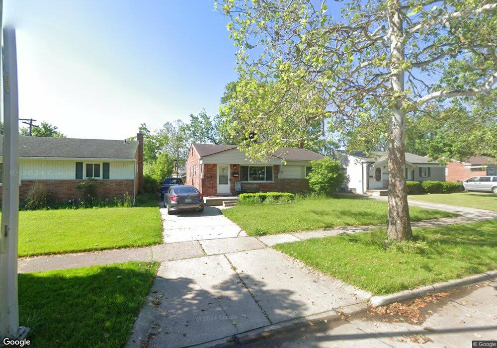
33043 Anita Dr Westland, MI 48185
Estimated Value: $212,257 - $234,000
3
Beds
1
Bath
1,041
Sq Ft
$217/Sq Ft
Est. Value
About This Home
This home is located at 33043 Anita Dr, Westland, MI 48185 and is currently estimated at $225,564, approximately $216 per square foot. 33043 Anita Dr is a home located in Wayne County with nearby schools including Hayes Elementary School, Emerson Middle School, and Cooper Upper Elementary School.
Ownership History
Date
Name
Owned For
Owner Type
Purchase Details
Closed on
Jun 28, 2011
Sold by
Citimortgage Inc
Bought by
First Place Bank
Current Estimated Value
Purchase Details
Closed on
Oct 28, 2009
Sold by
Debay Nicholas and Morrison Andrea
Bought by
Abn Amro Mortgage Group Inc and Citimortgage Inc
Purchase Details
Closed on
Feb 27, 2007
Sold by
Fannie Mae
Bought by
Debay Nicholas and Morrison Andrea
Purchase Details
Closed on
May 16, 2006
Sold by
Mortgage Electronic Registration Systems
Bought by
Federal National Mortgage Association
Purchase Details
Closed on
Feb 8, 2006
Sold by
Jones James
Bought by
Mortgage Electronic Registration Systems
Purchase Details
Closed on
May 28, 1997
Sold by
Afe Brian A and Afe Kimberly A
Bought by
Murphy James J and Murphy Kimberly A
Create a Home Valuation Report for This Property
The Home Valuation Report is an in-depth analysis detailing your home's value as well as a comparison with similar homes in the area
Home Values in the Area
Average Home Value in this Area
Purchase History
| Date | Buyer | Sale Price | Title Company |
|---|---|---|---|
| First Place Bank | -- | Cislo Title Co | |
| Abn Amro Mortgage Group Inc | $69,500 | None Available | |
| Debay Nicholas | $125,000 | Greco | |
| Federal National Mortgage Association | -- | None Available | |
| Mortgage Electronic Registration Systems | $166,315 | None Available | |
| Murphy James J | $106,900 | -- |
Source: Public Records
Tax History Compared to Growth
Tax History
| Year | Tax Paid | Tax Assessment Tax Assessment Total Assessment is a certain percentage of the fair market value that is determined by local assessors to be the total taxable value of land and additions on the property. | Land | Improvement |
|---|---|---|---|---|
| 2025 | $2,189 | $94,100 | $0 | $0 |
| 2024 | $2,189 | $87,700 | $0 | $0 |
| 2023 | $2,089 | $79,600 | $0 | $0 |
| 2022 | $2,728 | $68,900 | $0 | $0 |
| 2021 | $2,655 | $65,800 | $0 | $0 |
| 2020 | $2,623 | $62,300 | $0 | $0 |
| 2019 | $2,697 | $60,300 | $0 | $0 |
| 2018 | $1,774 | $50,500 | $0 | $0 |
| 2017 | $1,333 | $47,000 | $0 | $0 |
| 2016 | $2,405 | $47,300 | $0 | $0 |
| 2015 | $3,479 | $44,450 | $0 | $0 |
| 2013 | $3,370 | $34,420 | $0 | $0 |
| 2012 | $1,631 | $34,490 | $0 | $0 |
Source: Public Records
Map
Nearby Homes
- 33211 Anita Dr
- 32725 Joy Rd
- 32724 Hees St
- 32451 Sandra Ln
- 9243 Montana St
- 32327 Washington St
- 32047 Anita Dr
- 32611 Vermont St
- 8824 Nevada St
- 33632 Cindy St
- 7946 Moonwood Place
- 9668 Farmington Rd
- 33312 Lynx St
- 9212 Idaho St
- 9253 Idaho St
- 8332 Berwick Dr
- 33030 Cowan Rd
- 9085 Melrose St
- 9834 Brookfield St
- 8219 Roselawn St
- 33033 Anita Dr
- 33105 Anita Dr
- 33115 Anita Dr
- 33044 Benson Dr
- 33034 Benson Dr
- 33035 Sandra Ln
- 33054 Benson Dr
- 33023 Sandra Ln
- 33125 Anita Dr
- 33044 Anita Dr
- 33064 Benson Dr
- 33106 Anita Dr
- 33034 Anita Dr
- 33011 Sandra Ln
- 33063 Sandra Ln
- 33116 Anita Dr
- 33135 Anita Dr
- 33126 Anita Dr
- 33074 Benson Dr
- 33073 Sandra Ln