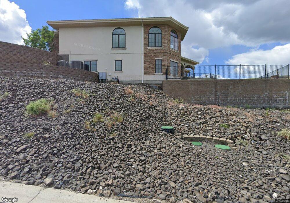
3306 Michael Dr Clarkston, WA 99403
Estimated Value: $1,037,000 - $1,572,000
4
Beds
4
Baths
6,460
Sq Ft
$208/Sq Ft
Est. Value
About This Home
This home is located at 3306 Michael Dr, Clarkston, WA 99403 and is currently estimated at $1,341,168, approximately $207 per square foot. 3306 Michael Dr is a home located in Asotin County with nearby schools including Asotin Elementary School and Asotin Junior/Senior High School.
Ownership History
Date
Name
Owned For
Owner Type
Purchase Details
Closed on
Oct 11, 2021
Sold by
Mulligan William Edward
Bought by
Mulligan William Edward and Mulligan Sharon Elaine
Current Estimated Value
Home Financials for this Owner
Home Financials are based on the most recent Mortgage that was taken out on this home.
Original Mortgage
$497,173
Outstanding Balance
$455,257
Interest Rate
3.09%
Mortgage Type
VA
Estimated Equity
$885,911
Purchase Details
Closed on
Dec 21, 2012
Sold by
Mulligan William E and Mulligan Shirley A
Bought by
Mulligan William Edward and Mulligan Shirley
Home Financials for this Owner
Home Financials are based on the most recent Mortgage that was taken out on this home.
Original Mortgage
$726,286
Interest Rate
3.27%
Mortgage Type
VA
Purchase Details
Closed on
Mar 30, 2006
Sold by
Poe Asphalt Paving Inc
Bought by
Mulligan William E and Mulligan Shirley A
Create a Home Valuation Report for This Property
The Home Valuation Report is an in-depth analysis detailing your home's value as well as a comparison with similar homes in the area
Home Values in the Area
Average Home Value in this Area
Purchase History
| Date | Buyer | Sale Price | Title Company |
|---|---|---|---|
| Mulligan William Edward | -- | Silk Abstract Co | |
| Mulligan William Edward | -- | None Available | |
| Mulligan William E | -- | None Available |
Source: Public Records
Mortgage History
| Date | Status | Borrower | Loan Amount |
|---|---|---|---|
| Open | Mulligan William Edward | $497,173 | |
| Closed | Mulligan William Edward | $726,286 |
Source: Public Records
Tax History
| Year | Tax Paid | Tax Assessment Tax Assessment Total Assessment is a certain percentage of the fair market value that is determined by local assessors to be the total taxable value of land and additions on the property. | Land | Improvement |
|---|---|---|---|---|
| 2025 | $13,931 | $1,270,316 | $86,716 | $1,183,600 |
| 2023 | $13,931 | $1,270,316 | $86,716 | $1,183,600 |
| 2022 | $14,701 | $1,270,316 | $86,716 | $1,183,600 |
| 2021 | $14,701 | $1,270,316 | $86,716 | $1,183,600 |
| 2020 | $12,046 | $1,270,316 | $86,716 | $1,183,600 |
| 2019 | $11,489 | $1,076,100 | $95,000 | $981,100 |
| 2018 | $13,835 | $1,076,100 | $95,000 | $981,100 |
| 2017 | $12,395 | $1,076,100 | $95,000 | $981,100 |
| 2016 | $12,395 | $1,076,100 | $95,000 | $981,100 |
| 2015 | $1,233 | $1,029,700 | $95,000 | $934,700 |
| 2013 | $11,770 | $1,008,600 | $95,000 | $913,600 |
Source: Public Records
Map
Nearby Homes
- 1783 Marshall Ct
- 3305 Michael Dr
- 3315 Michael Dr
- 1771 River Canyon Dr
- 1785 River Canyon Dr
- 1780 Cherry St
- 3350 Clemans Rd
- 3824 Pleasant View Dr
- 3780 Nicklaus Dr
- 3725 Nicklaus Dr
- 3733 and 3731 Swallows Nest Ct
- 1612 Swallows Nest Loop
- 2274 Chukar Dr
- 3435 Chukar Ln
- 2275 Chukar Dr
- 2271 Chukar Dr
- 2242 Chukar Ln
- 2662 S Slope Ln
- Lot 10 Cactus Ln
- Lot 10 Cactus Ln Unit 10
- 1784 Marshall Ct Unit Sunrise at River's B
- 1784 Marshall Ct
- 3304 Michael Dr
- 1782 Marshall Ct
- 3308 Michael Dr
- 3307 Michael Dr
- 1786 Marshall Ct
- 3309 Michael Dr
- 1783 Marshall Ct Unit 19
- 1788 River Canyon Dr
- 3303 Michael Dr
- 3302 Michael Dr
- 3312 Michael Dr
- 1785 Marshall Ct
- 3311 Michael Dr
- 3300 Michael Dr
- 3313 Michael Dr
- 1782 River Canyon Dr
- 1780 River Canyon Dr
- 3316 Michael Dr
Your Personal Tour Guide
Ask me questions while you tour the home.