Estimated Value: $344,000 - $386,000
3
Beds
2
Baths
2,323
Sq Ft
$156/Sq Ft
Est. Value
About This Home
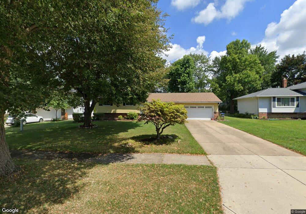
This home is located at 33065 E Nimrod St, Solon, OH 44139 and is currently estimated at $361,643, approximately $155 per square foot. 33065 E Nimrod St is a home located in Cuyahoga County with nearby schools including Grace L Roxbury Elementary School, Orchard Middle School, and Solon Middle School.
Ownership History
Date
Name
Owned For
Owner Type
Purchase Details
Closed on
Nov 19, 2024
Sold by
Horvath Marianne K and Kluk Daniel R
Bought by
Kluk Daniel R and Horvath Marianne K
Current Estimated Value
Purchase Details
Closed on
Sep 17, 1987
Sold by
Adzima James A
Bought by
Horvath Marianne K
Purchase Details
Closed on
May 5, 1978
Sold by
Hanson Darwin D and Hanson Lois K
Bought by
Executrans Inc
Purchase Details
Closed on
Jan 1, 1975
Bought by
Hanson Darwin D and Hanson Lois K
Create a Home Valuation Report for This Property
The Home Valuation Report is an in-depth analysis detailing your home's value as well as a comparison with similar homes in the area
Home Values in the Area
Average Home Value in this Area
Purchase History
| Date | Buyer | Sale Price | Title Company |
|---|---|---|---|
| Kluk Daniel R | -- | None Listed On Document | |
| Kluk Daniel R | -- | None Listed On Document | |
| Horvath Marianne K | $125,000 | -- | |
| Executrans Inc | -- | -- | |
| Adzima James A | $66,000 | -- | |
| Hanson Darwin D | -- | -- |
Source: Public Records
Tax History
| Year | Tax Paid | Tax Assessment Tax Assessment Total Assessment is a certain percentage of the fair market value that is determined by local assessors to be the total taxable value of land and additions on the property. | Land | Improvement |
|---|---|---|---|---|
| 2025 | $6,132 | $112,035 | $19,705 | $92,330 |
| 2024 | $6,131 | $112,035 | $19,705 | $92,330 |
| 2023 | $5,782 | $86,420 | $16,170 | $70,250 |
| 2022 | $5,770 | $86,415 | $16,170 | $70,245 |
| 2021 | $5,704 | $86,420 | $16,170 | $70,250 |
| 2020 | $5,722 | $79,280 | $14,840 | $64,440 |
| 2019 | $5,541 | $226,500 | $42,400 | $184,100 |
| 2018 | $4,891 | $79,280 | $14,840 | $64,440 |
| 2017 | $4,868 | $73,540 | $13,900 | $59,640 |
| 2016 | $4,822 | $73,540 | $13,900 | $59,640 |
| 2015 | $4,762 | $73,540 | $13,900 | $59,640 |
| 2014 | $4,762 | $70,040 | $13,230 | $56,810 |
Source: Public Records
Map
Nearby Homes
- 32623 Jefferson Dr Unit 23
- 33014 N Roundhead Dr
- 6746 Edgemoor Ave
- 32722 Washington Ct Unit 22
- 6678 Solon Blvd
- 34603 Bramble Ln
- 7282 Thornapple Ln
- 35160 Spatterdock Ln
- 32700 Pettibone Rd
- 6531 Arbordale Ave
- 7471 Som Center Rd
- 32443 S Burr Oak Dr
- V/L (1.32 Acres) Aurora Rd
- 32801 Baldwin Rd
- 34825 Aurora Rd
- 33771 Canterbury Rd
- 36725 Pettibone Rd
- 36965 Wexford Dr
- 7370 Stockwood Dr
- 10240 Orchard Hill Ln Unit I23
- 33035 E Nimrod St
- 33095 E Nimrod St
- 33005 E Nimrod St
- 33125 E Nimrod St
- 33060 Arlesford Dr
- 33090 Arlesford Dr
- 33030 Arlesford Dr
- 33060 E Nimrod St
- 33120 Arlesford Dr
- 32955 E Nimrod St
- 33000 Arlesford Dr
- 33030 E Nimrod St
- 33155 E Nimrod St
- 33090 E Nimrod St
- 33000 E Nimrod St
- 33120 E Nimrod St
- 33150 Arlesford Dr
- 32950 Arlesford Dr
- 32915 E Nimrod St
- 32950 E Nimrod St
Your Personal Tour Guide
Ask me questions while you tour the home.