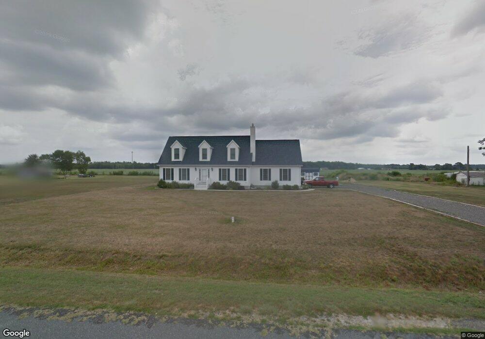
33083 Cowhouse Branch Rd Millsboro, DE 19966
Estimated Value: $388,000 - $453,000
3
Beds
--
Bath
1,890
Sq Ft
$224/Sq Ft
Est. Value
About This Home
This home is located at 33083 Cowhouse Branch Rd, Millsboro, DE 19966 and is currently estimated at $424,096, approximately $224 per square foot. 33083 Cowhouse Branch Rd is a home located in Sussex County with nearby schools including East Millsboro Elementary School, Millsboro Middle School, and Sussex Central High School.
Ownership History
Date
Name
Owned For
Owner Type
Purchase Details
Closed on
Jan 24, 2020
Sold by
Fisher Ashley M
Bought by
Touchton Ashley and Touchton Joseph
Current Estimated Value
Home Financials for this Owner
Home Financials are based on the most recent Mortgage that was taken out on this home.
Original Mortgage
$211,500
Interest Rate
3.74%
Mortgage Type
New Conventional
Purchase Details
Closed on
Sep 29, 1992
Bought by
Fisher Ashley M
Create a Home Valuation Report for This Property
The Home Valuation Report is an in-depth analysis detailing your home's value as well as a comparison with similar homes in the area
Home Values in the Area
Average Home Value in this Area
Purchase History
| Date | Buyer | Sale Price | Title Company |
|---|---|---|---|
| Touchton Ashley | -- | None Available | |
| Fisher Ashley M | -- | -- |
Source: Public Records
Mortgage History
| Date | Status | Borrower | Loan Amount |
|---|---|---|---|
| Previous Owner | Touchton Ashley | $211,500 | |
| Previous Owner | Fisher Ashley M | $39,200 |
Source: Public Records
Tax History Compared to Growth
Tax History
| Year | Tax Paid | Tax Assessment Tax Assessment Total Assessment is a certain percentage of the fair market value that is determined by local assessors to be the total taxable value of land and additions on the property. | Land | Improvement |
|---|---|---|---|---|
| 2025 | $942 | $23,200 | $1,550 | $21,650 |
| 2024 | $1,003 | $23,200 | $1,550 | $21,650 |
| 2023 | $1,002 | $23,200 | $1,550 | $21,650 |
| 2022 | $987 | $23,200 | $1,550 | $21,650 |
| 2021 | $959 | $23,200 | $1,550 | $21,650 |
| 2020 | $917 | $23,200 | $1,550 | $21,650 |
| 2019 | $901 | $23,200 | $1,550 | $21,650 |
| 2018 | $909 | $23,200 | $0 | $0 |
| 2017 | $916 | $23,200 | $0 | $0 |
| 2016 | $690 | $19,600 | $0 | $0 |
| 2015 | $711 | $19,600 | $0 | $0 |
| 2014 | $701 | $19,600 | $0 | $0 |
Source: Public Records
Map
Nearby Homes
- 32655 Millsboro Hwy
- Lot 1 Pear Tree Rd
- 31419 Collins Ct
- 31492 Careys Dr
- 31417 Collins Dr
- 31415 Collins Dr
- 0 Laurel Rd Unit DESU2099790
- 22240 Good Flocking Way
- 34280 Graham Cir
- 26002 Hayfield Ln Unit 44
- 26010 Hayfield Lane - Lot #42
- 63 Beacon Cir
- 26022 Hayfield Ln Unit 39
- 26029 Hayfield Lane - Lot #26
- 32542 Curley Dr
- 26026 Hayfield Lane - Lot #38
- 26034 Hayfield Lane - Lot #36
- 30480 Oak Ridge Dr
- 26040 Hayfield Ln Unit 34
- 24249 Indian Town Rd
- 33091 Cowhouse Branch Rd
- 33051 Cowhouse Branch Rd
- 22042 Laurel Rd
- 22032 Laurel Rd
- 22018 Laurel Rd
- 22006 Laurel Rd
- 21192 Laurel Rd
- 32626 Millsboro Hwy
- 32627 Millsboro Hwy
- 32631 Millsboro Hwy
- 32631 Millsboro Hwy Unit 4
- 32631 Millsboro Hwy Unit LOT 4
- 32629 Millsboro Hwy Unit 3
- 32629 Millsboro Hwy
- 32703 Millsboro Hwy
- 32703 Millsboro Hwy Unit 5
- 32703 Millsboro Hwy Unit LOT 5
- 32625 Millsboro Hwy Unit 2
- 32625 Millsboro Hwy
- 32623 Millsboro Hwy