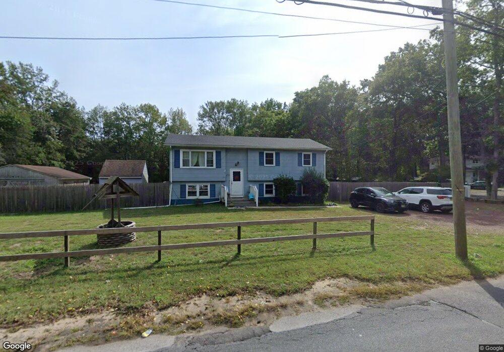
331 Kent Rd Howell, NJ 07731
Southard NeighborhoodEstimated Value: $479,000 - $653,000
3
Beds
2
Baths
1,954
Sq Ft
$285/Sq Ft
Est. Value
About This Home
This home is located at 331 Kent Rd, Howell, NJ 07731 and is currently estimated at $556,490, approximately $284 per square foot. 331 Kent Rd is a home located in Monmouth County with nearby schools including Taunton School, Aldrich School, and Howell Township Middle School South.
Ownership History
Date
Name
Owned For
Owner Type
Purchase Details
Closed on
Aug 18, 2021
Sold by
Reilly Geraldine M
Bought by
Elliott David and Elliott Jeanine
Current Estimated Value
Home Financials for this Owner
Home Financials are based on the most recent Mortgage that was taken out on this home.
Original Mortgage
$260,000
Outstanding Balance
$235,704
Interest Rate
2.7%
Mortgage Type
New Conventional
Estimated Equity
$320,786
Purchase Details
Closed on
Aug 11, 2015
Sold by
Reilly Geraldine M and Reilly Doris M
Bought by
Reilly Geraldine M
Purchase Details
Closed on
Sep 25, 2008
Sold by
Reilly Geraldine and Reilly Arthur
Bought by
Reilly Doris and Reilly Geraldine M
Purchase Details
Closed on
Sep 23, 2005
Sold by
Reilly Arthur
Bought by
Reilly Arthur and Reilly Doris
Purchase Details
Closed on
Feb 27, 2004
Sold by
Garramone Richard
Bought by
Reilly Arthur and Reilly Doris
Create a Home Valuation Report for This Property
The Home Valuation Report is an in-depth analysis detailing your home's value as well as a comparison with similar homes in the area
Home Values in the Area
Average Home Value in this Area
Purchase History
| Date | Buyer | Sale Price | Title Company |
|---|---|---|---|
| Elliott David | $325,000 | Chicago Title Insurance Co | |
| Reilly Geraldine M | -- | Pegasus Title Agency Llc | |
| Reilly Doris | -- | None Available | |
| Reilly Arthur | -- | -- | |
| Reilly Arthur | $285,000 | -- |
Source: Public Records
Mortgage History
| Date | Status | Borrower | Loan Amount |
|---|---|---|---|
| Open | Elliott David | $260,000 |
Source: Public Records
Tax History
| Year | Tax Paid | Tax Assessment Tax Assessment Total Assessment is a certain percentage of the fair market value that is determined by local assessors to be the total taxable value of land and additions on the property. | Land | Improvement |
|---|---|---|---|---|
| 2025 | $6,043 | $431,500 | $264,800 | $166,700 |
| 2024 | $5,678 | $339,900 | $176,200 | $163,700 |
| 2023 | $5,678 | $305,100 | $145,200 | $159,900 |
| 2022 | $5,604 | $319,800 | $124,100 | $195,700 |
| 2021 | $5,604 | $266,600 | $124,100 | $142,500 |
| 2020 | $6,153 | $265,000 | $124,100 | $140,900 |
| 2019 | $6,130 | $259,100 | $120,600 | $138,500 |
| 2018 | $5,498 | $230,900 | $98,900 | $132,000 |
| 2017 | $5,464 | $226,900 | $98,900 | $128,000 |
| 2016 | $5,302 | $218,000 | $93,200 | $124,800 |
| 2015 | $5,519 | $234,800 | $113,200 | $121,600 |
| 2014 | $4,776 | $189,800 | $93,200 | $96,600 |
Source: Public Records
Map
Nearby Homes
- 42 Brown Rd
- 1501 Pine Park Ave
- 652 Hope Chapel Rd
- 100 Avis Ave
- 132 Saint Katherine Place
- 606 W Kennedy Blvd
- 40 Brookwood Pkwy
- 3 Colorado Dr
- 2 Charlotte's Walk
- 1474 14th St
- 6 Charlotte's Walk
- 0 14th St
- 10 Charlotte's Walk
- 14 Charlotte's Walk
- 18 Charlotte's Walk
- 254 Alexander Ave
- 412 15th St
- 57 Church Rd
- 269 Alexander Ave
- 8 Trinity Place
Your Personal Tour Guide
Ask me questions while you tour the home.