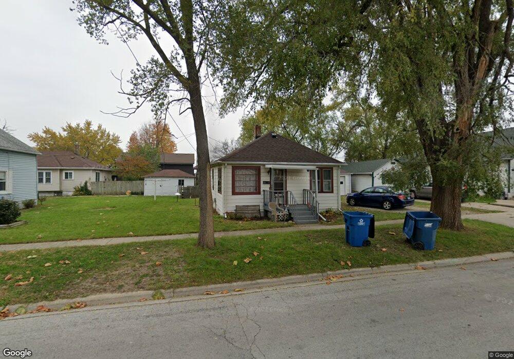
331 N Roy Ave Bourbonnais, IL 60914
Estimated Value: $124,401 - $166,000
Studio
--
Bath
--
Sq Ft
4,008
Sq Ft
About This Home
This home is located at 331 N Roy Ave, Bourbonnais, IL 60914 and is currently estimated at $150,350. 331 N Roy Ave is a home located in Kankakee County with nearby schools including Alan B. Shepard Elementary School, Liberty Intermediate School, and Bourbonnais Upper Grade Center.
Ownership History
Date
Name
Owned For
Owner Type
Purchase Details
Closed on
Apr 12, 2019
Sold by
Wissbroecker Raymond J and Wissbroecker Kathy M
Bought by
Lavoie Stephen J and Lavoie Jennifer K
Current Estimated Value
Home Financials for this Owner
Home Financials are based on the most recent Mortgage that was taken out on this home.
Original Mortgage
$68,715
Outstanding Balance
$60,331
Interest Rate
4.63%
Mortgage Type
New Conventional
Estimated Equity
$90,019
Create a Home Valuation Report for This Property
The Home Valuation Report is an in-depth analysis detailing your home's value as well as a comparison with similar homes in the area
Home Values in the Area
Average Home Value in this Area
Purchase History
| Date | Buyer | Sale Price | Title Company |
|---|---|---|---|
| Lavoie Stephen J | $76,500 | Homestar Title |
Source: Public Records
Mortgage History
| Date | Status | Borrower | Loan Amount |
|---|---|---|---|
| Open | Lavoie Stephen J | $68,715 |
Source: Public Records
Tax History
| Year | Tax Paid | Tax Assessment Tax Assessment Total Assessment is a certain percentage of the fair market value that is determined by local assessors to be the total taxable value of land and additions on the property. | Land | Improvement |
|---|---|---|---|---|
| 2024 | $2,687 | $38,329 | $4,594 | $33,735 |
| 2023 | $2,435 | $35,490 | $4,254 | $31,236 |
| 2022 | $2,293 | $32,636 | $4,100 | $28,536 |
| 2021 | $2,245 | $31,918 | $4,010 | $27,908 |
| 2020 | $2,144 | $30,273 | $3,903 | $26,370 |
| 2019 | $2,134 | $28,172 | $3,789 | $24,383 |
| 2018 | $2,365 | $26,396 | $3,733 | $22,663 |
| 2017 | $2,265 | $25,108 | $3,642 | $21,466 |
| 2016 | $2,190 | $24,322 | $3,588 | $20,734 |
| 2015 | $2,106 | $23,103 | $3,552 | $19,551 |
| 2014 | $2,445 | $27,927 | $3,552 | $24,375 |
| 2013 | -- | $28,288 | $3,552 | $24,736 |
Source: Public Records
Map
Nearby Homes
- 417 E Beaudoin St
- 179 N Levasseur Ave
- 250 N Levasseur Ave
- 292 Ashley Ave
- 132 N Tetrault Ave
- 899 Armour Rd
- 482 S Rivard St
- 703 Heritage Dr
- 260 W Country Ct
- 440 S Cryer Ave
- Lot 5/5A Almar Pkwy
- 261 Mohawk Dr
- 817 Stonewall Dr
- 473 Mohawk Dr
- 508 N Forest Ave
- 901 W North St
- 691 W River St
- 15 Hanson Dr
- 206 Meadows Rd S
- 830 W River St
- 281 E Beaudoin St
- 281 E Beaudoin St
- 309 N Roy Ave
- 261 E Beaudoin St
- 307 E Beaudoin St
- 282 E Beaudoin St
- 295 N Roy Ave
- 346 N Roy Ave Unit 352
- 327 E Beaudoin St
- 262 E Beaudoin St
- 296 N Roy Ave
- 332 N Roy Ave
- 245 E Beaudoin St
- 322 E Beaudoin St
- 272 N Roy Ave
- 248 E Beaudoin St
- 277 N Roy Ave
- 287 E Greenwood St
- 287 Greenwood Ave
- 388 N Roy St
Your Personal Tour Guide
Ask me questions while you tour the home.