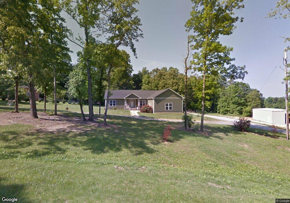
331 Pete Fritts Rd Lexington, NC 27292
Estimated Value: $338,706 - $486,000
3
Beds
2
Baths
2,488
Sq Ft
$158/Sq Ft
Est. Value
About This Home
This home is located at 331 Pete Fritts Rd, Lexington, NC 27292 and is currently estimated at $393,177, approximately $158 per square foot. 331 Pete Fritts Rd is a home located in Davidson County with nearby schools including Davis-Townsend Elementary School, Central Davidson Middle School, and Central Davidson High School.
Ownership History
Date
Name
Owned For
Owner Type
Purchase Details
Closed on
May 22, 2020
Sold by
Burkhart Chad A
Bought by
Burkhart Geovanna R
Current Estimated Value
Home Financials for this Owner
Home Financials are based on the most recent Mortgage that was taken out on this home.
Original Mortgage
$152,000
Outstanding Balance
$134,693
Interest Rate
3.3%
Mortgage Type
New Conventional
Estimated Equity
$258,484
Purchase Details
Closed on
Dec 1, 1977
Create a Home Valuation Report for This Property
The Home Valuation Report is an in-depth analysis detailing your home's value as well as a comparison with similar homes in the area
Home Values in the Area
Average Home Value in this Area
Purchase History
| Date | Buyer | Sale Price | Title Company |
|---|---|---|---|
| Burkhart Geovanna R | -- | None Available | |
| -- | $4,000 | -- |
Source: Public Records
Mortgage History
| Date | Status | Borrower | Loan Amount |
|---|---|---|---|
| Open | Burkhart Geovanna R | $152,000 |
Source: Public Records
Tax History Compared to Growth
Tax History
| Year | Tax Paid | Tax Assessment Tax Assessment Total Assessment is a certain percentage of the fair market value that is determined by local assessors to be the total taxable value of land and additions on the property. | Land | Improvement |
|---|---|---|---|---|
| 2025 | $1,537 | $232,970 | $0 | $0 |
| 2024 | $1,469 | $232,970 | $0 | $0 |
| 2023 | $1,469 | $232,970 | $0 | $0 |
| 2022 | $1,469 | $232,970 | $0 | $0 |
| 2021 | $1,469 | $232,970 | $0 | $0 |
| 2020 | $1,322 | $209,760 | $0 | $0 |
| 2019 | $1,321 | $209,760 | $0 | $0 |
| 2018 | $1,321 | $209,760 | $0 | $0 |
| 2017 | $1,321 | $209,760 | $0 | $0 |
| 2016 | $1,321 | $209,760 | $0 | $0 |
| 2015 | $1,280 | $209,760 | $0 | $0 |
| 2014 | $1,192 | $195,340 | $0 | $0 |
Source: Public Records
Map
Nearby Homes
- 19 Colonial Dr
- 410 Queens Dr
- 410 Queens Dr Unit 27 & 28
- 0 Queens Dr
- 260 Burkhart Rd
- 301 Queens Dr
- 609 Copperfield Ln
- 14 Arbor Dr
- 113 Trafalgar Dr
- 271 Lilys Place
- 6 Canterbury Place
- 7 Dora Ln
- 104 Alpine Dr
- 206 Abbotts Ave
- 1120 Country Club Dr
- 1103 Rhodes Rd
- 215 Lily's Place
- 324 Kimberly Ln
- 400 Glendale Rd
- 500 Maegeo Dr
- 128 Woodlawn St
- 1358 Spring Dr
- 144 Woodlawn St
- 1360 Spring Dr
- 131 Wilson Dr
- 1344 Spring Dr
- 404 Pete Fritts Rd
- 270 Pete Fritts Rd
- 346 Pete Fritts Rd
- 168 Woodlawn St
- 1382 Spring Dr
- 240 Pete Fritts Rd
- 259 Pete Fritts Rd
- 1309 Spring Dr
- 1232 Spring Dr
- 221 Pete Fritts Rd
- 1369 Spring Dr
- 1208 Spring Dr
- 188 Pete Fritts Rd
- 1249 Spring Dr