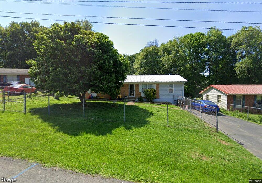
331 Rutledge St Bristol, TN 37620
Estimated Value: $155,822 - $281,000
Studio
1
Bath
1,300
Sq Ft
$169/Sq Ft
Est. Value
About This Home
This home is located at 331 Rutledge St, Bristol, TN 37620 and is currently estimated at $219,206, approximately $168 per square foot. 331 Rutledge St is a home located in Sullivan County with nearby schools including Bluff City Elementary School, Sullivan East Middle School, and Sullivan East High School.
Ownership History
Date
Name
Owned For
Owner Type
Purchase Details
Closed on
Feb 14, 2019
Sold by
Burnette Michael F and Burnette Heather L
Bought by
Burnette Michael F
Current Estimated Value
Home Financials for this Owner
Home Financials are based on the most recent Mortgage that was taken out on this home.
Original Mortgage
$75,000
Outstanding Balance
$65,535
Interest Rate
4.4%
Mortgage Type
New Conventional
Estimated Equity
$153,671
Purchase Details
Closed on
Nov 4, 1999
Sold by
Wayne Cardwell Kenneth
Bought by
Burnette Michael F
Create a Home Valuation Report for This Property
The Home Valuation Report is an in-depth analysis detailing your home's value as well as a comparison with similar homes in the area
Purchase History
| Date | Buyer | Sale Price | Title Company |
|---|---|---|---|
| Burnette Michael F | -- | Title Source Inc | |
| Burnette Michael F | $60,000 | -- |
Source: Public Records
Mortgage History
| Date | Status | Borrower | Loan Amount |
|---|---|---|---|
| Open | Burnette Michael F | $75,000 |
Source: Public Records
Tax History
| Year | Tax Paid | Tax Assessment Tax Assessment Total Assessment is a certain percentage of the fair market value that is determined by local assessors to be the total taxable value of land and additions on the property. | Land | Improvement |
|---|---|---|---|---|
| 2025 | $700 | $43,400 | $3,700 | $39,700 |
| 2024 | $564 | $22,600 | $3,225 | $19,375 |
| 2023 | $544 | $22,600 | $3,225 | $19,375 |
| 2022 | $544 | $22,600 | $3,225 | $19,375 |
| 2021 | $544 | $22,600 | $3,225 | $19,375 |
| 2020 | $549 | $22,600 | $3,225 | $19,375 |
| 2019 | $549 | $21,350 | $3,225 | $18,125 |
| 2018 | $544 | $21,350 | $3,225 | $18,125 |
| 2017 | $544 | $21,350 | $3,225 | $18,125 |
| 2016 | $521 | $20,225 | $3,225 | $17,000 |
| 2014 | $466 | $20,234 | $0 | $0 |
Source: Public Records
Map
Nearby Homes
- 2030 Vance Tank Rd Unit 1
- 436 Springfield Dr
- 361 Springfield Dr
- 549 Pleasant Grove Rd
- 257 Broyles Rd
- TBD Sweet Knobs Trail
- 228 Country Meadows Cir
- 229 Country Meadow Cir
- 229 Country Meadows Cir
- Tbd Sportsway Dr
- 4118 Weaver Pike
- 4045 Weaver Pike
- 413 Paddle Creek Rd
- Tbd Paddle Creek Rd
- 1320 Silver Grove Rd
- 1026 Deer Harbour Rd
- 3257 Avoca Rd
- 3253 Avoca Rd
- 18 Ross St
- 216 Old Weaver Pike
- 335 Rutledge St
- 325 Rutledge St
- 334 Rutledge St
- 338 Rutledge St
- 324 Rutledge St
- 317 Rutledge St
- 351 Rutledge St
- 346 Rutledge St
- 312 Rutledge St
- 313 Rutledge St
- 352 Rutledge St
- 357 Rutledge St
- 385 High Cir
- 306 Rutledge St
- 307 Rutledge St
- 391 High Cir
- 397 High Cir
- 377 High Cir
- 315 High Cir
- 305 High Cir
Your Personal Tour Guide
Ask me questions while you tour the home.