
Seller's Agent in 2025
Marlene Blose
RE/MAX
(610) 266-4000
1 in this area
52 Total Sales


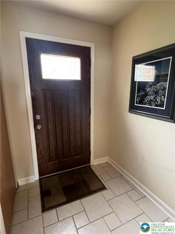


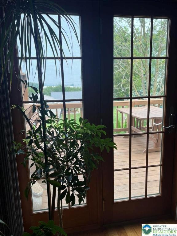
Welcome to 331 W 2nd Street. Spacious End Unit East Penn Townhome carefully maintained and updated throughout by Owner for over 30 years. This 3 BR 2.5 BA has been painted from top to bottom and features gorgeous hardwood floors on 2nd and 3rd levels with tile in baths, kitchen, and foyer. 1st floor welcomes you with beautiful wood finished entry doors, tile foyer, and hallway leading to FR, laundry area w/ s/s sink and utilities, under stairs closet and plumbed for future powder room. Access door to rear concrete patio, storage shed, and large rear yard. 2nd floor boasts flexible open concept space for DR and LR options, totally updated powder room with tile floor and eat-in kitchen w/ tiled floor, oak cabinets, S/S Sink, pantry and large Bay Window. 3rd floor spacious primary BR, hardwood floor, Bay Window, closet with a new en-suite BATH featuring tile corner shower with glass door and tile floor. Two additional BR's w/ hardwood floors and closets, hardwood hallway and Full Bath completely redone w/ tile floors and wainscoting. Outdoor living w/ 12 x 18 second floor deck and 12 x 18 covered concrete patio. Beautifully landscaped front, side and rear yards. Updates include HVAC system 2024, hot water heater, roof, windows, exterior doors, garage door, plumbing, flooring and painted throughout. All appliances remain as-is condition. Move-in ready - Conveniently located near Alburtis pool and school. This great upgraded property is ready for you to call HOME!
Last Agent to Sell the Property
RE/MAX Unlimited Real Estate License #AB047991L Listed on: 09/17/2025
| Date | Type | Sale Price | Title Company |
|---|---|---|---|
| Deed | $339,500 | Trident Land Transfer | |
| Deed | $107,500 | -- | |
| Deed | $90,000 | -- | |
| Deed | $708,500 | -- |
| Date | Event | Price | List to Sale | Price per Sq Ft |
|---|---|---|---|---|
| 11/21/2025 11/21/25 | Sold | $339,500 | 0.0% | $174 / Sq Ft |
| 10/13/2025 10/13/25 | Pending | -- | -- | -- |
| 10/10/2025 10/10/25 | Price Changed | $339,500 | -3.0% | $174 / Sq Ft |
| 09/17/2025 09/17/25 | Price Changed | $349,900 | +1.4% | $179 / Sq Ft |
| 09/17/2025 09/17/25 | For Sale | $345,000 | -- | $176 / Sq Ft |
| Year | Tax Paid | Tax Assessment Tax Assessment Total Assessment is a certain percentage of the fair market value that is determined by local assessors to be the total taxable value of land and additions on the property. | Land | Improvement |
|---|---|---|---|---|
| 2025 | $4,419 | $150,500 | $18,400 | $132,100 |
| 2024 | $4,306 | $150,500 | $18,400 | $132,100 |
| 2023 | $4,107 | $150,500 | $18,400 | $132,100 |
| 2022 | $4,020 | $150,500 | $132,100 | $18,400 |
| 2021 | $3,945 | $150,500 | $18,400 | $132,100 |
| 2020 | $3,912 | $150,500 | $18,400 | $132,100 |
| 2019 | $3,891 | $150,500 | $18,400 | $132,100 |
| 2018 | $3,846 | $150,500 | $18,400 | $132,100 |
| 2017 | $3,788 | $150,500 | $18,400 | $132,100 |
| 2016 | -- | $150,500 | $18,400 | $132,100 |
| 2015 | -- | $150,500 | $18,400 | $132,100 |
| 2014 | -- | $150,500 | $18,400 | $132,100 |
Seller's Agent in 2025
Marlene Blose
RE/MAX
(610) 266-4000
1 in this area
52 Total Sales
B
Buyer's Agent in 2025
Bonnie Lynn Hufton
BHGRE Valley Partners
(610) 762-0670
1 in this area
34 Total Sales
Source: Greater Lehigh Valley REALTORS®
MLS Number: 764866
APN: 546335578597-1
Disclaimer: Certain information contained herein is derived from information provided by parties other than Homes.com. All information provided is deemed reliable, but is not guaranteed to be accurate and should be independently verified.
![]() IDX information is provided exclusively for personal, non-commercial use, and may not be used for any purpose other than to identify prospective properties consumers may be interested in purchasing.
IDX information is provided exclusively for personal, non-commercial use, and may not be used for any purpose other than to identify prospective properties consumers may be interested in purchasing.
Information is deemed reliable but not guaranteed.