Estimated Value: $418,000 - $468,000
About This Home
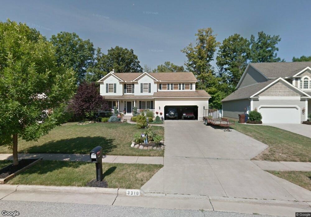
This home is located at 3310 Crown Pointe Dr, Stow, OH 44224 and is currently estimated at $435,783, approximately $290 per square foot. 3310 Crown Pointe Dr is a home located in Summit County with nearby schools including Stow-Munroe Falls High School and St Patrick Elementary School.
Ownership History
We collect this data history from publicly available records. To have your information removed, we recommend requesting removal directly through your county’s website.
Purchase Details
Purchase Details
Home Financials for this Owner
Home Financials are based on the most recent Mortgage that was taken out on this home.Home Values in the Area
Average Home Value in this Area
Purchase History
We collect this data history from publicly available records. To have your information removed, we recommend requesting removal directly through your county’s website.
| Date | Buyer | Sale Price | Title Company |
|---|---|---|---|
| -- | None Listed On Document | ||
| $52,000 | Endress/Lawyers Title |
Mortgage History
We collect this data history from publicly available records. To have your information removed, we recommend requesting removal directly through your county’s website.
| Date | Status | Borrower | Loan Amount |
|---|---|---|---|
| Previous Owner | $177,840 |
Tax History
We collect this data history from publicly available records. To have your information removed, we recommend requesting removal directly through your county’s website.
| Year | Tax Paid | Tax Assessment Tax Assessment Total Assessment is a certain percentage of the fair market value that is determined by local assessors to be the total taxable value of land and additions on the property. | Land | Improvement |
|---|---|---|---|---|
| 2026 | $9,507 | $118,847 | $19,912 | $98,935 |
| 2025 | $7,086 | $118,847 | $19,912 | $98,935 |
| 2024 | $6,839 | $118,847 | $19,912 | $98,935 |
| 2023 | $6,839 | $118,847 | $19,912 | $98,935 |
| 2022 | $6,678 | $102,554 | $17,168 | $85,386 |
| 2021 | $5,993 | $102,554 | $17,168 | $85,386 |
| 2020 | $5,892 | $102,560 | $17,170 | $85,390 |
| 2019 | $5,562 | $88,180 | $17,000 | $71,180 |
| 2018 | $5,336 | $88,180 | $17,000 | $71,180 |
| 2017 | $5,750 | $88,180 | $17,000 | $71,180 |
| 2016 | $5,204 | $81,170 | $17,000 | $64,170 |
| 2015 | $5,750 | $81,170 | $17,000 | $64,170 |
| 2014 | $5,856 | $81,170 | $17,000 | $64,170 |
| 2013 | $5,809 | $80,140 | $17,000 | $63,140 |
Map
- 1314 Denise Dr
- 1271 Carol Dr
- 1262 Carol Dr
- 1312 Sunset Way Cir
- 1295 Shady Lakes Dr
- 511 Suzanne Dr
- 3591 Dayton Ave
- 1265 W Main St
- 391 Louise Ave
- 3176 Wexford Blvd
- 3069 Snowshoe Cir
- 1132 Windward Ln
- 3464 Hunters Crossing
- 1180 Windward Ln
- 3023 Stockbridge Dr
- 2917 Windsor Ct Unit 106
- 4549 Bunker Ln
- 2932 Heatherwood Ct
- 3949 Lake Run Blvd
- 759 Admore Dr
- 3318 Crown Pointe Dr
- 3302 Crown Pointe Dr
- 3326 Crown Pointe Dr
- 4664 Edgewater Dr
- 3313 Crown Pointe Dr
- 3334 Crown Pointe Dr
- 3305 Crown Pointe Dr
- 3297 Crown Pointe Dr
- 3289 Crown Pointe Dr
- 3342 Crown Pointe Dr
- 3270 Crown Pointe Dr
- 4628 Edgewater Dr
- 3281 Crown Pointe Dr
- 3350 Crown Pointe Dr
- 3273 Crown Pointe Dr
- 4620 Edgewater Dr
- 3358 Crown Pointe Dr
- 3262 Crown Pointe Dr
- 4627 Edgewater Dr
- 3265 Crown Pointe Dr
Ask me questions while you tour the home.