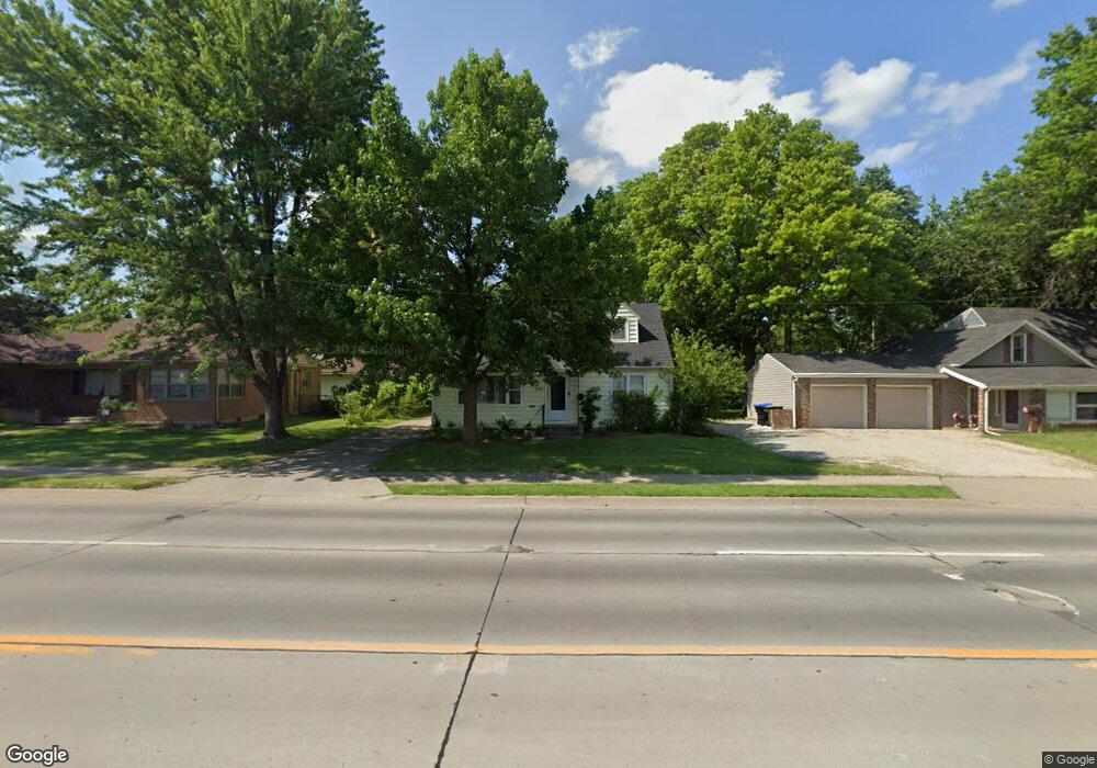
3310 SW 21st St Topeka, KS 66604
Central Topeka NeighborhoodEstimated Value: $186,760 - $213,000
4
Beds
2
Baths
1,561
Sq Ft
$126/Sq Ft
Est. Value
About This Home
This home is located at 3310 SW 21st St, Topeka, KS 66604 and is currently estimated at $197,190, approximately $126 per square foot. 3310 SW 21st St is a home located in Shawnee County with nearby schools including Whitson Elementary School, Marjorie French Middle School, and Topeka West High School.
Ownership History
Date
Name
Owned For
Owner Type
Purchase Details
Closed on
Sep 24, 2024
Sold by
Moran Christian A and Moran Kimberly L
Bought by
Patterson Kellie D
Current Estimated Value
Home Financials for this Owner
Home Financials are based on the most recent Mortgage that was taken out on this home.
Original Mortgage
$146,074
Outstanding Balance
$144,579
Interest Rate
6.49%
Mortgage Type
VA
Estimated Equity
$52,611
Purchase Details
Closed on
Jul 30, 2009
Sold by
Jacques Diane and Will Of Venice Clark
Bought by
Moran Christian A and Moran Kimberly L
Home Financials for this Owner
Home Financials are based on the most recent Mortgage that was taken out on this home.
Original Mortgage
$86,400
Interest Rate
5.41%
Mortgage Type
New Conventional
Create a Home Valuation Report for This Property
The Home Valuation Report is an in-depth analysis detailing your home's value as well as a comparison with similar homes in the area
Home Values in the Area
Average Home Value in this Area
Purchase History
| Date | Buyer | Sale Price | Title Company |
|---|---|---|---|
| Patterson Kellie D | -- | Lawyers Title | |
| Moran Christian A | -- | None Available |
Source: Public Records
Mortgage History
| Date | Status | Borrower | Loan Amount |
|---|---|---|---|
| Open | Patterson Kellie D | $146,074 | |
| Previous Owner | Moran Christian A | $86,400 |
Source: Public Records
Tax History Compared to Growth
Tax History
| Year | Tax Paid | Tax Assessment Tax Assessment Total Assessment is a certain percentage of the fair market value that is determined by local assessors to be the total taxable value of land and additions on the property. | Land | Improvement |
|---|---|---|---|---|
| 2025 | $2,484 | $18,371 | -- | -- |
| 2023 | $2,484 | $16,669 | $0 | $0 |
| 2022 | $2,149 | $14,495 | $0 | $0 |
| 2021 | $1,971 | $12,604 | $0 | $0 |
| 2020 | $1,855 | $12,004 | $0 | $0 |
| 2019 | $1,828 | $11,768 | $0 | $0 |
| 2018 | $1,776 | $11,425 | $0 | $0 |
| 2017 | $1,744 | $11,201 | $0 | $0 |
| 2014 | $1,815 | $11,535 | $0 | $0 |
Source: Public Records
Map
Nearby Homes
- 2012 SW Westwood Dr
- 2028 SW Stone Ave
- 2024 SW Stone Ave
- 1625 SW Lakeside Dr
- 4230 SW 19th St
- 3636 SW Stratford Rd
- 1520 SW Oakley Ave
- 2330 SW Wayne Ave
- 4221 SW 17th St
- 1533 SW Stratford Rd
- 2400 SW 24th St
- 3904 SW 26th St
- 4200 SW Stratford Rd
- 4401 SW Connemara Ln
- 4405 SW Connemara Ln
- 3100 SW Canterbury Ln
- 2401 SW James St
- 1944 SW Quivira Dr
- 2425 SW James St
- 1355 SW Medford Ave
- 3220 SW 21st St
- 3322 SW 21st St
- 2034 SW Arnold Ave
- 2041 SW Westwood Dr
- 2045 SW Westwood Dr
- 2025 SW Westwood Dr
- 2026 SW Arnold Ave
- 2020 SW Arnold Ave
- 2033 SW Arnold Ave
- 2019 SW Westwood Dr
- 2029 SW Arnold Ave
- 2027 SW Arnold Ave
- 2016 SW Arnold Ave
- 2046 SW Westwood Dr
- 2021 SW Arnold Ave
- 2040 SW Westwood Dr
- 2001 SW Westwood Dr
- 2024 SW Westwood Dr
- 2019 SW Arnold Ave
- 2008 SW Arnold Ave