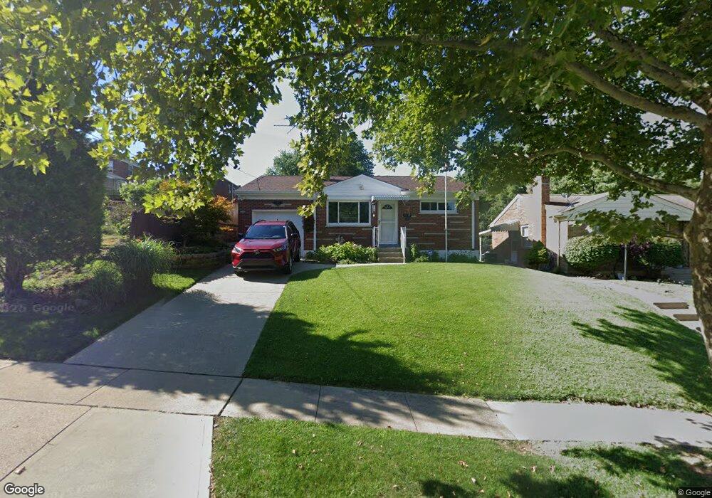
3311 Gerold Dr Cincinnati, OH 45238
Westwood NeighborhoodEstimated Value: $109,000 - $225,000
2
Beds
1
Bath
918
Sq Ft
$164/Sq Ft
Est. Value
About This Home
This home is located at 3311 Gerold Dr, Cincinnati, OH 45238 and is currently estimated at $150,429, approximately $163 per square foot. 3311 Gerold Dr is a home located in Hamilton County with nearby schools including Midway Elementary School, Western Hills High School, and Gilbert A. Dater High School.
Ownership History
Date
Name
Owned For
Owner Type
Purchase Details
Closed on
Aug 12, 1995
Sold by
Klaene Doris M
Bought by
Klaene Doris
Current Estimated Value
Home Financials for this Owner
Home Financials are based on the most recent Mortgage that was taken out on this home.
Original Mortgage
$53,000
Interest Rate
7.64%
Create a Home Valuation Report for This Property
The Home Valuation Report is an in-depth analysis detailing your home's value as well as a comparison with similar homes in the area
Home Values in the Area
Average Home Value in this Area
Purchase History
| Date | Buyer | Sale Price | Title Company |
|---|---|---|---|
| Klaene Doris | -- | -- | |
| Klaene Doris M | -- | -- |
Source: Public Records
Mortgage History
| Date | Status | Borrower | Loan Amount |
|---|---|---|---|
| Previous Owner | Klaene Doris M | $53,000 |
Source: Public Records
Tax History
| Year | Tax Paid | Tax Assessment Tax Assessment Total Assessment is a certain percentage of the fair market value that is determined by local assessors to be the total taxable value of land and additions on the property. | Land | Improvement |
|---|---|---|---|---|
| 2025 | $1,976 | $42,102 | $7,350 | $34,752 |
| 2024 | $1,919 | $42,102 | $7,350 | $34,752 |
| 2023 | $2,014 | $42,102 | $7,350 | $34,752 |
| 2022 | $1,018 | $23,612 | $5,968 | $17,644 |
| 2021 | $964 | $23,612 | $5,968 | $17,644 |
| 2020 | $1,008 | $23,612 | $5,968 | $17,644 |
| 2019 | $940 | $21,466 | $5,425 | $16,041 |
| 2018 | $942 | $21,466 | $5,425 | $16,041 |
| 2017 | $886 | $21,466 | $5,425 | $16,041 |
| 2016 | $1,116 | $24,633 | $6,300 | $18,333 |
| 2015 | $1,014 | $24,633 | $6,300 | $18,333 |
| 2014 | $1,022 | $24,633 | $6,300 | $18,333 |
| 2013 | $1,107 | $25,659 | $6,563 | $19,096 |
Source: Public Records
Map
Nearby Homes
- 3004 Glenmore Ave
- 2195 Woodmere Ct
- 3305 Queen City Ave
- 3141 W Tower Ave
- 3281 Pickbury Dr
- 5487 Belcross Ct
- 3124 Veazey Ave
- 3531 Werk Rd
- 5461 Bellfield Ln
- 2925 Boudinot Ave
- 2710 Carroll Ave
- 5524 Sidney Rd
- 3061 Veazey Ave
- 3230 Stanhope Ave
- 3106 Werk Rd
- 5301 Leon Ct
- 3238 Buell St
- 3223 Manning Ave
- 3011 Westbrook Dr
- 1650 Colonial Dr
- 2719 Anderson Ferry Rd
- 2723 Anderson Ferry Rd
- 2715 Anderson Ferry Rd
- 3319 Gerold Dr
- 2709 Anderson Ferry Rd
- 2655 Foran Dr
- 3323 Gerold Dr
- 2731 Anderson Ferry Rd
- 3310 Gerold Dr
- 2651 Foran Dr
- 3314 Gerold Dr
- 3327 Gerold Dr
- 2659 Foran Dr
- 2735 Anderson Ferry Rd
- 3320 Gerold Dr
- 2647 Foran Dr
- 3324 Gerold Dr
- 2739 Anderson Ferry Rd
- 3331 Gerold Dr
- 2643 Foran Dr
Your Personal Tour Guide
Ask me questions while you tour the home.