

33175 Bausenburg Rd N Davenport, WA 99122
Estimated Value: $59,744 - $108,000
5
Acres
$17,537
Price per Acre
217,800
Sq Ft Lot
Highlights
- Territorial View
- Davenport Elementary School Rated A-
- Green energy is off-grid
About This Lot
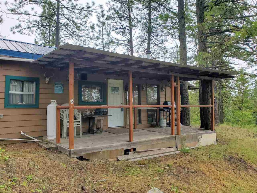
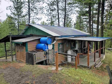
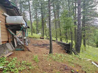
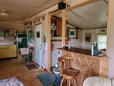
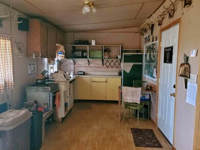
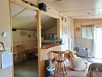
As of June 2020Come check out this 5 acre parcel on secluded Bausenburg Rd outside Davenport WA. Nicely Treed and comfortably setup for hunting and camping. Self-contained off grid cabin with water and power systems in place. This property makes a nice quiet getaway for many occasions.
Property Details
Property Type
- Land
Est. Annual Taxes
- $242
Year Built
- 2009
Lot Details
- 5 Acre Lot
- Dirt Road
Utilities
- Water Not Available
- Sewer Not Available
Additional Features
- Territorial Views
- Green energy is off-grid
Listing and Financial Details
- Assessor Parcel Number 2637014300011
Ownership History
Date
Name
Owned For
Owner Type
Purchase Details
Closed on
Apr 12, 2007
Sold by
Sloan John and Sloan Christine
Bought by
Sloan John and Sloan Christine
Total Days on Market
18
Current Estimated Value
Purchase Details
Closed on
Dec 21, 2004
Sold by
Verhaag Dan
Bought by
Verhaag Dan
Purchase Details
Closed on
Nov 12, 2004
Sold by
Phillipson Wallace
Bought by
Phillipson Wallace
Create a Home Valuation Report for This Property
The Home Valuation Report is an in-depth analysis detailing your home's value as well as a comparison with similar homes in the area
Similar Properties in Davenport, WA
-
$89,000
- Land
- 5 Acres
- $17,800 per Acre
- 1 Lot Dalloul Meadow Ln
- Davenport, WA
One of the best lots in Hawk Creek Ranch Estates! Sellers are motivated to work with the right Seller. Breath taking Hawk Creek area views. Property offers easy access close to the lodge, drilled well and plenty of great build sites. Lodge offers a relaxing atmosphere in a Yellowstone themed cabin, large porch over looking the area, tennis courts and seasonal pool.
Cassandra Becker Katz Realty, Inc.
-
$99,000
- Land
- 4.97 Acres
- $19,920 per Acre
- 0 Lot 2 Scenic Ruffed Grouse Dr
- Davenport, WA
Coveted Hawk Creek Ranch property with pastoral view now available! Located just off the main paved road and close to the south gate this shy 5Ac lot has 2 tired cleared level building site. Come enjoy all the recreation the area has to offer. This private, peaceful, secure gated community allows up to 3 buildings per lot. No manufactured homes or pole buildings but you can park your RV for up to
Candace Stephenson 4 Degrees Real Estate
Home Values in the Area
Average Home Value in this Area
Purchase History
| Date | Buyer | Sale Price | Title Company |
|---|---|---|---|
| Sloan John | $20,000 | -- | |
| Verhaag Dan | -- | -- | |
| Phillipson Wallace | $4,000 | -- |
Source: Public Records
Property History
| Date | Event | Price | Change | Sq Ft Price |
|---|---|---|---|---|
| 06/22/2020 06/22/20 | Sold | $42,000 | -6.5% | -- |
| 06/09/2020 06/09/20 | Pending | -- | -- | -- |
| 05/22/2020 05/22/20 | For Sale | $44,900 | -- | -- |
Source: Spokane Association of REALTORS®
Tax History Compared to Growth
Tax History
| Year | Tax Paid | Tax Assessment Tax Assessment Total Assessment is a certain percentage of the fair market value that is determined by local assessors to be the total taxable value of land and additions on the property. | Land | Improvement |
|---|---|---|---|---|
| 2025 | $504 | $42,220 | $10,000 | $32,220 |
| 2024 | $504 | $42,220 | $10,000 | $32,220 |
| 2023 | $529 | $42,220 | $10,000 | $32,220 |
| 2022 | $485 | $32,220 | $10,000 | $22,220 |
| 2021 | $486 | $32,220 | $10,000 | $22,220 |
| 2019 | $216 | $14,570 | $10,000 | $4,570 |
| 2018 | $233 | $14,570 | $10,000 | $4,570 |
| 2017 | $226 | $14,570 | $10,000 | $4,570 |
| 2015 | -- | $10,000 | $10,000 | $0 |
| 2013 | -- | $10,000 | $10,000 | $0 |
Source: Public Records
Agents Affiliated with this Home
-
Jade Jahn
J
Seller's Agent in 2020
Jade Jahn
Katz Realty, Inc.
(509) 721-1226
17 Total Sales
Map
Source: Spokane Association of REALTORS®
MLS Number: 202016044
APN: 2637-014-300011
Disclaimer: Certain information contained herein is derived from information provided by parties other than Homes.com. All information provided is deemed reliable, but is not guaranteed to be accurate and should be independently verified.
![]() IDX information is provided exclusively for personal, non-commercial use, and may not be used for any purpose other than to identify prospective properties consumers may be interested in purchasing.
IDX information is provided exclusively for personal, non-commercial use, and may not be used for any purpose other than to identify prospective properties consumers may be interested in purchasing.
Information is deemed reliable but not guaranteed.
Nearby Homes
- 36435 Western Pines Dr N
- 26405 Lone Pine Rd E
- Lot 1 Blue Jay Bob White Ln
- Lot 2 Scenic Short Plat Dr
- Tract E Meadow Lane Rd
- Lot 10 Timberbay Ranches Dr
- 2 Hart Rd N
- 27750 Evers Rd
- 28222 Wild Rose Ln N
- 28148 State Route 25 N
- 45XXX Devore Rd
- 200 Gunning Rd Unit N B04
- 610 Ross St
- 401 4th St
- 802 Logan St
- 1032 Morgan St
- 925 Morgan St
- 1015 Morgan St
- 78 Maxwell St
- 817 Park St