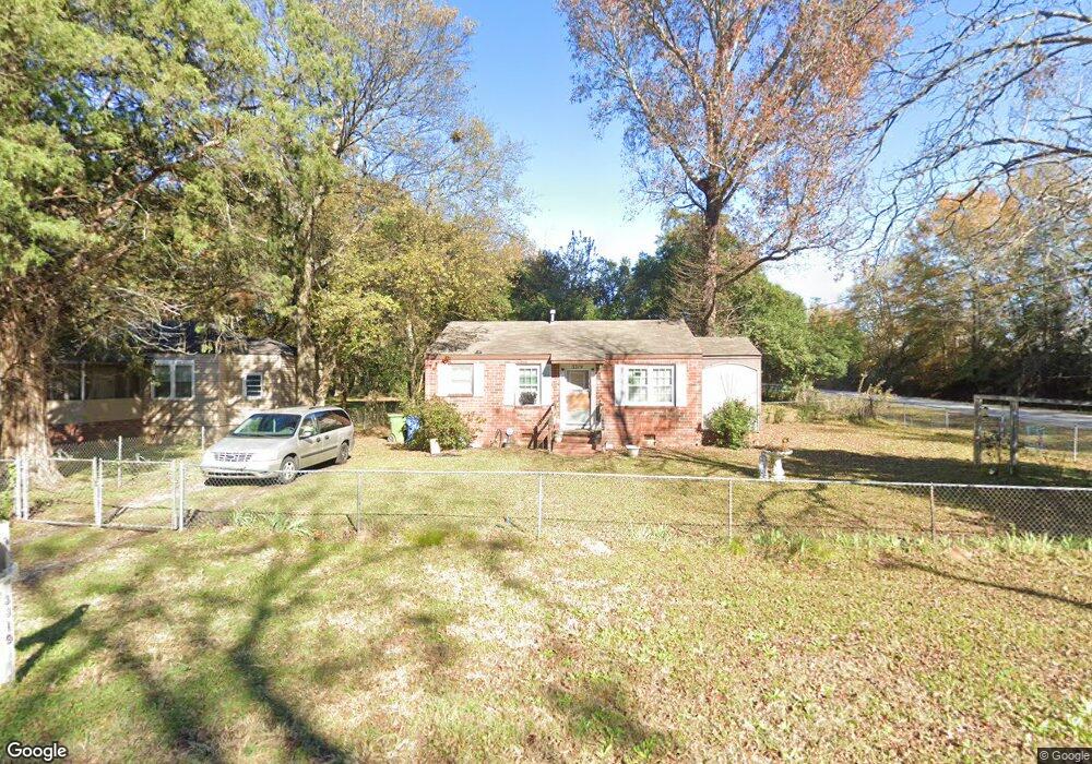
3319 Albert St Columbus, GA 31903
South Columbus NeighborhoodEstimated Value: $66,000 - $79,000
3
Beds
2
Baths
942
Sq Ft
$75/Sq Ft
Est. Value
About This Home
This home is located at 3319 Albert St, Columbus, GA 31903 and is currently estimated at $70,332, approximately $74 per square foot. 3319 Albert St is a home located in Muscogee County with nearby schools including South Columbus Elementary School, Eddy Middle School, and Spencer High School.
Ownership History
Date
Name
Owned For
Owner Type
Purchase Details
Closed on
May 18, 2022
Sold by
Mccorlew Realty Inc
Bought by
House And Home Rentals Llc
Current Estimated Value
Home Financials for this Owner
Home Financials are based on the most recent Mortgage that was taken out on this home.
Original Mortgage
$2,229,119
Interest Rate
4.48%
Mortgage Type
Seller Take Back
Create a Home Valuation Report for This Property
The Home Valuation Report is an in-depth analysis detailing your home's value as well as a comparison with similar homes in the area
Home Values in the Area
Average Home Value in this Area
Purchase History
| Date | Buyer | Sale Price | Title Company |
|---|---|---|---|
| House And Home Rentals Llc | $2,317,400 | Page Scrantom Sprouse Tucker & |
Source: Public Records
Mortgage History
| Date | Status | Borrower | Loan Amount |
|---|---|---|---|
| Closed | House And Home Rentals Llc | $2,229,119 |
Source: Public Records
Tax History
| Year | Tax Paid | Tax Assessment Tax Assessment Total Assessment is a certain percentage of the fair market value that is determined by local assessors to be the total taxable value of land and additions on the property. | Land | Improvement |
|---|---|---|---|---|
| 2025 | $1,101 | $28,128 | $6,224 | $21,904 |
| 2024 | $524 | $13,376 | $4,232 | $9,144 |
| 2023 | $527 | $13,376 | $4,232 | $9,144 |
| 2022 | $455 | $11,140 | $4,232 | $6,908 |
| 2021 | $360 | $8,820 | $4,232 | $4,588 |
| 2020 | $360 | $8,820 | $4,232 | $4,588 |
| 2019 | $361 | $8,820 | $4,232 | $4,588 |
| 2018 | $484 | $13,892 | $4,232 | $9,660 |
| 2017 | $571 | $13,892 | $4,232 | $9,660 |
| 2016 | $455 | $11,018 | $1,766 | $9,252 |
| 2015 | $455 | $11,018 | $1,766 | $9,252 |
| 2014 | $456 | $11,018 | $1,766 | $9,252 |
| 2013 | -- | $11,018 | $1,766 | $9,252 |
Source: Public Records
Map
Nearby Homes
- 2404 Bruce Ave
- 2343 Manning Ave
- 2339 Manning Ave
- 2333 Bruce Ave
- 3120 Drake St
- 2241 Bruce Ave
- 3063 Meade St
- 3233 Hendrix St
- 3044 Wise St
- 3048 Knox St
- 58 Ticknor Dr
- 2425 Howe Ave
- 2940 Walker St
- 2102 Somerset Ave
- 2058 Somerset Ave
- 2940 Blan St
- 3015 Hendrix St
- 122 Torch Hill Rd
- 41 Mason Dr
- 52 Mathews St
- 3313 Albert St
- 2353 Manning Ave
- 3309 Albert St
- 2349 Manning Ave
- 3320 Albert St
- 2354 Bruce Ave
- 3314 Albert St
- 2360 Bruce Ave
- 2348 Bruce Ave
- 2344 Bruce Ave
- 2411 Manning Ave
- 2340 Bruce Ave
- 2410 Bruce Ave
- 2417 Manning Ave
- 3314 Drake St
- 2414 Bruce Ave
- 3310 Drake St
- 3320 Drake St
- 2348 Simmons Ave
- 3302 Drake St
Your Personal Tour Guide
Ask me questions while you tour the home.