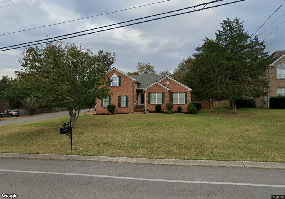
332 Baronswood Dr Nolensville, TN 37135
Estimated Value: $640,320 - $847,000
--
Bed
4
Baths
2,232
Sq Ft
$315/Sq Ft
Est. Value
About This Home
This home is located at 332 Baronswood Dr, Nolensville, TN 37135 and is currently estimated at $703,080, approximately $315 per square foot. 332 Baronswood Dr is a home located in Williamson County with nearby schools including Nolensville Elementary School, Mill Creek Middle School, and Nolensville High School.
Ownership History
Date
Name
Owned For
Owner Type
Purchase Details
Closed on
Oct 24, 2018
Sold by
Anderson Joan G and Estellee Y Sullivan Living Tru
Bought by
Anderson Joan G
Current Estimated Value
Purchase Details
Closed on
Oct 30, 1998
Sold by
Fox Ridge Homes Inc
Bought by
Anderson Scott H and Anderson Joan G
Home Financials for this Owner
Home Financials are based on the most recent Mortgage that was taken out on this home.
Original Mortgage
$140,000
Outstanding Balance
$29,991
Interest Rate
6.65%
Estimated Equity
$673,089
Create a Home Valuation Report for This Property
The Home Valuation Report is an in-depth analysis detailing your home's value as well as a comparison with similar homes in the area
Home Values in the Area
Average Home Value in this Area
Purchase History
| Date | Buyer | Sale Price | Title Company |
|---|---|---|---|
| Anderson Joan G | -- | None Available | |
| Anderson Scott H | $196,963 | -- |
Source: Public Records
Mortgage History
| Date | Status | Borrower | Loan Amount |
|---|---|---|---|
| Open | Anderson Scott H | $140,000 |
Source: Public Records
Tax History Compared to Growth
Tax History
| Year | Tax Paid | Tax Assessment Tax Assessment Total Assessment is a certain percentage of the fair market value that is determined by local assessors to be the total taxable value of land and additions on the property. | Land | Improvement |
|---|---|---|---|---|
| 2025 | $2,313 | $169,725 | $46,250 | $123,475 |
| 2024 | $2,313 | $106,600 | $18,750 | $87,850 |
| 2023 | $2,313 | $106,600 | $18,750 | $87,850 |
| 2022 | $2,313 | $106,600 | $18,750 | $87,850 |
| 2021 | $2,313 | $106,600 | $18,750 | $87,850 |
| 2020 | $2,097 | $83,550 | $15,000 | $68,550 |
| 2019 | $1,980 | $83,550 | $15,000 | $68,550 |
| 2018 | $1,921 | $83,550 | $15,000 | $68,550 |
| 2017 | $1,905 | $83,550 | $15,000 | $68,550 |
| 2016 | $0 | $83,550 | $15,000 | $68,550 |
| 2015 | -- | $69,450 | $12,500 | $56,950 |
| 2014 | -- | $69,450 | $12,500 | $56,950 |
Source: Public Records
Map
Nearby Homes
- 373 Baronswood Dr
- 625 Mer Rouge Dr
- Ansley Plan at The Mill at McFarlin - Estates Series
- Kingston Plan at The Mill at McFarlin - Estates Series
- Weston Plan at The Mill at McFarlin - Estates Series
- Buchanan Plan at The Mill at McFarlin - Estates Series
- 825 Piccadilly Dr
- 2207 Potter Place
- 2248 Rolling Hills Dr
- 1115 Oak Creek Dr
- 2211 Potter Place
- 4137 Brendlyn Dr
- 2222 Potter Place
- 2215 Potter Place
- 4133 Brendlyn Dr
- 2219 Potter Place
- 2223 Potter Place
- 607 Quarter Horse Ln
- 1228 Countryside Rd
- 3009 Winterberry Dr
- 328 Baronswood Dr
- 336 Baronswood Dr
- 324 Baronswood Dr
- 333 Baronswood Dr
- 340 Baronswood Dr
- 329 Baronswood Dr
- 337 Baronswood Dr
- 320 Baronswood Dr
- 325 Baronswood Dr
- 341 Baronswood Dr
- 321 Baronswood Dr
- 316 Baronswood Dr
- 317 Baronswood Dr
- 313 Baronswood Dr
- 308 Baronswood Dr
- 361 Baronswood Dr
- 309 Baronswood Dr
- 364 Baronswood Dr
- 304 Baronswood Dr
- 365 Baronswood Dr