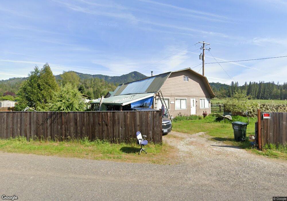
332 Covered Bridge Rd Rogue River, OR 97537
Wimer NeighborhoodEstimated Value: $306,135 - $406,000
2
Beds
1
Bath
1,142
Sq Ft
$326/Sq Ft
Est. Value
About This Home
This home is located at 332 Covered Bridge Rd, Rogue River, OR 97537 and is currently estimated at $372,045, approximately $325 per square foot. 332 Covered Bridge Rd is a home located in Jackson County with nearby schools including Rogue River Elementary School, South Valley Academy, and Rogue River Junior/Senior High School.
Ownership History
Date
Name
Owned For
Owner Type
Purchase Details
Closed on
Jul 30, 2021
Sold by
Moydell Michael Lee and Moydell Family Trust
Bought by
King Nebbie Ann and Moydell Family Trust
Current Estimated Value
Purchase Details
Closed on
Dec 29, 1999
Sold by
Worthington Greg A
Bought by
Moydell Michael L and Moydell Marilyn M
Home Financials for this Owner
Home Financials are based on the most recent Mortgage that was taken out on this home.
Original Mortgage
$114,823
Outstanding Balance
$33,675
Interest Rate
7.68%
Mortgage Type
FHA
Estimated Equity
$338,370
Create a Home Valuation Report for This Property
The Home Valuation Report is an in-depth analysis detailing your home's value as well as a comparison with similar homes in the area
Home Values in the Area
Average Home Value in this Area
Purchase History
| Date | Buyer | Sale Price | Title Company |
|---|---|---|---|
| King Nebbie Ann | -- | None Available | |
| Moydell Michael L | $115,000 | Crater Title Insurance |
Source: Public Records
Mortgage History
| Date | Status | Borrower | Loan Amount |
|---|---|---|---|
| Open | Moydell Michael L | $114,823 |
Source: Public Records
Tax History Compared to Growth
Tax History
| Year | Tax Paid | Tax Assessment Tax Assessment Total Assessment is a certain percentage of the fair market value that is determined by local assessors to be the total taxable value of land and additions on the property. | Land | Improvement |
|---|---|---|---|---|
| 2026 | $2,076 | $187,150 | -- | -- |
| 2025 | $1,846 | $181,700 | $128,690 | $53,010 |
| 2024 | $1,846 | $176,410 | $124,940 | $51,470 |
| 2023 | $1,786 | $171,280 | $121,310 | $49,970 |
| 2022 | $1,682 | $171,280 | $121,310 | $49,970 |
| 2021 | $1,640 | $166,300 | $117,790 | $48,510 |
| 2020 | $1,600 | $162,330 | $110,180 | $52,150 |
| 2019 | $1,560 | $153,020 | $103,860 | $49,160 |
| 2018 | $1,519 | $148,570 | $100,840 | $47,730 |
| 2017 | $1,482 | $148,570 | $100,840 | $47,730 |
| 2016 | $1,444 | $140,050 | $95,060 | $44,990 |
| 2015 | $1,398 | $140,050 | $95,060 | $44,990 |
| 2014 | $1,350 | $132,020 | $89,610 | $42,410 |
Source: Public Records
Map
Nearby Homes
- 643 Covered Bridge Rd
- 149 Queens Branch Rd
- 8951 E Evans Creek Rd Unit 14
- 798 Covered Bridge Rd
- 100 Minthorne Rd
- 7118 Redthorne Rd
- 6324 E Evans Creek Rd
- 9820 E Evans Creek Rd
- 1105 Pine Grove Rd
- 7310 W Evans Creek Rd
- 835 Minthorne Rd
- 1740 Pleasant Creek Rd
- 9184 W Evans Creek Rd
- 0 E Evans Creek Rd Unit 11568775
- 0 E Evans Creek Rd Unit 24656493
- 0 Sykes Cr Rd
- 8797 W Evans Creek Rd
- 250 Deruyte Way
- 252 Deruyte Way
- 254 Deruyte Way
- 368 Covered Bridge Rd
- 3302 TL# Covered Bridge Rd
- 3301 TL# Covered Bridge Rd
- 350 Covered Bridge Rd
- 465 Covered Bridge Rd
- 374 Covered Bridge Rd
- 374 Covered Bridge Realty
- 8436 E Evans Creek Rd
- 534 Covered Bridge Rd
- 8452 E Evans Creek Rd
- 296 Covered Bridge Rd
- 7974 E Evans Creek Rd
- 8450 E Evans Creek Rd
- 7924 E Evans Creek Rd
- 7994 E Evans Creek Rd
- 577 Covered Bridge Rd
- 674 Covered Bridge Rd
- 8027 E Evans Creek Rd
- 598 Cov Bridge
- 598 Covered Bridge Rd