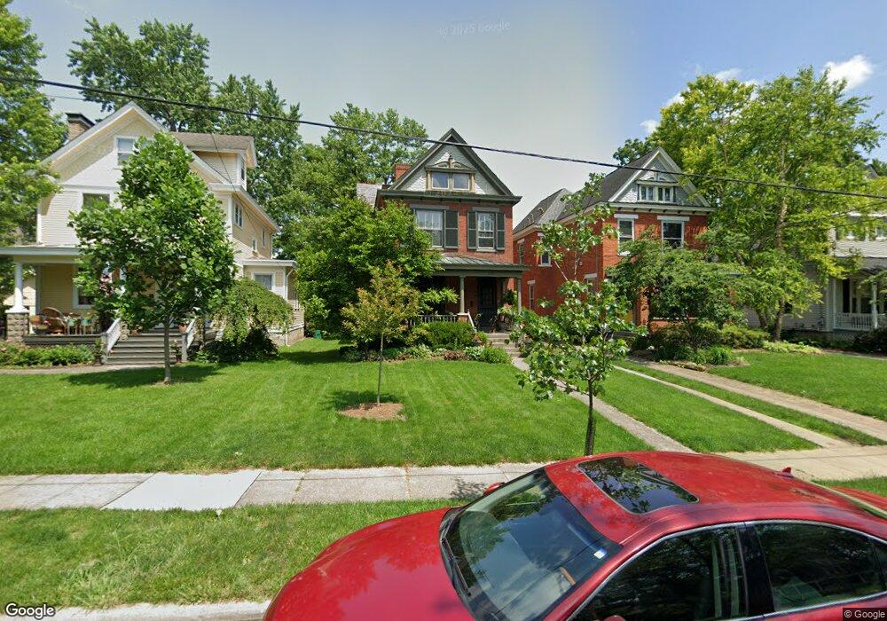
332 Grove Ave Cincinnati, OH 45215
Estimated Value: $571,000 - $717,000
4
Beds
2
Baths
2,575
Sq Ft
$250/Sq Ft
Est. Value
About This Home
This home is located at 332 Grove Ave, Cincinnati, OH 45215 and is currently estimated at $644,212, approximately $250 per square foot. 332 Grove Ave is a home located in Hamilton County with nearby schools including Wyoming High School.
Ownership History
Date
Name
Owned For
Owner Type
Purchase Details
Closed on
Apr 29, 2002
Sold by
Schreckenhofer Jay J and Schreckenhofer Karen L
Bought by
Parker Alan W and Parker Paula C
Current Estimated Value
Home Financials for this Owner
Home Financials are based on the most recent Mortgage that was taken out on this home.
Original Mortgage
$256,400
Outstanding Balance
$105,820
Interest Rate
7.18%
Estimated Equity
$538,392
Purchase Details
Closed on
Apr 24, 1997
Sold by
Laspina James P and Laspina Linda M
Bought by
Schreckenhofer Jay J and Schreckenhofer Karen L
Home Financials for this Owner
Home Financials are based on the most recent Mortgage that was taken out on this home.
Original Mortgage
$166,200
Interest Rate
7.92%
Create a Home Valuation Report for This Property
The Home Valuation Report is an in-depth analysis detailing your home's value as well as a comparison with similar homes in the area
Home Values in the Area
Average Home Value in this Area
Purchase History
| Date | Buyer | Sale Price | Title Company |
|---|---|---|---|
| Parker Alan W | $302,000 | Title First Agency Inc | |
| Schreckenhofer Jay J | $175,000 | -- |
Source: Public Records
Mortgage History
| Date | Status | Borrower | Loan Amount |
|---|---|---|---|
| Open | Parker Alan W | $256,400 | |
| Closed | Schreckenhofer Jay J | $166,200 |
Source: Public Records
Tax History
| Year | Tax Paid | Tax Assessment Tax Assessment Total Assessment is a certain percentage of the fair market value that is determined by local assessors to be the total taxable value of land and additions on the property. | Land | Improvement |
|---|---|---|---|---|
| 2025 | $9,264 | $152,205 | $23,776 | $128,429 |
| 2024 | $9,046 | $152,205 | $23,776 | $128,429 |
| 2023 | $8,339 | $152,205 | $23,776 | $128,429 |
| 2022 | $8,313 | $122,714 | $15,547 | $107,167 |
| 2021 | $8,101 | $122,714 | $15,547 | $107,167 |
| 2020 | $8,286 | $122,714 | $15,547 | $107,167 |
| 2019 | $8,378 | $114,685 | $14,529 | $100,156 |
| 2018 | $8,381 | $114,685 | $14,529 | $100,156 |
| 2017 | $8,025 | $114,685 | $14,529 | $100,156 |
| 2016 | $6,768 | $111,731 | $15,190 | $96,541 |
| 2015 | $6,846 | $111,731 | $15,190 | $96,541 |
| 2014 | $6,863 | $111,731 | $15,190 | $96,541 |
| 2013 | $6,236 | $97,157 | $13,209 | $83,948 |
Source: Public Records
Map
Nearby Homes
- 177 Burns Ave
- 701 W Wyoming Ave
- 342 Durrell Ave
- 127 Locust St
- 25 Euclid Ave
- 8421 Wiswell St
- 1019 Crosley Ave
- 42 Sheehan Ave
- 217 W Wyoming Ave
- 320 Reily Rd
- 1118 Burns Ave
- 334 Williams St
- 8338 Anthony Wayne Ave
- 8318 Marley St
- 29 Forest Ave
- 8415 Mayfair St
- 163 Compton Rd
- 405 Home Ave
- 529 Elliott Ave
- 415 Arlington Ave
- 330 Grove Ave
- 334 Grove Ave
- 326 Grove Ave
- 415 Worthington Ave
- 340 Grove Ave
- 417 Worthington Ave
- 318 Grove Ave
- 329 Crescent Ave
- 325 Crescent Ave
- 321 Crescent Ave
- 331 Grove Ave
- 321 Worthington Ave
- 323 Grove Ave
- 314 Grove Ave
- 317 Crescent Ave
- 404 Grove Ave
- 317 Grove Ave
- 313 Crescent Ave
- 308 Grove Ave
- 412 Worthington Ave
Your Personal Tour Guide
Ask me questions while you tour the home.