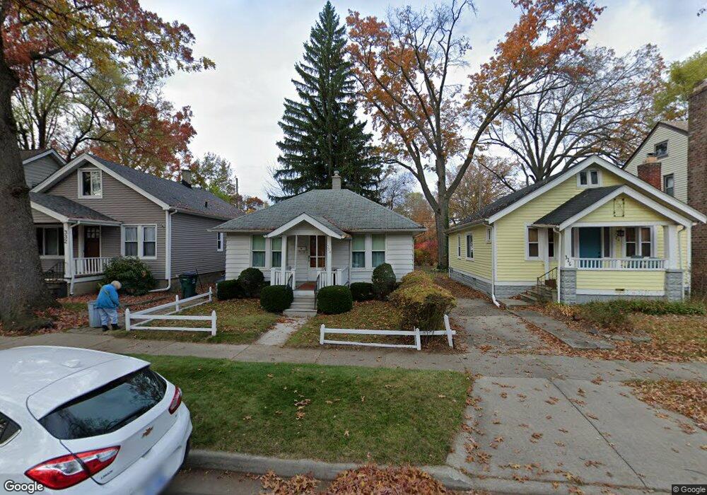
332 W Webster St Unit Bldg-Unit Ferndale, MI 48220
Estimated Value: $264,000 - $316,000
3
Beds
3
Baths
1,252
Sq Ft
$230/Sq Ft
Est. Value
About This Home
This home is located at 332 W Webster St Unit Bldg-Unit, Ferndale, MI 48220 and is currently estimated at $287,516, approximately $229 per square foot. 332 W Webster St Unit Bldg-Unit is a home located in Oakland County with nearby schools including Ferndale Lower Elementary Campus, Ferndale Upper Elementary Campus, and Ferndale Middle School.
Ownership History
Date
Name
Owned For
Owner Type
Purchase Details
Closed on
May 19, 2021
Sold by
Wurtz Kelsey
Bought by
Gray Janet and Gray William
Current Estimated Value
Purchase Details
Closed on
Jun 29, 2018
Sold by
Rodd Randall Nathan
Bought by
Wurtz Kelsey
Purchase Details
Closed on
Aug 26, 2013
Sold by
Secretary Of Housing & Urban Development
Bought by
Rodd Randall Nathan
Purchase Details
Closed on
Oct 4, 2012
Sold by
Bank Of America Na
Bought by
Secretary Of Housing & Urban Development
Purchase Details
Closed on
Aug 21, 2012
Sold by
Holland Inga and Mortgage Electronic Registrati
Bought by
Bank Of America Na
Purchase Details
Closed on
Sep 21, 2005
Sold by
Auspseter Anna G and Mcdonald Robert C
Bought by
Holland Inga
Create a Home Valuation Report for This Property
The Home Valuation Report is an in-depth analysis detailing your home's value as well as a comparison with similar homes in the area
Home Values in the Area
Average Home Value in this Area
Purchase History
| Date | Buyer | Sale Price | Title Company |
|---|---|---|---|
| Gray Janet | $250,000 | Embassy Title Agency Inc | |
| Wurtz Kelsey | $220,000 | Liberty Title | |
| Rodd Randall Nathan | $57,501 | None Available | |
| Secretary Of Housing & Urban Development | -- | None Available | |
| Bank Of America Na | $131,822 | None Available | |
| Holland Inga | $103,000 | Multiple |
Source: Public Records
Tax History Compared to Growth
Tax History
| Year | Tax Paid | Tax Assessment Tax Assessment Total Assessment is a certain percentage of the fair market value that is determined by local assessors to be the total taxable value of land and additions on the property. | Land | Improvement |
|---|---|---|---|---|
| 2024 | $5,181 | $111,980 | $0 | $0 |
| 2023 | $5,038 | $102,170 | $0 | $0 |
| 2022 | $5,070 | $93,770 | $0 | $0 |
| 2021 | $4,689 | $87,930 | $0 | $0 |
| 2020 | $4,441 | $86,690 | $0 | $0 |
| 2019 | $4,514 | $80,520 | $0 | $0 |
| 2018 | $2,299 | $47,520 | $0 | $0 |
| 2017 | $2,266 | $47,010 | $0 | $0 |
| 2016 | $1,725 | $39,020 | $0 | $0 |
| 2015 | -- | $32,220 | $0 | $0 |
| 2014 | -- | $27,570 | $0 | $0 |
| 2011 | -- | $32,500 | $0 | $0 |
Source: Public Records
Map
Nearby Homes
- 295 W Webster St
- 378 Fielding St
- 243 W Webster St
- 260 Fielding St
- 243 Edgewood Place
- 457 W Bennett
- 482 W 8 Mile Rd
- 210 Saint Louis St
- 168 W Bennett
- 2564 Woodstock Dr
- 2836 Woodstock Dr
- 415 Laprairie St
- 211 Silman St
- 230 E Webster St
- 221 Silman St
- 274 Silman St
- 2545 Woodstock Dr
- 2444 Woodstock Dr
- 250 Spencer St
- 306 Silman St
- 332 W Webster St
- 340 W Webster St
- 316 W Webster St
- 312 W Webster St
- 350 W Webster St
- 343 Fielding St
- 327 Fielding St
- 323 Fielding St
- 358 W Webster St
- 306 W Webster St
- 304 W Webster St
- 347 W Webster St
- 349 Fielding St
- 357 Fielding St
- 303 Fielding St
- 294 W Webster St
- 319 W Webster St
- 341 W Webster St
- 333 W Webster St
- 353 W Webster St