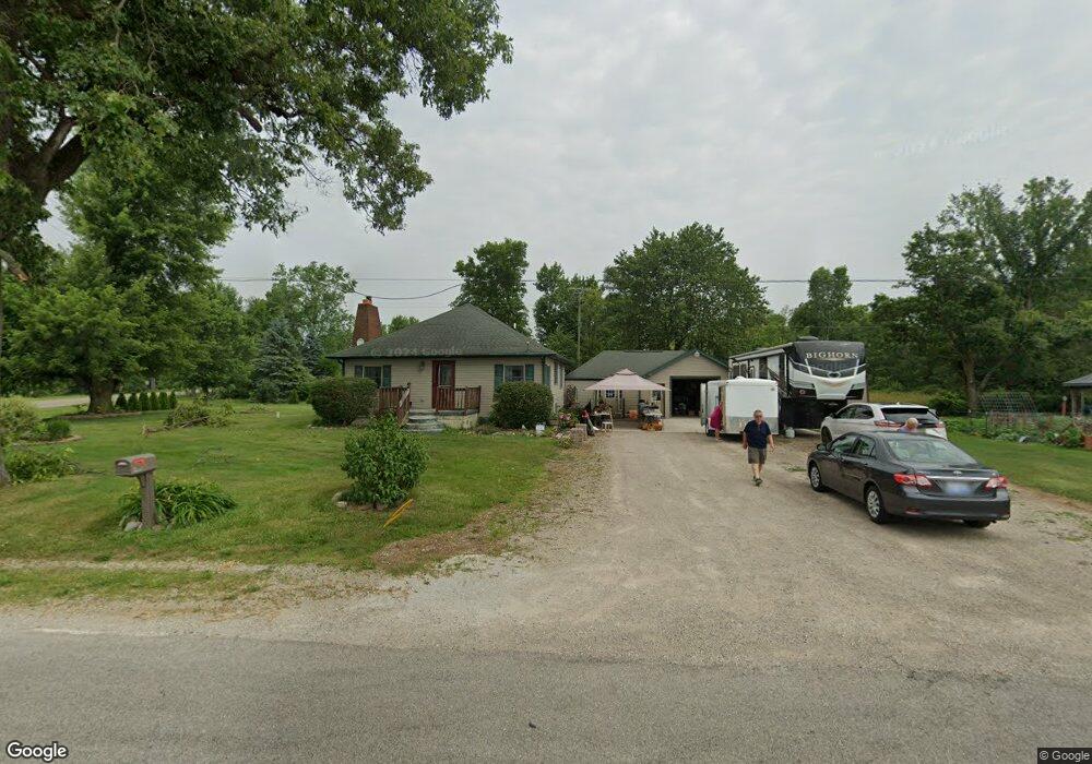
3320 Pennington Rd Clinton, MI 49236
Estimated Value: $232,313 - $268,000
2
Beds
1
Bath
1,350
Sq Ft
$191/Sq Ft
Est. Value
About This Home
This home is located at 3320 Pennington Rd, Clinton, MI 49236 and is currently estimated at $258,078, approximately $191 per square foot. 3320 Pennington Rd is a home located in Lenawee County with nearby schools including Clinton Elementary School, Clinton Middle School, and Clinton High School.
Ownership History
Date
Name
Owned For
Owner Type
Purchase Details
Closed on
Apr 15, 2015
Sold by
Young Michael D
Bought by
Retter Mark E and Retter Michelle L
Current Estimated Value
Home Financials for this Owner
Home Financials are based on the most recent Mortgage that was taken out on this home.
Original Mortgage
$114,795
Outstanding Balance
$88,339
Interest Rate
3.73%
Mortgage Type
New Conventional
Estimated Equity
$169,739
Purchase Details
Closed on
Apr 9, 2004
Bought by
Young Michael D
Create a Home Valuation Report for This Property
The Home Valuation Report is an in-depth analysis detailing your home's value as well as a comparison with similar homes in the area
Home Values in the Area
Average Home Value in this Area
Purchase History
| Date | Buyer | Sale Price | Title Company |
|---|---|---|---|
| Retter Mark E | $112,500 | None Available | |
| Young Michael D | $120,000 | -- |
Source: Public Records
Mortgage History
| Date | Status | Borrower | Loan Amount |
|---|---|---|---|
| Open | Retter Mark E | $114,795 |
Source: Public Records
Tax History
| Year | Tax Paid | Tax Assessment Tax Assessment Total Assessment is a certain percentage of the fair market value that is determined by local assessors to be the total taxable value of land and additions on the property. | Land | Improvement |
|---|---|---|---|---|
| 2025 | $2,243 | $106,000 | $0 | $0 |
| 2024 | $9 | $98,200 | $0 | $0 |
| 2022 | $1,880 | $76,800 | $0 | $0 |
| 2021 | $1,855 | $73,900 | $0 | $0 |
| 2020 | $1,833 | $71,400 | $0 | $0 |
| 2019 | $173,281 | $63,500 | $0 | $0 |
| 2018 | $1,753 | $77,131 | $0 | $0 |
| 2017 | $1,623 | $56,124 | $0 | $0 |
| 2016 | $1,621 | $55,862 | $0 | $0 |
| 2014 | -- | $60,768 | $0 | $0 |
Source: Public Records
Map
Nearby Homes
- V/L Post Oak Dr
- 11180 Tecumseh - Clinton Hwy
- 10000 Meads Hwy
- 102 Tyrrell St
- 317 Clark St Unit B
- 11100 Murphy Hwy
- 108 Burton St
- 316 W Michigan Ave Unit 28
- 100 BLK Pleasant Dr
- 9103 N Union St Unit LOT 46
- 9103 N Union St Unit Lot 93
- 9103 N Union Lot #116 St Unit 116
- 919 Pontiac Trail
- 618 Nokomis St
- 9000 Matthews Hwy
- 766 Eagle View Point
- 765 Eagle View Point
- 758 Eagle View Way
- 756 Eagle View Way Unit 18 Lone Oak of
- 752 Eagle View Way
- 3340 Pennington Rd
- 3400 Pennington Rd
- 3148 Pennington Rd
- 3153 Pennington Rd
- 3430 Pennington Rd
- 3129 Pennington Rd
- 3458 Post Oak Dr
- 3472 Post Oak Dr
- 3440 Post Oak Dr
- 3110 Pennington Rd
- 3486 Post Oak Dr
- 3105 Pennington Rd
- 3500 Post Oak Dr
- 3424 Post Oak Dr
- 3474 Pennington Rd
- 11047 Tecumseh Clinton Rd
- 3408 Post Oak Dr
- 11085 Clinton Rd Unit TEC
- 11085 Clinton Rd
- 11107 Clinton Rd Unit TEC
Your Personal Tour Guide
Ask me questions while you tour the home.