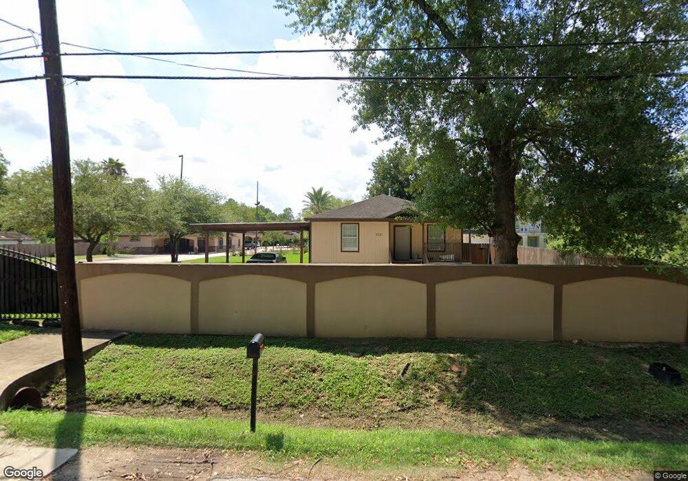
3321 Mansfield St Houston, TX 77091
Acres Homes NeighborhoodEstimated Value: $240,000 - $548,161
2
Beds
1
Bath
960
Sq Ft
$417/Sq Ft
Est. Value
About This Home
This home is located at 3321 Mansfield St, Houston, TX 77091 and is currently estimated at $400,290, approximately $416 per square foot. 3321 Mansfield St is a home with nearby schools including Edward a Vines EC/Pre-K/K School, Harris Elementary School, and Hoffman Middle School.
Ownership History
Date
Name
Owned For
Owner Type
Purchase Details
Closed on
Nov 20, 2020
Sold by
Guerra Aldo R
Bought by
Guerra Ana M
Current Estimated Value
Purchase Details
Closed on
Jul 19, 2005
Sold by
Ford Alfonzo Lamarr
Bought by
Guerra Aldo R
Purchase Details
Closed on
Apr 16, 2001
Sold by
Walker Eddie Mae Davis and Rollins Mervin Joyce
Bought by
Ford Alfonzo Lamarr
Create a Home Valuation Report for This Property
The Home Valuation Report is an in-depth analysis detailing your home's value as well as a comparison with similar homes in the area
Home Values in the Area
Average Home Value in this Area
Purchase History
| Date | Buyer | Sale Price | Title Company |
|---|---|---|---|
| Guerra Ana M | -- | None Listed On Document | |
| Guerra Aldo R | -- | Ameripoint Title | |
| Ford Alfonzo Lamarr | -- | Lawyers Title Company |
Source: Public Records
Tax History Compared to Growth
Tax History
| Year | Tax Paid | Tax Assessment Tax Assessment Total Assessment is a certain percentage of the fair market value that is determined by local assessors to be the total taxable value of land and additions on the property. | Land | Improvement |
|---|---|---|---|---|
| 2025 | $10,672 | $467,866 | $375,452 | $92,414 |
| 2024 | $10,672 | $470,252 | $375,452 | $94,800 |
| 2023 | $10,672 | $412,945 | $326,480 | $86,465 |
| 2022 | $7,324 | $305,343 | $204,050 | $101,293 |
| 2021 | $6,533 | $260,088 | $163,240 | $96,848 |
| 2020 | $4,945 | $187,343 | $102,025 | $85,318 |
| 2019 | $4,700 | $169,857 | $102,025 | $67,832 |
| 2018 | $1,995 | $138,939 | $69,377 | $69,562 |
| 2017 | $3,686 | $138,939 | $69,377 | $69,562 |
| 2016 | $3,398 | $128,077 | $61,215 | $66,862 |
| 2015 | $2,487 | $128,077 | $61,215 | $66,862 |
| 2014 | $2,487 | $93,456 | $38,770 | $54,686 |
Source: Public Records
Map
Nearby Homes
- 3318 Paul Quinn St
- 3402 Paul Quinn St
- 3217 Mansfield St
- 3406 Mansfield St
- 3422 Mansfield St
- 3414 Mansfield St
- 5913 Manning Oaks St
- 5917 Manning Oaks St
- 5914 Manning Oaks St
- 5916 Manning Oaks St
- Honeysuckle Plan at Mansfield Estates
- Daisy Plan at Mansfield Estates
- 5929 Manning Oaks St
- 3216 Mansfield St Unit 5903
- 3216 Mansfield St Unit 5904
- 5810 Balbo St
- 6024 T C Jester Blvd
- Jefferson II Plan at Highland Grove
- 5703 Balbo St
- 5612 Iris Harvest Dr
- 3313 Mansfield St
- 3317 Mansfield St
- 3403 Mansfield St
- 3315 Mansfield St
- 3409 Mansfield St
- 3511 Mansfield St
- 3423 Mansfield St
- RES B & C, 0 T C Jester Blvd
- 3402 NW Paul Quinn
- 3300 Paul Quinn St
- 0000 T C Jester Bl
- 1715 Paul Quinn St
- 3418 Mansfield St
- 3308 Mansfield St
- 3304 Mansfield St
- 3410 Paul Quinn St
- 3322 Mansfield St
- 5926 Manning Oaks St
- 3215 Mansfield St
- 6014 T c Jester Blvd