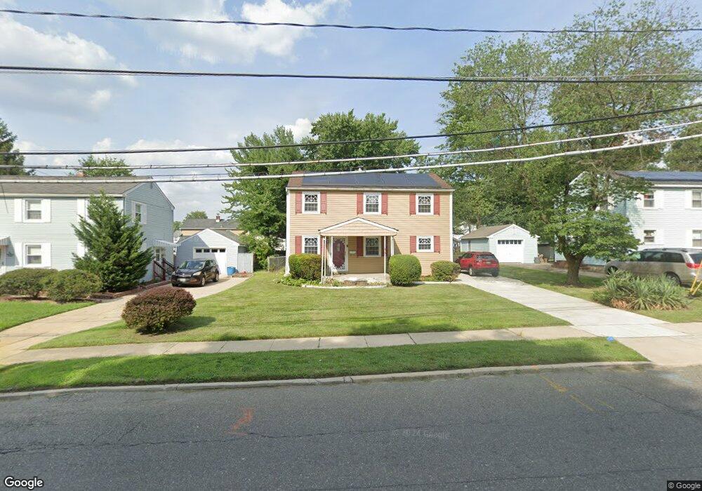
3322 Browning Rd Pennsauken, NJ 08109
Estimated Value: $280,000 - $317,000
--
Bed
--
Bath
1,408
Sq Ft
$214/Sq Ft
Est. Value
About This Home
This home is located at 3322 Browning Rd, Pennsauken, NJ 08109 and is currently estimated at $301,796, approximately $214 per square foot. 3322 Browning Rd is a home located in Camden County with nearby schools including Pennsauken High School, St. Peter Elementary School, and St. Cecilia School.
Ownership History
Date
Name
Owned For
Owner Type
Purchase Details
Closed on
Jul 31, 2001
Sold by
New Jersey Housing & Mtg Fin
Bought by
Hughes Courtney E
Current Estimated Value
Home Financials for this Owner
Home Financials are based on the most recent Mortgage that was taken out on this home.
Original Mortgage
$78,300
Outstanding Balance
$30,566
Interest Rate
7.16%
Estimated Equity
$271,230
Create a Home Valuation Report for This Property
The Home Valuation Report is an in-depth analysis detailing your home's value as well as a comparison with similar homes in the area
Home Values in the Area
Average Home Value in this Area
Purchase History
| Date | Buyer | Sale Price | Title Company |
|---|---|---|---|
| Hughes Courtney E | $87,000 | -- |
Source: Public Records
Mortgage History
| Date | Status | Borrower | Loan Amount |
|---|---|---|---|
| Open | Hughes Courtney E | $78,300 |
Source: Public Records
Tax History Compared to Growth
Tax History
| Year | Tax Paid | Tax Assessment Tax Assessment Total Assessment is a certain percentage of the fair market value that is determined by local assessors to be the total taxable value of land and additions on the property. | Land | Improvement |
|---|---|---|---|---|
| 2025 | $5,692 | $249,400 | $56,300 | $193,100 |
| 2024 | $5,583 | $130,800 | $44,200 | $86,600 |
| 2023 | $5,583 | $130,800 | $44,200 | $86,600 |
| 2022 | $5,048 | $130,800 | $44,200 | $86,600 |
| 2021 | $5,184 | $130,800 | $44,200 | $86,600 |
| 2020 | $4,643 | $130,800 | $44,200 | $86,600 |
| 2019 | $4,697 | $130,800 | $44,200 | $86,600 |
| 2018 | $4,722 | $130,800 | $44,200 | $86,600 |
| 2017 | $4,731 | $130,800 | $44,200 | $86,600 |
| 2016 | $4,646 | $130,800 | $44,200 | $86,600 |
| 2015 | $4,785 | $130,800 | $44,200 | $86,600 |
| 2014 | $4,817 | $86,600 | $25,400 | $61,200 |
Source: Public Records
Map
Nearby Homes
- 5532 Whitman Terrace
- 3241 N 48th St
- 3300 Springfield Ave
- 3204 Merchantville Ave
- 320 W Maple Ave
- 5745 Cedar Ave
- 2446 46th St
- 6116 Rogers Ave
- 220 Volans St
- 5507 Wayne Ave
- 21 Alexander Ave
- 41 Alexander Ave
- 2154 Browning Rd
- 15 W Walnut Ave
- 2404 42nd St
- 116 N Centre St
- 2254 Hollinshed Ave
- 6151 Harvey Ave
- 6134 Grant Ave
- 2232 42nd St
- 3314 Browning Rd
- 3328 Browning Rd
- 5022 Walnut Ave
- 5016 Walnut Ave
- 3306 Browning Rd
- 5028 Walnut Ave
- 3336 Browning Rd
- 3331 Browning Rd
- 5010 Walnut Ave
- 3337 Browning Rd
- 3300 Browning Rd
- 5032 Walnut Ave
- 5000 Walnut Ave
- 4938 Whitman Terrace
- 3257 Browning Rd
- 3345 Browning Rd
- 5021 Walnut Ave
- 5011 Walnut Ave
- 4935 Whitman Terrace
- 4932 Whitman Terrace