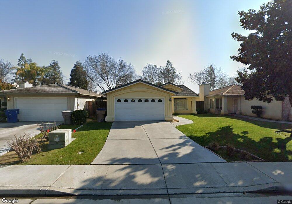
3322 Wenham Dr Bakersfield, CA 93311
The Oaks NeighborhoodEstimated Value: $305,000 - $370,000
3
Beds
2
Baths
1,377
Sq Ft
$252/Sq Ft
Est. Value
About This Home
This home is located at 3322 Wenham Dr, Bakersfield, CA 93311 and is currently estimated at $347,617, approximately $252 per square foot. 3322 Wenham Dr is a home located in Kern County with nearby schools including Leo B. Hart Elementary School, Tevis Junior High School, and Stockdale High School.
Ownership History
Date
Name
Owned For
Owner Type
Purchase Details
Closed on
Dec 4, 2020
Sold by
Thurston Trina
Bought by
Robertson Ward
Current Estimated Value
Home Financials for this Owner
Home Financials are based on the most recent Mortgage that was taken out on this home.
Original Mortgage
$186,965
Outstanding Balance
$166,751
Interest Rate
2.8%
Mortgage Type
FHA
Estimated Equity
$180,866
Purchase Details
Closed on
Nov 12, 2020
Sold by
Weldon Lupe H
Bought by
Robertson Ward
Home Financials for this Owner
Home Financials are based on the most recent Mortgage that was taken out on this home.
Original Mortgage
$186,965
Outstanding Balance
$166,751
Interest Rate
2.8%
Mortgage Type
FHA
Estimated Equity
$180,866
Purchase Details
Closed on
Jan 22, 2010
Sold by
Federal National Mortgage Association
Bought by
Weldon Lupe H
Home Financials for this Owner
Home Financials are based on the most recent Mortgage that was taken out on this home.
Original Mortgage
$118,808
Interest Rate
5.03%
Mortgage Type
FHA
Purchase Details
Closed on
Sep 22, 2009
Sold by
Reynolds Paul
Bought by
Federal National Mortgage Association
Purchase Details
Closed on
Jul 25, 2006
Sold by
Reynolds Paul and Reynolds Kathy
Bought by
Reynolds Paul
Home Financials for this Owner
Home Financials are based on the most recent Mortgage that was taken out on this home.
Original Mortgage
$207,000
Interest Rate
6.57%
Mortgage Type
New Conventional
Purchase Details
Closed on
Aug 21, 2002
Sold by
Reynolds Paul W
Bought by
Reynolds Paul W and Reynolds Kathy J
Home Financials for this Owner
Home Financials are based on the most recent Mortgage that was taken out on this home.
Original Mortgage
$122,358
Interest Rate
6.16%
Mortgage Type
FHA
Purchase Details
Closed on
Dec 20, 1996
Sold by
Kyle Carter Homes Inc
Bought by
Reynolds Paul W
Home Financials for this Owner
Home Financials are based on the most recent Mortgage that was taken out on this home.
Original Mortgage
$101,432
Interest Rate
7.74%
Mortgage Type
FHA
Create a Home Valuation Report for This Property
The Home Valuation Report is an in-depth analysis detailing your home's value as well as a comparison with similar homes in the area
Home Values in the Area
Average Home Value in this Area
Purchase History
| Date | Buyer | Sale Price | Title Company |
|---|---|---|---|
| Robertson Ward | -- | Ticor Title | |
| Robertson Ward | $245,000 | None Listed On Document | |
| Weldon Lupe H | $121,000 | Stewart Title Of California | |
| Federal National Mortgage Association | $251,663 | None Available | |
| Reynolds Paul | -- | United Independent Title Ins | |
| Reynolds Paul W | -- | Commonwealth Title | |
| Reynolds Paul W | $102,000 | American Title Co |
Source: Public Records
Mortgage History
| Date | Status | Borrower | Loan Amount |
|---|---|---|---|
| Open | Robertson Ward | $186,965 | |
| Previous Owner | Weldon Lupe H | $118,808 | |
| Previous Owner | Reynolds Paul | $207,000 | |
| Previous Owner | Reynolds Paul W | $122,358 | |
| Previous Owner | Reynolds Paul W | $101,432 |
Source: Public Records
Tax History
| Year | Tax Paid | Tax Assessment Tax Assessment Total Assessment is a certain percentage of the fair market value that is determined by local assessors to be the total taxable value of land and additions on the property. | Land | Improvement |
|---|---|---|---|---|
| 2025 | $3,910 | $265,194 | $64,945 | $200,249 |
| 2024 | $3,854 | $259,995 | $63,672 | $196,323 |
| 2023 | $3,854 | $254,898 | $62,424 | $192,474 |
| 2022 | $3,704 | $249,900 | $61,200 | $188,700 |
| 2021 | $3,583 | $245,000 | $60,000 | $185,000 |
| 2020 | $2,232 | $142,806 | $35,404 | $107,402 |
| 2019 | $2,201 | $142,806 | $35,404 | $107,402 |
| 2018 | $2,110 | $137,263 | $34,030 | $103,233 |
| 2017 | $2,079 | $134,572 | $33,363 | $101,209 |
| 2016 | $1,958 | $131,934 | $32,709 | $99,225 |
| 2015 | $1,938 | $129,953 | $32,218 | $97,735 |
| 2014 | $1,890 | $127,408 | $31,587 | $95,821 |
Source: Public Records
Map
Nearby Homes
- 3601 Litchfield Dr
- 3000 Victoria Way
- 8213 Birch St
- 3901 Boswellia Dr
- 2909 Woodglen Dr
- 7713 Kamloops Dr
- 3612 Sonoita Dr
- 7504 Deming Ct
- 7512 Lordsburg Dr
- 7517 Hachita Ct
- 3009 Buford Way
- 2704 El Portal Dr
- 3313 Colony Oak St
- 7501 Hachita Ct
- 8909 Summer Creek Rd
- 8832 Sierra Oak Dr
- 7321 Alamosa Ln
- 3105 Loveland Way
- 7134 Hanover Cir
- 3708 Meade Ct
- 3318 Wenham Dr
- 3400 Wenham Dr
- 3310 Wenham Dr
- 3404 Wenham Dr
- 3314 Wenham Dr
- 3408 Wenham Dr
- 8101 Essex Ct
- 8100 Essex Ct
- 3306 Wenham Dr
- 3412 Wenham Dr
- 8105 Essex Ct
- 8104 Essex Ct
- 8102 Newhaven Ct
- 8103 Ipswich Way
- 8203 Essex Ct
- 3302 Wenham Dr
- 8202 Essex Ct
- 8106 Newhaven Ct
- 8111 Ipswich Way
- 8200 Newhaven Ct
Your Personal Tour Guide
Ask me questions while you tour the home.