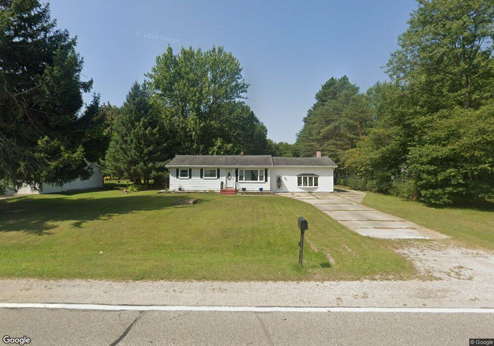
3325 Range Rd Port Huron, MI 48060
Estimated Value: $185,000 - $220,848
3
Beds
1
Bath
1,305
Sq Ft
$151/Sq Ft
Est. Value
About This Home
This home is located at 3325 Range Rd, Port Huron, MI 48060 and is currently estimated at $196,462, approximately $150 per square foot. 3325 Range Rd is a home located in St. Clair County with nearby schools including Michigamme Elementary School, Central Middle School, and Port Huron High School.
Ownership History
Date
Name
Owned For
Owner Type
Purchase Details
Closed on
Jul 3, 2025
Sold by
Badger Deborah R
Bought by
Broda Daniel and Broda Jessica
Current Estimated Value
Purchase Details
Closed on
Nov 6, 2020
Sold by
Badger Deborah R and Badger John
Bought by
Badger Deborah R and Higgins Dawn M
Create a Home Valuation Report for This Property
The Home Valuation Report is an in-depth analysis detailing your home's value as well as a comparison with similar homes in the area
Home Values in the Area
Average Home Value in this Area
Purchase History
| Date | Buyer | Sale Price | Title Company |
|---|---|---|---|
| Broda Daniel | $180,000 | Liberty Title | |
| Broda Daniel | $180,000 | Liberty Title | |
| Badger Deborah R | -- | None Available |
Source: Public Records
Tax History Compared to Growth
Tax History
| Year | Tax Paid | Tax Assessment Tax Assessment Total Assessment is a certain percentage of the fair market value that is determined by local assessors to be the total taxable value of land and additions on the property. | Land | Improvement |
|---|---|---|---|---|
| 2025 | $1,070 | $100,600 | $0 | $0 |
| 2024 | $1,039 | $94,400 | $0 | $0 |
| 2023 | $958 | $81,300 | $0 | $0 |
| 2022 | $1,771 | $70,900 | $0 | $0 |
| 2020 | $1,626 | $62,500 | $0 | $62,500 |
| 2019 | $1,591 | $56,400 | $0 | $0 |
| 2018 | $1,574 | $56,400 | $0 | $0 |
| 2017 | $1,588 | $54,900 | $0 | $0 |
| 2016 | $787 | $54,900 | $0 | $0 |
| 2015 | -- | $49,200 | $10,000 | $39,200 |
| 2014 | -- | $45,400 | $45,400 | $0 |
| 2013 | -- | $43,600 | $0 | $0 |
Source: Public Records
Map
Nearby Homes
- 4425 Atkins Rd
- 4440 Cambridge Dr
- 4459 Cambridge Dr
- 3101 Range Rd
- 4224 Atkins Rd
- 3115 Spruce Dr
- 4570 Atkins Rd
- 4167 N River Rd
- 3345 Beach Rd
- 3971 N River Rd
- 4901 Lorwood Dr
- Lot #9 Thornton Dr
- 3559 Lightle Rd
- 3679 Old Farm Ln
- 4911 Castlewood Dr
- 3669 Connie Ln
- 0000 W Water St
- VL Oxbow Dr
- 3845 Campbell Rd
- 3465 West Dr