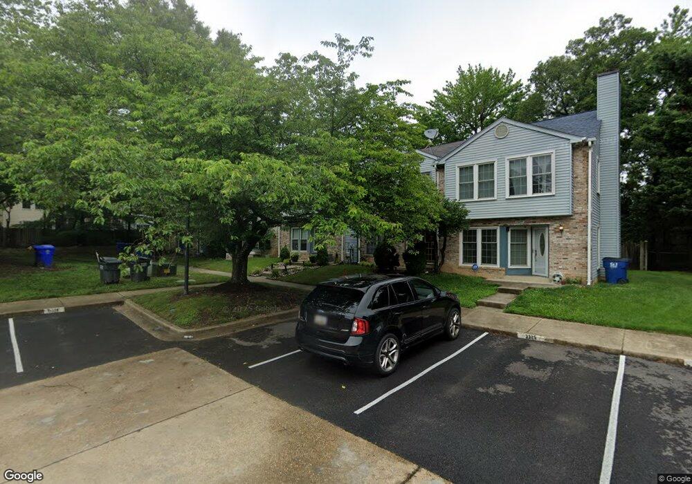
3326 Westdale Ct Waldorf, MD 20601
Estimated Value: $306,000 - $328,933
--
Bed
3
Baths
1,300
Sq Ft
$244/Sq Ft
Est. Value
About This Home
This home is located at 3326 Westdale Ct, Waldorf, MD 20601 and is currently estimated at $317,733, approximately $244 per square foot. 3326 Westdale Ct is a home located in Charles County with nearby schools including Daniel of St. Thomas Jenifer Elementary School, Mattawoman Middle School, and Thomas Stone High School.
Ownership History
Date
Name
Owned For
Owner Type
Purchase Details
Closed on
Jun 26, 2003
Sold by
Kidwell Thomas E and Kidwell Margaret M
Bought by
Cole Lawrence
Current Estimated Value
Purchase Details
Closed on
Jul 18, 1990
Sold by
Acton Village Limited Partnership
Bought by
Kidwell Thomas and Wolfe Margaret M
Home Financials for this Owner
Home Financials are based on the most recent Mortgage that was taken out on this home.
Original Mortgage
$118,643
Interest Rate
10.11%
Create a Home Valuation Report for This Property
The Home Valuation Report is an in-depth analysis detailing your home's value as well as a comparison with similar homes in the area
Home Values in the Area
Average Home Value in this Area
Purchase History
| Date | Buyer | Sale Price | Title Company |
|---|---|---|---|
| Cole Lawrence | $134,000 | -- | |
| Kidwell Thomas | $117,100 | -- |
Source: Public Records
Mortgage History
| Date | Status | Borrower | Loan Amount |
|---|---|---|---|
| Previous Owner | Kidwell Thomas | $118,643 | |
| Closed | Cole Lawrence | -- |
Source: Public Records
Tax History Compared to Growth
Tax History
| Year | Tax Paid | Tax Assessment Tax Assessment Total Assessment is a certain percentage of the fair market value that is determined by local assessors to be the total taxable value of land and additions on the property. | Land | Improvement |
|---|---|---|---|---|
| 2025 | $8,101 | $253,633 | -- | -- |
| 2024 | $3,499 | $241,200 | $120,000 | $121,200 |
| 2023 | $3,245 | $227,067 | $0 | $0 |
| 2022 | $3,072 | $212,933 | $0 | $0 |
| 2021 | $2,593 | $198,800 | $90,000 | $108,800 |
| 2020 | $2,593 | $180,100 | $0 | $0 |
| 2019 | $2,330 | $161,400 | $0 | $0 |
| 2018 | $2,044 | $142,700 | $80,000 | $62,700 |
| 2017 | $2,021 | $141,433 | $0 | $0 |
| 2016 | -- | $140,167 | $0 | $0 |
| 2015 | $2,139 | $138,900 | $0 | $0 |
| 2014 | $2,139 | $138,900 | $0 | $0 |
Source: Public Records
Map
Nearby Homes
- 2545 Enterprise Place
- HAYDEN Plan at Acton Park
- 2522 Regal Place
- 2031 Tanglewood Dr
- 231 Westdale Dr
- 2073 Tanglewood Dr
- 12113 Farrar Place
- 11519 Shearwater Dr
- 11565 Timberbrook Dr
- 11748 Torcello Ct
- 11613 Gallinule Ct
- 11824 Murre Ct
- 11616 Kipling Dr
- 11800 Railroad Place
- 11540 Leland Place
- 2712 Tred Avon Ct
- 2704 Tred Avon Ct
- 11507 Timberbrook Dr
- 11814 Oak Manor Dr
- 2717 Stanford Place
- 3327 Westdale Ct
- 3325 Westdale Ct
- 3328 Westdale Ct
- 3329 Westdale Ct
- 3324 Westdale Ct
- 3330 Westdale Ct
- 3323 Westdale Ct
- 3331 Westdale Ct
- 2590 Business Park Ct Unit 101E
- 3332 Westdale Ct
- 2598 Business Park Ct Unit B1 B2
- 3321 Westdale Ct
- 3333 Westdale Ct
- 2602 Business Ct Unit 101 A AND 101 B
- 3320 Westdale Ct
- 2606 Business Park Ct Unit 101A
- 2606 Business Park Ct Unit 101-A, 101-B
- 3334 Westdale Ct
- 19520 Lariat Place
- 19522 Lariat Place