Estimated Value: $145,528 - $215,000
Studio
2
Baths
1,620
Sq Ft
$112/Sq Ft
Est. Value
About This Home
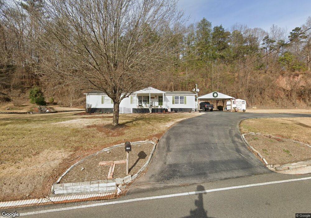
This home is located at 333 N Mohawk Dr, Erwin, TN 37650 and is currently estimated at $181,632, approximately $112 per square foot. 333 N Mohawk Dr is a home located in Unicoi County with nearby schools including Rock Creek Elementary School, Unicoi County Middle School, and Unicoi County High School.
Ownership History
Date
Name
Owned For
Owner Type
Purchase Details
Closed on
Sep 17, 2021
Sold by
Maupin Melissa A and Maupin Scotty L
Bought by
Farmer Kathy Jo
Current Estimated Value
Home Financials for this Owner
Home Financials are based on the most recent Mortgage that was taken out on this home.
Original Mortgage
$108,000
Outstanding Balance
$97,843
Interest Rate
2.8%
Mortgage Type
New Conventional
Estimated Equity
$83,789
Purchase Details
Closed on
Jul 6, 2004
Sold by
Harvey Anna M
Bought by
Maupin Melissa
Home Financials for this Owner
Home Financials are based on the most recent Mortgage that was taken out on this home.
Original Mortgage
$124,000
Interest Rate
6.1%
Purchase Details
Closed on
Nov 22, 1996
Sold by
Murphy Howard
Bought by
Holifield Melissa
Create a Home Valuation Report for This Property
The Home Valuation Report is an in-depth analysis detailing your home's value as well as a comparison with similar homes in the area
Home Values in the Area
Average Home Value in this Area
Purchase History
| Date | Buyer | Sale Price | Title Company |
|---|---|---|---|
| Farmer Kathy Jo | $120,000 | None Available | |
| Maupin Melissa | -- | -- | |
| Holifield Melissa | $10,000 | -- |
Source: Public Records
Mortgage History
| Date | Status | Borrower | Loan Amount |
|---|---|---|---|
| Open | Farmer Kathy Jo | $108,000 | |
| Previous Owner | Holifield Melissa | $124,000 |
Source: Public Records
Tax History
| Year | Tax Paid | Tax Assessment Tax Assessment Total Assessment is a certain percentage of the fair market value that is determined by local assessors to be the total taxable value of land and additions on the property. | Land | Improvement |
|---|---|---|---|---|
| 2025 | $858 | $32,850 | $7,200 | $25,650 |
| 2024 | $858 | $32,850 | $7,200 | $25,650 |
| 2023 | $858 | $32,850 | $0 | $0 |
| 2022 | $1,282 | $32,850 | $7,200 | $25,650 |
| 2021 | $1,144 | $24,250 | $7,200 | $17,050 |
| 2020 | $1,103 | $24,250 | $7,200 | $17,050 |
| 2019 | $1,103 | $24,250 | $7,200 | $17,050 |
| 2018 | $1,006 | $24,250 | $7,200 | $17,050 |
| 2017 | $1,002 | $24,250 | $7,200 | $17,050 |
| 2016 | $1,002 | $24,475 | $7,125 | $17,350 |
Source: Public Records
Map
Nearby Homes
Your Personal Tour Guide
Ask me questions while you tour the home.