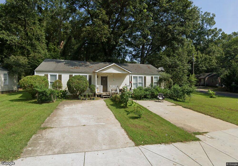
333 Roosevelt Cir NE Unit 1 Marietta, GA 30060
Fort Hill-Roosevelt NeighborhoodEstimated Value: $350,000 - $407,000
--
Bed
2
Baths
1,568
Sq Ft
$237/Sq Ft
Est. Value
About This Home
This home is located at 333 Roosevelt Cir NE Unit 1, Marietta, GA 30060 and is currently estimated at $371,663, approximately $237 per square foot. 333 Roosevelt Cir NE Unit 1 is a home located in Cobb County with nearby schools including Marietta Sixth Grade Academy, A.L. Burruss Elementary School, and Marietta Middle School.
Ownership History
Date
Name
Owned For
Owner Type
Purchase Details
Closed on
Aug 30, 2013
Sold by
Federal National Mortgage Association
Bought by
Ghallab Ghallab M M
Current Estimated Value
Purchase Details
Closed on
Apr 2, 2013
Sold by
Jpmorgan Chase Bank Na
Bought by
Federal National Mtg Associati
Purchase Details
Closed on
Mar 5, 2013
Sold by
Rodriguez Ramiro
Bought by
Jpmorgan Chase Bank Na
Purchase Details
Closed on
Apr 20, 2005
Sold by
Tabor Evelyn M and Tabor Thomas
Bought by
Rodriguez Ramiro
Home Financials for this Owner
Home Financials are based on the most recent Mortgage that was taken out on this home.
Original Mortgage
$103,500
Interest Rate
5.88%
Mortgage Type
New Conventional
Create a Home Valuation Report for This Property
The Home Valuation Report is an in-depth analysis detailing your home's value as well as a comparison with similar homes in the area
Home Values in the Area
Average Home Value in this Area
Purchase History
| Date | Buyer | Sale Price | Title Company |
|---|---|---|---|
| Ghallab Ghallab M M | -- | -- | |
| Federal National Mtg Associati | -- | -- | |
| Jpmorgan Chase Bank Na | $100,000 | -- | |
| Rodriguez Ramiro | $115,000 | -- |
Source: Public Records
Mortgage History
| Date | Status | Borrower | Loan Amount |
|---|---|---|---|
| Previous Owner | Rodriguez Ramiro | $103,500 |
Source: Public Records
Tax History Compared to Growth
Tax History
| Year | Tax Paid | Tax Assessment Tax Assessment Total Assessment is a certain percentage of the fair market value that is determined by local assessors to be the total taxable value of land and additions on the property. | Land | Improvement |
|---|---|---|---|---|
| 2025 | $1,074 | $126,960 | $40,000 | $86,960 |
| 2024 | $1,025 | $121,136 | $34,000 | $87,136 |
| 2023 | $1,025 | $121,136 | $34,000 | $87,136 |
| 2022 | $600 | $70,924 | $18,000 | $52,924 |
| 2021 | $609 | $70,924 | $18,000 | $52,924 |
| 2020 | $609 | $70,924 | $18,000 | $52,924 |
| 2019 | $378 | $44,060 | $11,200 | $32,860 |
| 2018 | $378 | $44,060 | $11,200 | $32,860 |
| 2017 | $281 | $40,776 | $11,200 | $29,576 |
| 2016 | $173 | $25,048 | $10,000 | $15,048 |
| 2015 | $188 | $25,048 | $10,000 | $15,048 |
| 2014 | $194 | $25,048 | $0 | $0 |
Source: Public Records
Map
Nearby Homes
- 382 Mcarthur Dr NE
- 232 Hunt St NE
- 428 Lemon St NE
- 282 Montgomery St NE
- 231 Fowler Cir NE
- 454 Birney St NE
- 466 Birney St NE
- 351 Washington Ave NE Unit 309
- 351 Washington Ave NE Unit 208
- 389 Washington Ave NE
- 554 Fort St NE
- 452 Cherokee St NE
- 104 Jackson Cir SE
- 307 Green St SE
- 363 Seminole Dr NE
- 0 Polk St NW Unit 1523635
- 29 Sessions St NW
- 356 Campbell Hill St NW
- 247 Austin Ave NE
- 486 Church St NE
- 333 Roosevelt Cir NE
- 231 Mcintosh Ave NE Unit 233
- 321 Roosevelt Cir NE Unit 323
- 237 Mcintosh Ave NE
- 370 Roosevelt Cir NE Unit 368
- 370 Roosevelt Cir NE Unit 370
- 370 Roosevelt Cir NE
- 351 Roosevelt Cir NE
- 332 Roosevelt Cir NE
- 232 Mcintosh Ave NE
- 328 Roosevelt Cir NE
- 334 Roosevelt Cir NE
- 324 Roosevelt Cir NE
- 344 Roosevelt Cir NE
- 222 Cole St NE
- 241 Mcintosh Ave NE
- 230 Cole St NE
- 318 Roosevelt Cir NE
- 236 Cole St NE
- 350 Roosevelt Cir NE