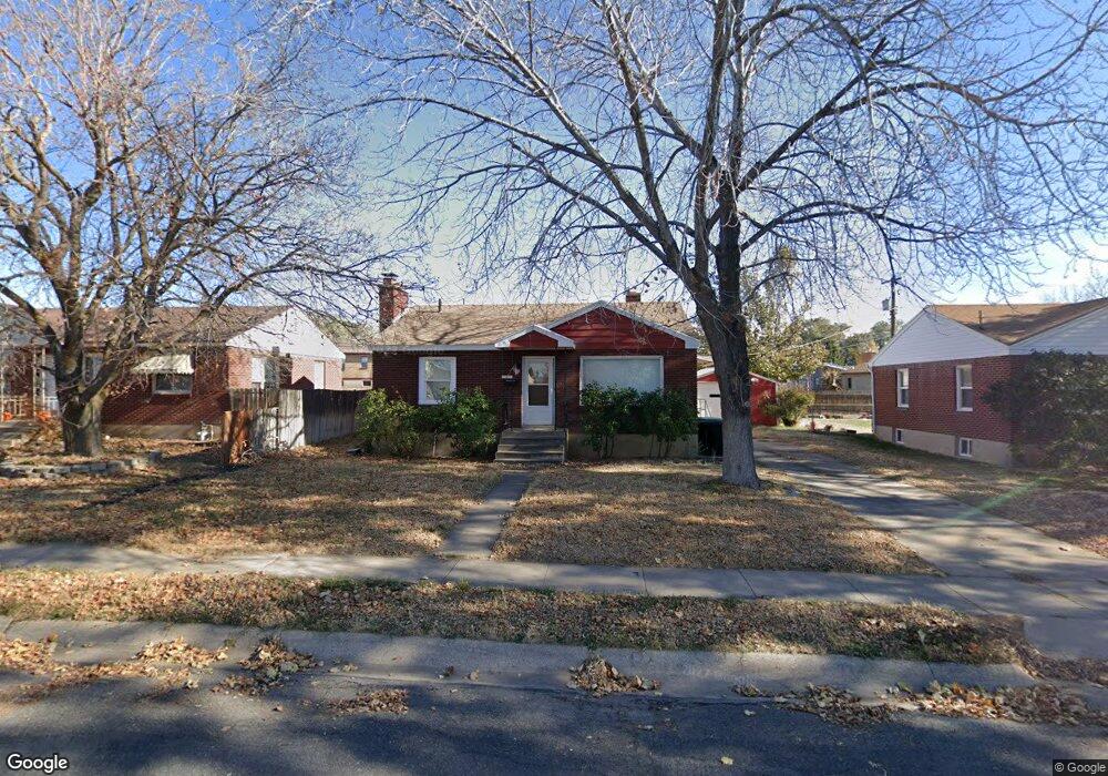
333 S 700 E Clearfield, UT 84015
Estimated Value: $377,000 - $438,000
3
Beds
2
Baths
1,848
Sq Ft
$218/Sq Ft
Est. Value
About This Home
This home is located at 333 S 700 E, Clearfield, UT 84015 and is currently estimated at $403,271, approximately $218 per square foot. 333 S 700 E is a home located in Davis County with nearby schools including Wasatch Elementary School, North Davis Junior High School, and Clearfield High School.
Ownership History
Date
Name
Owned For
Owner Type
Purchase Details
Closed on
Aug 2, 2024
Sold by
Mike Bowman Real Estate Inc
Bought by
Huntsman James
Current Estimated Value
Home Financials for this Owner
Home Financials are based on the most recent Mortgage that was taken out on this home.
Original Mortgage
$408,600
Outstanding Balance
$403,606
Interest Rate
6.87%
Mortgage Type
VA
Estimated Equity
-$335
Purchase Details
Closed on
Apr 29, 2024
Sold by
Martinez Lonnie
Bought by
Mike Bowman Real Estate Inc
Purchase Details
Closed on
Mar 18, 2024
Sold by
Montoya Jolanda and Martinez Jolanda
Bought by
Martinez Lonnie
Purchase Details
Closed on
Oct 10, 2019
Sold by
Thain Matthew T
Bought by
Martinez Lonnie and Martinez Jolanda
Purchase Details
Closed on
Jun 13, 2016
Sold by
Ferguson Andrew L and Ferguson Mary J
Bought by
Thain Matthew T
Purchase Details
Closed on
Feb 21, 2008
Sold by
Lombardi Tracy J
Bought by
Ferguson Andrew L and Ferguson Mary Jane
Home Financials for this Owner
Home Financials are based on the most recent Mortgage that was taken out on this home.
Original Mortgage
$4,032
Interest Rate
5.85%
Mortgage Type
Stand Alone Second
Purchase Details
Closed on
Nov 15, 2002
Sold by
Peugh Tracy J and Lombardi Tracy J
Bought by
Lombardi Tracy J
Home Financials for this Owner
Home Financials are based on the most recent Mortgage that was taken out on this home.
Original Mortgage
$96,419
Interest Rate
5.89%
Mortgage Type
VA
Purchase Details
Closed on
Oct 27, 1998
Sold by
Bouwhuis Delvon and Bouwhuis Alicia
Bought by
Peugh Tracy J
Home Financials for this Owner
Home Financials are based on the most recent Mortgage that was taken out on this home.
Original Mortgage
$97,098
Interest Rate
6.6%
Mortgage Type
VA
Purchase Details
Closed on
Feb 6, 1997
Sold by
Montgomery Michael A and Posey Shirley A
Bought by
Bouwhuis Delvon and Bouwhuis Alicia
Purchase Details
Closed on
Jul 15, 1996
Sold by
Montgomery Michael A
Bought by
Montgomery Michael A and Posey Shirley A
Create a Home Valuation Report for This Property
The Home Valuation Report is an in-depth analysis detailing your home's value as well as a comparison with similar homes in the area
Home Values in the Area
Average Home Value in this Area
Purchase History
| Date | Buyer | Sale Price | Title Company |
|---|---|---|---|
| Huntsman James | -- | Us Title | |
| Mike Bowman Real Estate Inc | -- | First American Title | |
| Mike Bowman Real Estate Inc | -- | First American Title | |
| Martinez Lonnie | -- | First American Title | |
| Martinez Lonnie | -- | Vanguard Title Ins | |
| Thain Matthew T | -- | First American Title | |
| Ferguson Andrew L | -- | First American Title | |
| Lombardi Tracy J | -- | First American Title Co | |
| Peugh Tracy J | -- | Backman Stewart Title Servic | |
| Bouwhuis Delvon | -- | Backman Stewart Title Servic | |
| Bouwhuis Delvon | -- | Backman Stewart Title Servic | |
| Montgomery Michael A | -- | Founders Title Co |
Source: Public Records
Mortgage History
| Date | Status | Borrower | Loan Amount |
|---|---|---|---|
| Open | Huntsman James | $408,600 | |
| Previous Owner | Ferguson Andrew L | $4,032 | |
| Previous Owner | Ferguson Andrew L | $140,474 | |
| Previous Owner | Lombardi Tracy J | $96,419 | |
| Previous Owner | Peugh Tracy J | $97,098 |
Source: Public Records
Tax History
| Year | Tax Paid | Tax Assessment Tax Assessment Total Assessment is a certain percentage of the fair market value that is determined by local assessors to be the total taxable value of land and additions on the property. | Land | Improvement |
|---|---|---|---|---|
| 2025 | $2,381 | $213,400 | $65,215 | $148,185 |
| 2024 | $2,059 | $185,900 | $62,396 | $123,504 |
| 2023 | $1,931 | $176,000 | $55,289 | $120,710 |
| 2022 | $2,062 | $336,000 | $106,049 | $229,951 |
| 2021 | $1,684 | $228,000 | $58,488 | $169,512 |
| 2020 | $1,495 | $201,000 | $48,575 | $152,425 |
| 2019 | $1,447 | $192,000 | $53,204 | $138,796 |
| 2018 | $1,299 | $168,000 | $44,863 | $123,137 |
| 2016 | $1,113 | $75,240 | $18,637 | $56,603 |
| 2015 | $1,061 | $68,365 | $18,637 | $49,728 |
| 2014 | $1,021 | $66,704 | $18,637 | $48,067 |
| 2013 | -- | $50,187 | $22,580 | $27,607 |
Source: Public Records
Map
Nearby Homes
- 582 E 350 S
- 527 E 250 S
- 35 Airlane Dr
- 288 S 500 E Unit 1
- 564 S 800 E
- 549 S 450 E
- 338 E 200 S
- 51 S 400 E
- 490 E 700 S Unit 524
- 490 E 700 S Unit C36
- 490 E 700 S Unit D39
- 490 E 700 S Unit D42
- 490 E 700 S Unit D43
- 15 S 400 E
- 417 E 500 S
- 458 E Depot St
- 462 E 625 S
- 246 E 200 S
- 434 E Depot St
- 421 E Penny Ln
Your Personal Tour Guide
Ask me questions while you tour the home.