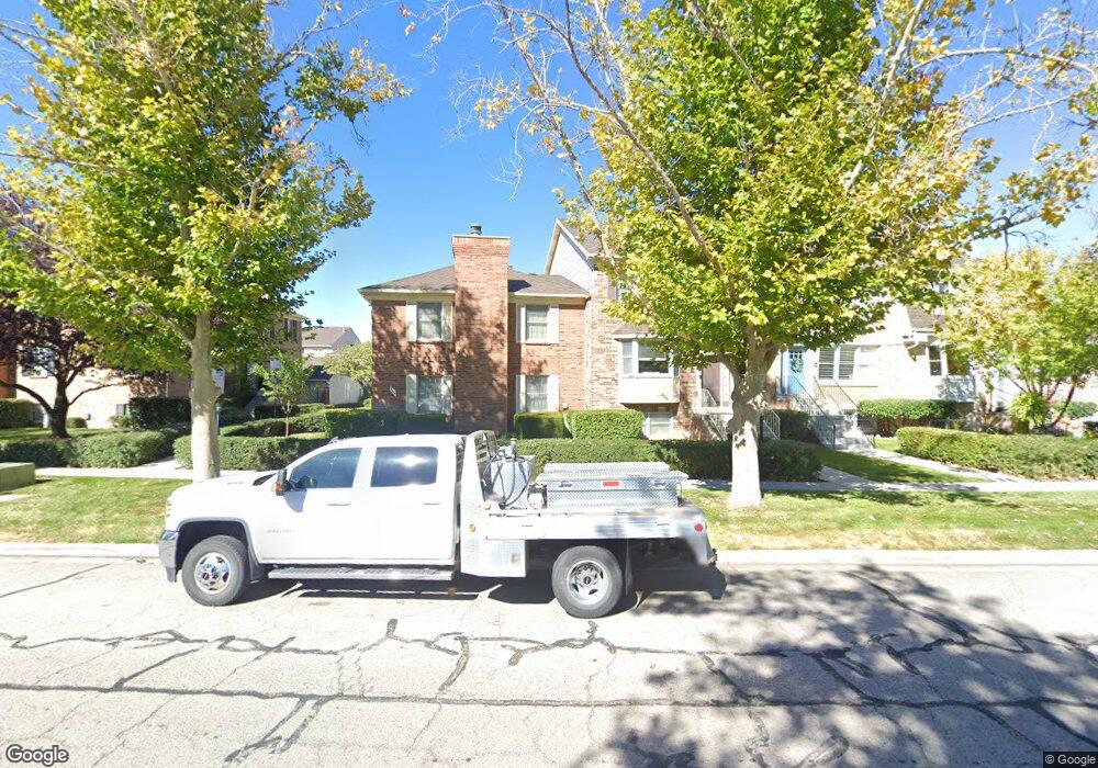
333 W 4650 N Provo, UT 84604
Riverside NeighborhoodEstimated Value: $522,000 - $603,000
2
Beds
3
Baths
1,806
Sq Ft
$314/Sq Ft
Est. Value
About This Home
This home is located at 333 W 4650 N, Provo, UT 84604 and is currently estimated at $566,543, approximately $313 per square foot. 333 W 4650 N is a home located in Utah County with nearby schools including Canyon Crest Elementary School, Centennial Middle School, and Timpview High School.
Ownership History
Date
Name
Owned For
Owner Type
Purchase Details
Closed on
Nov 15, 2019
Sold by
Griffith Darryl Dennis
Bought by
Henson Blake and Henson Kassandra
Current Estimated Value
Purchase Details
Closed on
May 18, 2015
Sold by
Griffith Dennis A and Griffith Helen M
Bought by
Griffith Darryl Dennis
Purchase Details
Closed on
Nov 20, 2002
Sold by
Robinson Veloris A and Robinson Clayne
Bought by
Griffith Dennis A and Griffith Helen M
Purchase Details
Closed on
Jan 4, 2002
Sold by
Robinson Clayne and Robison Veloris A
Bought by
Robison Clayne and Robison Veloris A
Home Financials for this Owner
Home Financials are based on the most recent Mortgage that was taken out on this home.
Original Mortgage
$150,000
Interest Rate
7.01%
Create a Home Valuation Report for This Property
The Home Valuation Report is an in-depth analysis detailing your home's value as well as a comparison with similar homes in the area
Home Values in the Area
Average Home Value in this Area
Purchase History
| Date | Buyer | Sale Price | Title Company |
|---|---|---|---|
| Henson Blake | -- | Inwest Title Orem | |
| Griffith Darryl Dennis | -- | None Available | |
| Griffith Dennis A | -- | Guardian Title Company Of U | |
| Robison Veloris A | -- | Guardian Title Company Of U | |
| Robison Clayne | -- | Fidelity Land & Title |
Source: Public Records
Mortgage History
| Date | Status | Borrower | Loan Amount |
|---|---|---|---|
| Previous Owner | Robison Clayne | $150,000 |
Source: Public Records
Tax History Compared to Growth
Tax History
| Year | Tax Paid | Tax Assessment Tax Assessment Total Assessment is a certain percentage of the fair market value that is determined by local assessors to be the total taxable value of land and additions on the property. | Land | Improvement |
|---|---|---|---|---|
| 2025 | $2,479 | $268,510 | $71,800 | $416,400 |
| 2024 | $2,479 | $243,980 | $0 | $0 |
| 2023 | $2,399 | $232,815 | $0 | $0 |
| 2022 | $2,522 | $246,785 | $0 | $0 |
| 2021 | $1,977 | $337,400 | $50,600 | $286,800 |
| 2020 | $2,109 | $337,400 | $44,000 | $293,400 |
| 2019 | $2,028 | $337,400 | $44,000 | $293,400 |
| 2018 | $2,000 | $337,400 | $42,000 | $295,400 |
| 2017 | $1,888 | $175,065 | $0 | $0 |
| 2016 | $1,846 | $159,500 | $0 | $0 |
| 2015 | $1,769 | $154,550 | $0 | $0 |
| 2014 | $1,471 | $133,980 | $0 | $0 |
Source: Public Records
Map
Nearby Homes
- 1643 Mountain Oaks Dr
- 1070 E 120 S
- 153 S 1000 E
- 5005 N Edgewood Dr Unit 310
- 4246 N Stonecrossing
- 204 E 4635 N
- 325 S 1000 E
- 5013 N Edgewood Dr
- 209 E 4735 N
- 221 E 4735 N
- 387 S 1000 E
- 455 W 4150 St N
- 282 W 4020 N
- 400 Palisade Dr
- 645 Foothill Dr
- 350 S 900 E
- 386 N 1100 E
- 4839 N 350 E
- 478 S 950 E
- 847 E 400 S