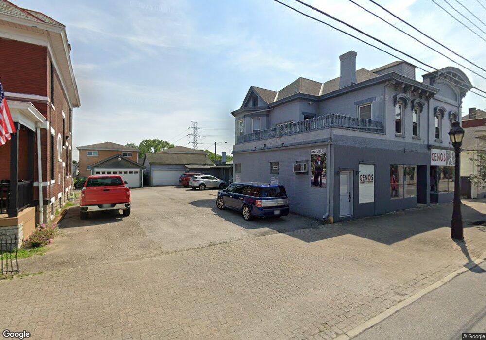
333 W Benson St Cincinnati, OH 45215
Estimated Value: $348,770
--
Bed
--
Bath
5,889
Sq Ft
$59/Sq Ft
Est. Value
About This Home
This home is located at 333 W Benson St, Cincinnati, OH 45215 and is currently estimated at $348,770, approximately $59 per square foot. 333 W Benson St is a home located in Hamilton County with nearby schools including Reading Community High School, Saints Peter and Paul Academy, and Mount Notre Dame High School.
Ownership History
Date
Name
Owned For
Owner Type
Purchase Details
Closed on
Apr 27, 2021
Sold by
Billkon Properties Llc
Bought by
Corleone Properties Llc
Current Estimated Value
Home Financials for this Owner
Home Financials are based on the most recent Mortgage that was taken out on this home.
Original Mortgage
$225,000
Interest Rate
3%
Mortgage Type
Commercial
Purchase Details
Closed on
May 31, 2006
Sold by
Belieu Kon and Baker William H
Bought by
Billkon Properties Llc
Purchase Details
Closed on
Nov 15, 2004
Sold by
Rea O Inc
Bought by
Belieu Kon and Baker William H
Home Financials for this Owner
Home Financials are based on the most recent Mortgage that was taken out on this home.
Original Mortgage
$116,000
Interest Rate
5.8%
Mortgage Type
Commercial
Create a Home Valuation Report for This Property
The Home Valuation Report is an in-depth analysis detailing your home's value as well as a comparison with similar homes in the area
Home Values in the Area
Average Home Value in this Area
Purchase History
| Date | Buyer | Sale Price | Title Company |
|---|---|---|---|
| Corleone Properties Llc | $250,000 | None Available | |
| Billkon Properties Llc | -- | None Available | |
| Belieu Kon | $145,900 | -- |
Source: Public Records
Mortgage History
| Date | Status | Borrower | Loan Amount |
|---|---|---|---|
| Closed | Corleone Properties Llc | $225,000 | |
| Previous Owner | Belieu Kon | $116,000 |
Source: Public Records
Tax History Compared to Growth
Tax History
| Year | Tax Paid | Tax Assessment Tax Assessment Total Assessment is a certain percentage of the fair market value that is determined by local assessors to be the total taxable value of land and additions on the property. | Land | Improvement |
|---|---|---|---|---|
| 2024 | $5,004 | $60,015 | $14,949 | $45,066 |
| 2023 | $5,013 | $60,015 | $14,949 | $45,066 |
| 2022 | $5,242 | $54,037 | $14,151 | $39,886 |
| 2021 | $4,718 | $54,037 | $14,151 | $39,886 |
| 2020 | $4,673 | $54,037 | $14,151 | $39,886 |
| 2019 | $4,849 | $52,462 | $13,738 | $38,724 |
| 2018 | $4,866 | $52,462 | $13,738 | $38,724 |
| 2017 | $4,740 | $52,462 | $13,738 | $38,724 |
| 2016 | $4,846 | $53,495 | $12,849 | $40,646 |
| 2015 | $4,813 | $53,495 | $12,849 | $40,646 |
| 2014 | $4,391 | $53,495 | $12,849 | $40,646 |
| 2013 | $4,413 | $54,586 | $13,111 | $41,475 |
Source: Public Records
Map
Nearby Homes
- 327 Cooper St
- 435 Pearl St
- 116 Pike St
- 1013 Market St
- 312 Arlington Ave
- 122 Walnut St
- 8914 Reading Rd
- 414 Dexter Ave
- 202 W Mechanic St
- 423 Arlington Ave
- 797 4th St
- 334 Williams St
- 310 E Vine St
- 405 W Forrer St
- 217 W Wyoming Ave
- 218 Lock St
- 404 Flora St
- 229 Bernard Ave
- 0 Hill St Unit 1616370
- 1521 Hunt Rd
- 337 W Benson St
- 341 W Benson St
- 325 W Benson St
- 323 W Benson St
- 320 Cooper St
- 321 W Benson St
- 336 W Benson St
- 318 Cooper St
- 415 W Benson St
- 314 Cooper St Unit 1 & 2
- 314 Cooper St
- 319 W Benson St
- 400 W Benson St
- 320 W Benson St
- 312 Cooper St
- 806 Wachendorf St
- 419 W Benson St
- 804 Wachendorf St
- 333 Cooper St
- 323 Cooper St