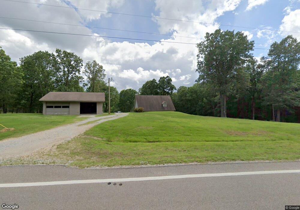
3339 Highway 34 W Paragould, AR 72450
Estimated Value: $212,000 - $274,000
--
Bed
2
Baths
1,816
Sq Ft
$129/Sq Ft
Est. Value
About This Home
This home is located at 3339 Highway 34 W, Paragould, AR 72450 and is currently estimated at $233,727, approximately $128 per square foot. 3339 Highway 34 W is a home located in Greene County with nearby schools including Paragould High School.
Ownership History
Date
Name
Owned For
Owner Type
Purchase Details
Closed on
Mar 18, 2022
Sold by
Curtis Phillip P
Bought by
Curtis Phillip P and Curtis James
Current Estimated Value
Purchase Details
Closed on
Nov 22, 2006
Sold by
Curtis Susan and Curtis Phillip P
Bought by
Curtis Phillip P
Purchase Details
Closed on
May 21, 2004
Bought by
Curtis Pp and Curtis S
Purchase Details
Closed on
Mar 31, 2004
Bought by
Susan Phillip P and Susan Curtis
Purchase Details
Closed on
Jan 29, 2004
Bought by
American State Bank
Purchase Details
Closed on
Jun 3, 2003
Bought by
Certified Lands For 2000 Of Co
Purchase Details
Closed on
Aug 30, 2000
Bought by
Buddy W Brown
Purchase Details
Closed on
May 16, 1991
Bought by
Bw and Cj Brown
Purchase Details
Closed on
Oct 15, 1971
Bought by
James H Midgett
Purchase Details
Closed on
Apr 14, 1970
Bought by
Kenneth R Parvi
Purchase Details
Closed on
Mar 28, 1968
Bought by
R C and Jean Louise Brittingham
Purchase Details
Closed on
Feb 10, 1962
Bought by
R C and Jean Louise Brittingham
Purchase Details
Closed on
Feb 28, 1961
Bought by
Arthur and Mary Hess
Create a Home Valuation Report for This Property
The Home Valuation Report is an in-depth analysis detailing your home's value as well as a comparison with similar homes in the area
Home Values in the Area
Average Home Value in this Area
Purchase History
| Date | Buyer | Sale Price | Title Company |
|---|---|---|---|
| Curtis Phillip P | -- | None Listed On Document | |
| Curtis Phillip P | -- | None Available | |
| Curtis Pp | $400 | -- | |
| Susan Phillip P | $55,000 | -- | |
| American State Bank | $60,000 | -- | |
| Certified Lands For 2000 Of Co | -- | -- | |
| Buddy W Brown | -- | -- | |
| Bw | $15,000 | -- | |
| James H Midgett | -- | -- | |
| Kenneth R Parvi | -- | -- | |
| R C | -- | -- | |
| R C | -- | -- | |
| Arthur | -- | -- |
Source: Public Records
Tax History Compared to Growth
Tax History
| Year | Tax Paid | Tax Assessment Tax Assessment Total Assessment is a certain percentage of the fair market value that is determined by local assessors to be the total taxable value of land and additions on the property. | Land | Improvement |
|---|---|---|---|---|
| 2025 | $934 | $35,810 | $5,600 | $30,210 |
| 2024 | $934 | $35,810 | $5,600 | $30,210 |
| 2023 | $934 | $27,650 | $4,800 | $22,850 |
| 2022 | $559 | $27,650 | $4,800 | $22,850 |
| 2021 | $559 | $27,650 | $4,800 | $22,850 |
| 2020 | $934 | $23,860 | $5,200 | $18,660 |
| 2019 | $559 | $23,860 | $5,200 | $18,660 |
| 2018 | $584 | $23,860 | $5,200 | $18,660 |
| 2017 | $912 | $23,860 | $5,200 | $18,660 |
| 2016 | $562 | $23,860 | $5,200 | $18,660 |
| 2015 | $812 | $21,600 | $4,400 | $17,200 |
| 2014 | $812 | $21,600 | $4,400 | $17,200 |
Source: Public Records
Map
Nearby Homes
- 1 Acre Hwy 34 W
- 0 Greene 611 Tract A East Rd
- TBD Greene Road 611
- 1 Arkansas 34
- 5.38 AC Highway 135 N
- 2844 Greene Road 624
- 9496 Arkansas 135
- 205 Raymond
- 143 Greene Road 610
- 146 Messer Dr
- 422 Sunset Dr
- 181 Misty Marie
- 000 Arkansas 141
- 3 Highway 135 N
- 00 Off Hwy 135 N
- 522 Vaughn Dr
- 193 Granny Jean Ln
- 0 125
- 233 Lois Ln
- 44 Oak Grove Rd
- 3299 Highway 34 W
- 3417 Highway 34 W
- 3417 Arkansas 34
- 3420 Highway 34 W
- 3205 Highway 34 W
- 3505 Highway 34 W
- 3123 Highway 34 W
- 3123 Highway 34 W
- 1252 Greene 620 Rd
- 3023 Highway 34 W
- 3023 Highway 34 W
- 1187 Greene 620 Rd
- 2955 Highway 34 W
- 3561 Highway 34 W
- 2955 Arkansas 34
- 3720 Highway 34 W
- 2847 Highway 34 W
- 3601 Highway 34 W
- 3601 Highway 34 W
- 2872 Highway 34 W