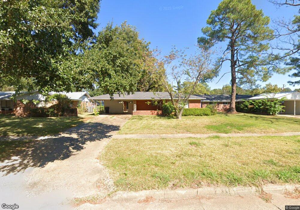
334 E Southfield Rd Shreveport, LA 71105
Broadmoor/Anderson Island/Shreve Isle NeighborhoodEstimated Value: $170,533 - $205,000
3
Beds
2
Baths
1,610
Sq Ft
$119/Sq Ft
Est. Value
About This Home
This home is located at 334 E Southfield Rd, Shreveport, LA 71105 and is currently estimated at $192,133, approximately $119 per square foot. 334 E Southfield Rd is a home located in Caddo Parish with nearby schools including Fairfield Magnet School, Judson Fundamental Elementary School, and Eden Gardens Fundamental Elementary School.
Ownership History
Date
Name
Owned For
Owner Type
Purchase Details
Closed on
Jul 8, 2025
Sold by
Parish Of Caddo
Bought by
Ggg Investing Group and Union Bank
Current Estimated Value
Purchase Details
Closed on
Jun 28, 2024
Sold by
Parish Of Caddo
Bought by
White Oak Title Llc
Purchase Details
Closed on
Jun 12, 2024
Sold by
Parish Of Caddo
Bought by
Eastern Property Corporation and Union Bank
Purchase Details
Closed on
Jul 9, 2018
Sold by
Gulf Ventures Bmo Harris
Bought by
Wine Mary C and Wine Donald
Create a Home Valuation Report for This Property
The Home Valuation Report is an in-depth analysis detailing your home's value as well as a comparison with similar homes in the area
Home Values in the Area
Average Home Value in this Area
Purchase History
| Date | Buyer | Sale Price | Title Company |
|---|---|---|---|
| Ggg Investing Group | $2,228 | None Listed On Document | |
| White Oak Title Llc | $2,097 | None Listed On Document | |
| Eastern Property Corporation | $663 | None Listed On Document | |
| Wine Mary C | $4,200 | None Available |
Source: Public Records
Tax History Compared to Growth
Tax History
| Year | Tax Paid | Tax Assessment Tax Assessment Total Assessment is a certain percentage of the fair market value that is determined by local assessors to be the total taxable value of land and additions on the property. | Land | Improvement |
|---|---|---|---|---|
| 2024 | $1,974 | $12,662 | $2,689 | $9,973 |
| 2023 | $1,842 | $11,559 | $2,561 | $8,998 |
| 2022 | $1,842 | $11,559 | $2,561 | $8,998 |
| 2021 | $1,814 | $11,559 | $2,561 | $8,998 |
| 2020 | $1,814 | $11,559 | $2,561 | $8,998 |
| 2019 | $1,849 | $11,436 | $2,561 | $8,875 |
| 2018 | $1,473 | $11,436 | $2,561 | $8,875 |
| 2017 | $1,879 | $11,436 | $2,561 | $8,875 |
| 2015 | $1,561 | $12,043 | $2,561 | $9,482 |
| 2014 | $1,504 | $11,520 | $2,560 | $8,960 |
| 2013 | -- | $11,520 | $2,560 | $8,960 |
Source: Public Records
Map
Nearby Homes
- 502 Mockingbird Ln
- 2045 Horton Ave
- 2049 River Rd
- 306 Oriole Ln
- 5822 River Rd
- 1919 Audubon Place
- 1923 Bermuda St
- 2013 E Kings Hwy
- 2005 E Kings Hwy
- 5707 Anniston Ave
- 5737 Anniston Ave
- 5108 Dixie Garden Dr
- 1810 Captain Shreve Dr
- 156 Charles Ave
- 636 Pelican Place
- 163 Charles Ave
- 1836 Bryan Place
- 142 Lynn Ave
- 110 Kings Crossing
- 114 Kings Crossing
- 330 E Southfield Rd
- 342 E Southfield Rd
- 405 Haynes Ave
- 326 E Southfield Rd
- 409 Haynes Ave
- 401 Haynes Ave
- 413 Haynes Ave
- 341 Haynes Ave
- 322 E Southfield Rd
- 323 E Southfield Rd
- 331 E Southfield Rd
- 502 E Southfield Rd
- 337 Haynes Ave
- 318 E Southfield Rd
- 503 Haynes Ave
- 410 Haynes Ave
- 2061 Captain Shreve Dr
- 333 Haynes Ave
- 506 E Southfield Rd
- 314 E Southfield Rd