Estimated Value: $587,247 - $652,000
Studio
--
Bath
1,503
Sq Ft
$412/Sq Ft
Est. Value
About This Home
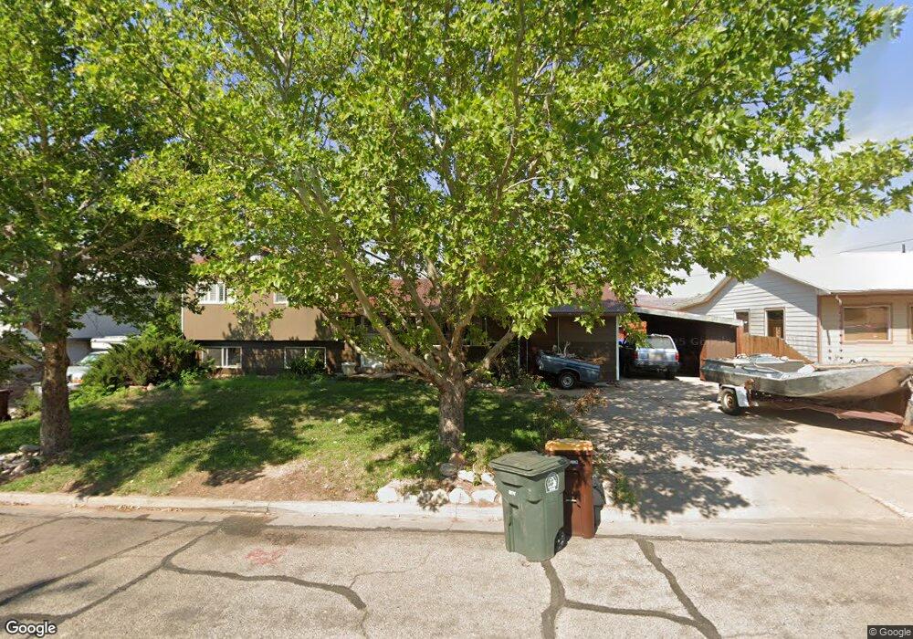
This home is located at 334 Hillside Dr, Moab, UT 84532 and is currently estimated at $619,812, approximately $412 per square foot. 334 Hillside Dr is a home with nearby schools including Helen M. Knight School, Grand County Middle School, and Grand County High School.
Ownership History
Date
Name
Owned For
Owner Type
Purchase Details
Closed on
Mar 11, 2005
Sold by
Lewis James A and Lewis Carli
Bought by
Hoppensteadt Matthew L and Wilson Connie C
Current Estimated Value
Home Financials for this Owner
Home Financials are based on the most recent Mortgage that was taken out on this home.
Original Mortgage
$131,950
Outstanding Balance
$65,648
Interest Rate
5.53%
Estimated Equity
$554,164
Create a Home Valuation Report for This Property
The Home Valuation Report is an in-depth analysis detailing your home's value as well as a comparison with similar homes in the area
Home Values in the Area
Average Home Value in this Area
Purchase History
| Date | Buyer | Sale Price | Title Company |
|---|---|---|---|
| Hoppensteadt Matthew L | -- | -- |
Source: Public Records
Mortgage History
| Date | Status | Borrower | Loan Amount |
|---|---|---|---|
| Open | Hoppensteadt Matthew L | $131,950 |
Source: Public Records
Tax History
| Year | Tax Paid | Tax Assessment Tax Assessment Total Assessment is a certain percentage of the fair market value that is determined by local assessors to be the total taxable value of land and additions on the property. | Land | Improvement |
|---|---|---|---|---|
| 2025 | $3,401 | $586,675 | $75,000 | $511,675 |
| 2024 | $3,401 | $586,675 | $75,000 | $511,675 |
| 2023 | $3,510 | $479,486 | $75,000 | $404,486 |
| 2022 | $2,414 | $451,876 | $75,000 | $376,876 |
| 2021 | $1,484 | $248,673 | $75,000 | $173,673 |
| 2020 | $1,540 | $248,673 | $75,000 | $173,673 |
| 2019 | $1,453 | $248,673 | $75,000 | $173,673 |
| 2018 | $1,440 | $248,673 | $75,000 | $173,673 |
| 2017 | $1,492 | $0 | $0 | $0 |
| 2016 | $1,477 | $0 | $0 | $0 |
| 2015 | $1,026 | $0 | $0 | $0 |
| 2014 | $988 | $0 | $0 | $0 |
| 2013 | $989 | $95,568 | $0 | $0 |
Source: Public Records
Map
Nearby Homes
- 738 Locust Ln
- 248 Hillside Dr
- 552 Nichols Ln
- 499 E 200 S
- 494 E Kachina Way
- 615 Rosetree Ln
- 424 E Secret Cove Ct
- 151 Badgers Bend Unit 25
- 199 S 400 E
- 661 S 400 E
- 115 Badgers Bend Unit 7
- 346 E 200 S Unit A105
- 346 E 200 S Unit A208
- 346 E 200 S Unit A202
- 346 E 200 S Unit A203
- 346 E 200 S Unit A201
- 346 E 200 S Unit A206
- 346 E 200 S Unit A103
- 346 E 200 S Unit A107
- 346 E 200 S Unit A207
- 322 Hillside Dr
- 368 Hillside Dr
- 337 Walker St
- 325 Walker St
- 329 Hillside Dr
- 351 Walker St
- 341 Hillside Dr
- 820 Locust Ln
- 358 Hillside Dr
- 802 Locust Ln
- 317 Hillside Dr
- 355 Hillside Dr
- 365 Walker St
- 344 Crestview Dr
- 326 Crestview Dr
- 370 Hillside Dr
- 840 Locust Ln
- 330 Walker St
- 342 Walker St
- 314 Crestview Dr
Your Personal Tour Guide
Ask me questions while you tour the home.