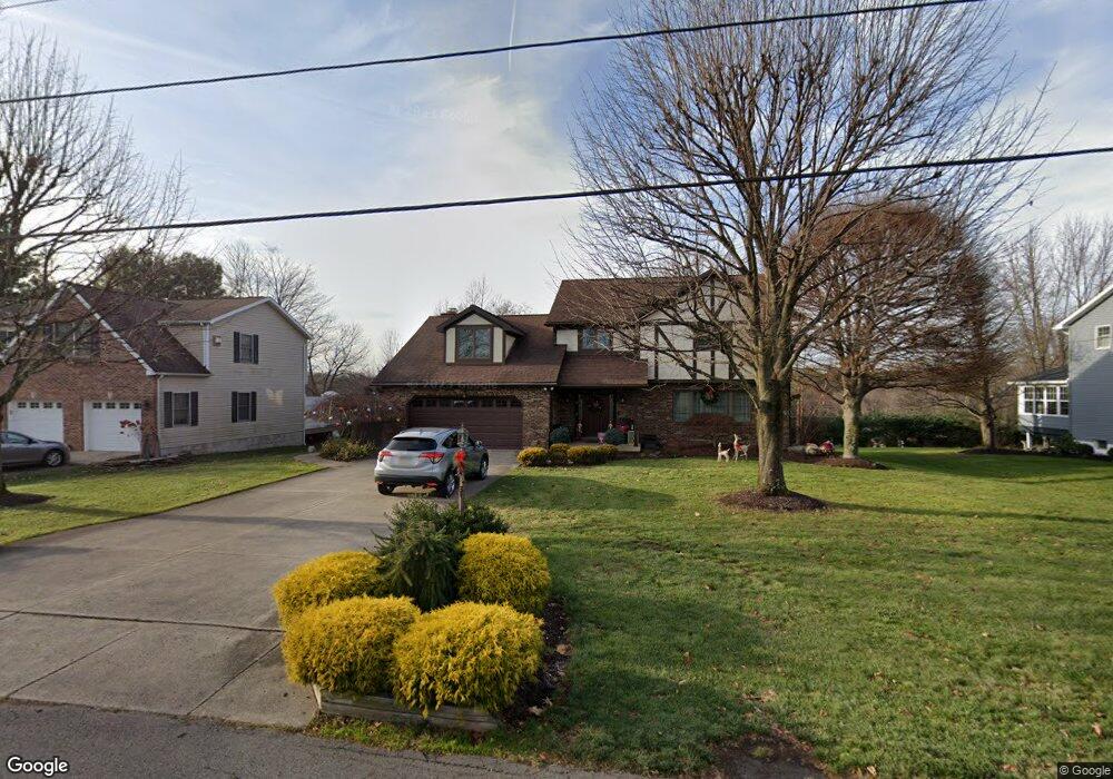
334 Howell Rd Shavertown, PA 18708
Estimated Value: $366,000 - $499,000
--
Bed
--
Bath
2,294
Sq Ft
$189/Sq Ft
Est. Value
About This Home
This home is located at 334 Howell Rd, Shavertown, PA 18708 and is currently estimated at $432,653, approximately $188 per square foot. 334 Howell Rd is a home located in Luzerne County with nearby schools including Dallas Senior High School.
Ownership History
Date
Name
Owned For
Owner Type
Purchase Details
Closed on
Jan 7, 2010
Sold by
Mcandrew Sean M and Mcandrew Lara L
Bought by
Mcandrew Lara
Current Estimated Value
Create a Home Valuation Report for This Property
The Home Valuation Report is an in-depth analysis detailing your home's value as well as a comparison with similar homes in the area
Home Values in the Area
Average Home Value in this Area
Purchase History
| Date | Buyer | Sale Price | Title Company |
|---|---|---|---|
| Mcandrew Lara | -- | None Available |
Source: Public Records
Tax History Compared to Growth
Tax History
| Year | Tax Paid | Tax Assessment Tax Assessment Total Assessment is a certain percentage of the fair market value that is determined by local assessors to be the total taxable value of land and additions on the property. | Land | Improvement |
|---|---|---|---|---|
| 2025 | $6,029 | $278,400 | $47,000 | $231,400 |
| 2024 | $5,843 | $278,400 | $47,000 | $231,400 |
| 2023 | $5,843 | $278,400 | $47,000 | $231,400 |
| 2022 | $5,792 | $278,400 | $47,000 | $231,400 |
| 2021 | $5,792 | $278,400 | $47,000 | $231,400 |
| 2020 | $5,792 | $278,400 | $47,000 | $231,400 |
| 2019 | $5,738 | $278,400 | $47,000 | $231,400 |
| 2018 | $5,682 | $278,400 | $47,000 | $231,400 |
| 2017 | $5,600 | $278,400 | $47,000 | $231,400 |
| 2016 | -- | $278,400 | $47,000 | $231,400 |
| 2015 | $4,681 | $278,400 | $47,000 | $231,400 |
| 2014 | $4,681 | $278,400 | $47,000 | $231,400 |
Source: Public Records
Map
Nearby Homes
- 235 E Center St
- 10 Roosevelt St
- 1 Maple Leaf Rd
- 7 Echo Valley Dr
- 205 Beech St
- 1259 Lower Demunds Rd
- 162 E Overbrook Rd
- 37 E Center St
- 0 Main St
- 65 E Overbrook Rd
- 65 E Overbrook Ave
- 129 Harris Hill Rd
- 120 Frangorma Dr
- 70 Shaver Ave
- 0 Lt Michael Cleary Dr
- 209 Terrace Ave
- 1 Fern Ridge Ct
- 190 Carverton Rd
- 31 Dorchester Dr
- 222 Hillside Rd
- 338 Howell Rd
- 330 Howell Rd
- 122 S Legend Rd
- 181 Limewood Rd
- 342 Howell Rd
- 339 Howell Rd
- 180 Limewood Rd
- 341 Howell Rd
- 177 Limewood Rd
- 343 Howell Rd
- 348 Howell Rd
- 176 Limewood Rd
- 180 Butternut Rd
- 325 Howell Rd
- 328 Howell Rd
- 184 Butternut Rd
- 170 Limewood Rd
- 345 Howell Rd
- 324 Howell Rd
- 186 Butternut Rd