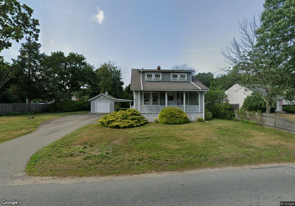
334 King Philip St Raynham, MA 02767
Estimated Value: $475,402 - $566,000
2
Beds
3
Baths
1,404
Sq Ft
$362/Sq Ft
Est. Value
About This Home
This home is located at 334 King Philip St, Raynham, MA 02767 and is currently estimated at $508,101, approximately $361 per square foot. 334 King Philip St is a home located in Bristol County with nearby schools including Merrill Elementary School, LaLiberte Elementary School, and Williams Intermediate School.
Ownership History
Date
Name
Owned For
Owner Type
Purchase Details
Closed on
Aug 26, 2010
Sold by
Procknik Beverly J
Bought by
Sprague Julie B and Procknik Wayne D
Current Estimated Value
Purchase Details
Closed on
Jul 12, 1973
Bought by
Procknik Beverly J
Create a Home Valuation Report for This Property
The Home Valuation Report is an in-depth analysis detailing your home's value as well as a comparison with similar homes in the area
Home Values in the Area
Average Home Value in this Area
Purchase History
| Date | Buyer | Sale Price | Title Company |
|---|---|---|---|
| Sprague Julie B | -- | -- | |
| Procknik Beverly J | $8,300 | -- |
Source: Public Records
Mortgage History
| Date | Status | Borrower | Loan Amount |
|---|---|---|---|
| Open | Procknik Beverly J | $360,000 | |
| Previous Owner | Procknik Beverly J | $30,000 | |
| Previous Owner | Procknik Beverly J | $30,000 |
Source: Public Records
Tax History
| Year | Tax Paid | Tax Assessment Tax Assessment Total Assessment is a certain percentage of the fair market value that is determined by local assessors to be the total taxable value of land and additions on the property. | Land | Improvement |
|---|---|---|---|---|
| 2025 | $4,680 | $386,800 | $189,400 | $197,400 |
| 2024 | $4,675 | $376,400 | $189,400 | $187,000 |
| 2023 | $4,677 | $343,900 | $170,500 | $173,400 |
| 2022 | $4,673 | $315,100 | $161,000 | $154,100 |
| 2021 | $5,029 | $305,700 | $151,600 | $154,100 |
| 2020 | $4,267 | $296,100 | $144,000 | $152,100 |
| 2019 | $3,943 | $277,100 | $125,000 | $152,100 |
| 2018 | $3,838 | $257,600 | $119,400 | $138,200 |
| 2017 | $3,922 | $242,600 | $113,700 | $128,900 |
| 2016 | $3,577 | $238,800 | $109,900 | $128,900 |
| 2015 | $3,197 | $209,800 | $110,200 | $99,600 |
Source: Public Records
Map
Nearby Homes
- 314 Britton St
- 634 Broadway
- 646 Broadway
- 4-B High Ridge Dr
- 123 Center St
- 2 Maplewood Ln Unit 21-1
- 0 Maplewood Unit 21.3 73426136
- 19 Abbey Ln
- 13 Daisy Ave
- 191 Red Oak Terrace
- 41 Scadding St
- 138 Carver St
- 84 Diniz Dr
- 9 Valley Forge Rd
- 1 Elizabeth St
- 658 Broadway
- 11 Settlers Rd
- 930 Bay St
- 68 Sabbatia Ln
- 33 White St
- 340 King Philip St
- 337 King Philip St Unit 3
- 361 Broadway
- 331 King Philip St
- 331 King Philip St Unit 2
- 350 King Philip St
- 339 King Philip St
- 349 King Philip St
- 349 King Philip St Unit 1
- 321 Broadway
- 373 Broadway
- 338 Broadway
- 382 King Philip St
- 382 King Philip St Unit H
- 360 King Philip St
- 0 King Philip St
- 357 King Philip St
- 370 Broadway
- 362 Broadway
- 412 King Philip St
Your Personal Tour Guide
Ask me questions while you tour the home.