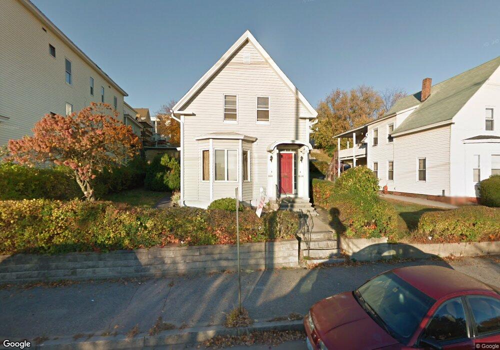
334 Main St Unit 2 Manchester, NH 03102
Notre Dame NeighborhoodEstimated Value: $411,000 - $482,000
2
Beds
1
Bath
900
Sq Ft
$484/Sq Ft
Est. Value
About This Home
This home is located at 334 Main St Unit 2, Manchester, NH 03102 and is currently estimated at $435,329, approximately $483 per square foot. 334 Main St Unit 2 is a home located in Hillsborough County with nearby schools including Middle School at Parkside, Manchester West High School, and Polaris Charter School.
Ownership History
Date
Name
Owned For
Owner Type
Purchase Details
Closed on
Mar 8, 2016
Sold by
Masterson Laura G
Bought by
Rosario Monica M
Current Estimated Value
Home Financials for this Owner
Home Financials are based on the most recent Mortgage that was taken out on this home.
Original Mortgage
$166,822
Outstanding Balance
$135,234
Interest Rate
4.4%
Mortgage Type
FHA
Estimated Equity
$300,095
Purchase Details
Closed on
Dec 19, 2007
Sold by
Charpentier Raymond and Charpentier Donald
Bought by
Masterson Laura G
Create a Home Valuation Report for This Property
The Home Valuation Report is an in-depth analysis detailing your home's value as well as a comparison with similar homes in the area
Home Values in the Area
Average Home Value in this Area
Purchase History
| Date | Buyer | Sale Price | Title Company |
|---|---|---|---|
| Rosario Monica M | $169,933 | -- | |
| Masterson Laura G | $180,000 | -- |
Source: Public Records
Mortgage History
| Date | Status | Borrower | Loan Amount |
|---|---|---|---|
| Open | Rosario Monica M | $166,822 |
Source: Public Records
Tax History Compared to Growth
Tax History
| Year | Tax Paid | Tax Assessment Tax Assessment Total Assessment is a certain percentage of the fair market value that is determined by local assessors to be the total taxable value of land and additions on the property. | Land | Improvement |
|---|---|---|---|---|
| 2024 | $5,901 | $301,400 | $84,600 | $216,800 |
| 2023 | $5,684 | $301,400 | $84,600 | $216,800 |
| 2022 | $5,498 | $301,400 | $84,600 | $216,800 |
| 2021 | $5,329 | $301,400 | $84,600 | $216,800 |
| 2020 | $4,560 | $184,900 | $58,300 | $126,600 |
| 2019 | $4,497 | $184,900 | $58,300 | $126,600 |
| 2018 | $4,329 | $184,900 | $58,300 | $126,600 |
| 2017 | $4,125 | $184,900 | $58,300 | $126,600 |
| 2016 | $4,279 | $184,900 | $58,300 | $126,600 |
| 2015 | $3,945 | $168,300 | $58,300 | $110,000 |
| 2014 | $3,955 | $168,300 | $58,300 | $110,000 |
| 2013 | $3,815 | $168,300 | $58,300 | $110,000 |
Source: Public Records
Map
Nearby Homes
- 183 Cartier St
- 8 Rimmon St
- 47 Blucher St
- 125 W Merrimack St Unit 2
- 486 Granite St
- 15 West St
- 76 W Merrimack St Unit 2
- 00 Adeline St Unit 33
- 67 Stark St
- 633 Canal St
- 699 Montgomery St
- 100 Hollis St
- 162 Blaine St
- 225 Reed St
- 1217 Elm St
- 166 Varney St
- 25 Saint Marie St
- 162 Central St
- 245 Laval St
- 220 Mast Rd