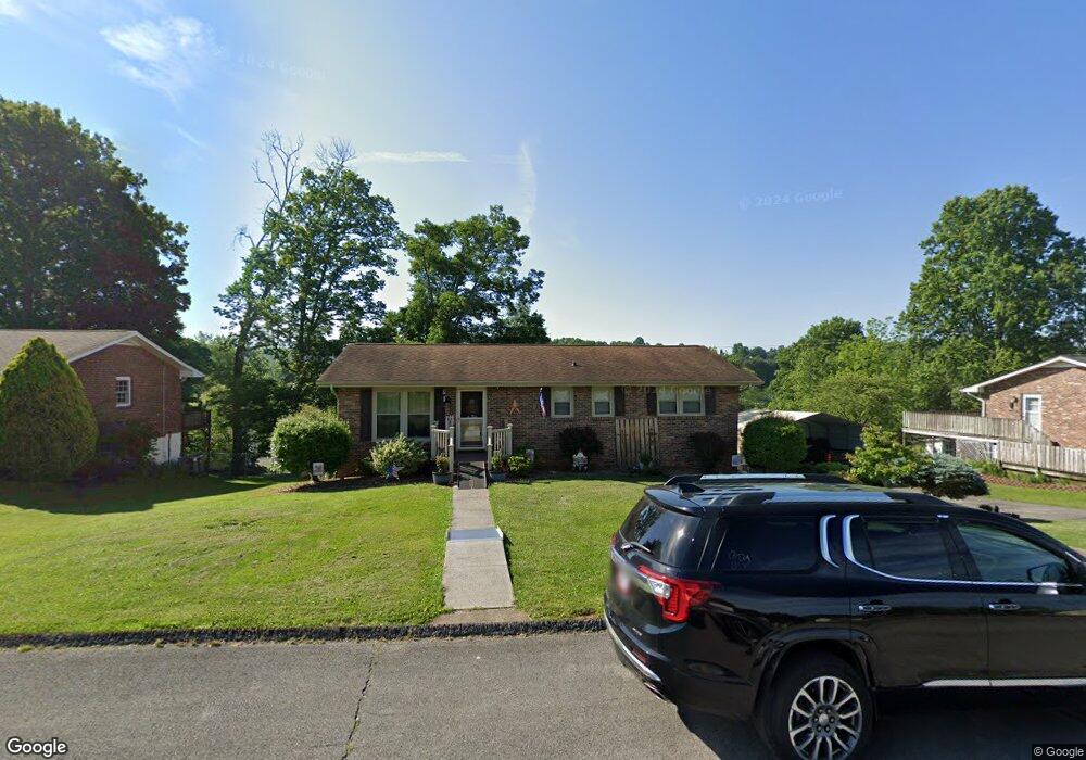
334 Mayfield Dr Bristol, TN 37620
Estimated Value: $265,547 - $300,000
3
Beds
3
Baths
1,725
Sq Ft
$166/Sq Ft
Est. Value
About This Home
This home is located at 334 Mayfield Dr, Bristol, TN 37620 and is currently estimated at $286,137, approximately $165 per square foot. 334 Mayfield Dr is a home located in Sullivan County with nearby schools including Bluff City Elementary School, Sullivan East Middle School, and Sullivan East High School.
Ownership History
Date
Name
Owned For
Owner Type
Purchase Details
Closed on
Jun 30, 1999
Sold by
Roberts Deborah T
Bought by
Woods Kevin L
Current Estimated Value
Create a Home Valuation Report for This Property
The Home Valuation Report is an in-depth analysis detailing your home's value as well as a comparison with similar homes in the area
Home Values in the Area
Average Home Value in this Area
Purchase History
| Date | Buyer | Sale Price | Title Company |
|---|---|---|---|
| Woods Kevin L | $92,000 | -- |
Source: Public Records
Tax History Compared to Growth
Tax History
| Year | Tax Paid | Tax Assessment Tax Assessment Total Assessment is a certain percentage of the fair market value that is determined by local assessors to be the total taxable value of land and additions on the property. | Land | Improvement |
|---|---|---|---|---|
| 2024 | $798 | $31,950 | $3,375 | $28,575 |
| 2023 | $769 | $31,950 | $3,375 | $28,575 |
| 2022 | $769 | $31,950 | $3,375 | $28,575 |
| 2021 | $769 | $31,950 | $3,375 | $28,575 |
| 2020 | $767 | $31,950 | $3,375 | $28,575 |
| 2019 | $767 | $29,825 | $3,375 | $26,450 |
| 2018 | $761 | $29,825 | $3,375 | $26,450 |
| 2017 | $761 | $29,825 | $3,375 | $26,450 |
| 2016 | $740 | $28,750 | $3,375 | $25,375 |
| 2014 | $664 | $28,797 | $0 | $0 |
Source: Public Records
Map
Nearby Homes
- Tbd Hill Dr
- 2158 Vance Tank Rd
- 1237 White Top Rd
- 3493 Weaver Pike
- 496 Pleasant Grove Rd
- TBD Sweet Knobs Trail
- 143 Lazy Acres
- 159 Peoples Rd
- 1026 Deer Harbour Rd
- 292 Peters Rd
- 4045 Weaver Pike
- 1476 Silver Grove Rd
- 1056 White Top Rd
- 403 Martindale Rd
- 302 Martindale Rd
- 100 Martindale Rd
- 101 Timberlane Rd
- 316 Timberlane Rd
- 216 Old Weaver Pike
- 305 Sunnybrook Dr
- 326 Mayfield Dr
- 342 Mayfield Dr
- 472 Springfield Dr
- 480 Springfield Dr
- 318 Mayfield Dr
- 350 Mayfield Dr
- 464 Springfield Dr
- 341 Mayfield Dr
- 488 Springfield Dr
- 325 Mayfield Dr
- 456 Springfield Dr
- 310 Mayfield Dr
- 358 Mayfield Dr
- 357 Mayfield Dr
- 496 Springfield Dr
- 317 Mayfield Dr
- 475 Springfield Dr
- 370 Skyland Dr
- 483 Springfield Dr
- 465 Springfield Dr