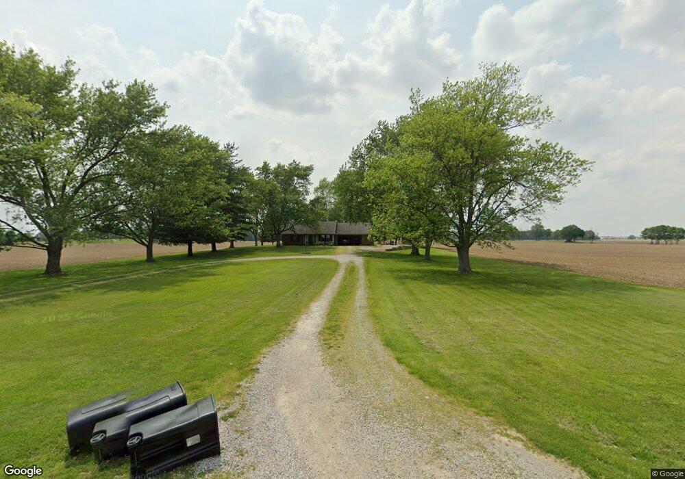
334 S 700 E Franklin, IN 46131
Estimated Value: $206,000 - $408,000
3
Beds
2
Baths
1,454
Sq Ft
$201/Sq Ft
Est. Value
About This Home
This home is located at 334 S 700 E, Franklin, IN 46131 and is currently estimated at $292,903, approximately $201 per square foot. 334 S 700 E is a home located in Johnson County with nearby schools including Needham Elementary School, Franklin Community Middle School, and Custer Baker Intermediate School.
Ownership History
Date
Name
Owned For
Owner Type
Purchase Details
Closed on
Apr 20, 2023
Sold by
Whitworth William
Bought by
Webb Jessica
Current Estimated Value
Purchase Details
Closed on
Mar 10, 2023
Sold by
Webb Patrick and Webb Jessica
Bought by
Whitworth William and Whitworth Susan
Purchase Details
Closed on
Aug 4, 2021
Sold by
Whitworth William W and Whitworth Susan M
Bought by
Webb Patrick and Webb Jessica
Home Financials for this Owner
Home Financials are based on the most recent Mortgage that was taken out on this home.
Original Mortgage
$136,365
Interest Rate
2.9%
Mortgage Type
VA
Create a Home Valuation Report for This Property
The Home Valuation Report is an in-depth analysis detailing your home's value as well as a comparison with similar homes in the area
Home Values in the Area
Average Home Value in this Area
Purchase History
| Date | Buyer | Sale Price | Title Company |
|---|---|---|---|
| Webb Jessica | $145,077 | None Listed On Document | |
| Whitworth William | -- | None Listed On Document | |
| Webb Patrick | -- | Denali Title & Escrow Agency |
Source: Public Records
Mortgage History
| Date | Status | Borrower | Loan Amount |
|---|---|---|---|
| Previous Owner | Webb Patrick | $136,365 |
Source: Public Records
Tax History
| Year | Tax Paid | Tax Assessment Tax Assessment Total Assessment is a certain percentage of the fair market value that is determined by local assessors to be the total taxable value of land and additions on the property. | Land | Improvement |
|---|---|---|---|---|
| 2025 | $1,727 | $232,600 | $41,300 | $191,300 |
| 2024 | $1,683 | $187,200 | $41,300 | $145,900 |
| 2023 | $1,597 | $180,600 | $41,300 | $139,300 |
| 2022 | $1,988 | $192,100 | $41,300 | $150,800 |
| 2021 | $1,561 | $149,600 | $36,400 | $113,200 |
| 2020 | $2,884 | $129,300 | $32,400 | $96,900 |
| 2019 | $2,777 | $129,300 | $32,400 | $96,900 |
| 2018 | $2,524 | $122,700 | $32,400 | $90,300 |
| 2017 | $2,583 | $128,600 | $32,400 | $96,200 |
| 2016 | $2,457 | $119,900 | $32,400 | $87,500 |
| 2014 | $2,365 | $118,100 | $32,400 | $85,700 |
| 2013 | $2,365 | $117,800 | $32,400 | $85,400 |
Source: Public Records
Map
Nearby Homes
- 6227 E State Road 44
- W S 900 W
- 5495 E Greensburg Rd
- 863 S 450 E
- 409 Paris Dr
- 150 E South St
- 2080 Fairway Lakes Dr
- 1810 E Jefferson St
- 3366 S 800 E
- 1083 Beechtree Ln
- 1185 Beechtree Ln
- 1682 Millpond Ln
- 1636 Millpond Ln
- 1679 Millpond Ln
- 1663 Millpond Ln
- 1640 Millpond Ln
- 1650 Millpond Ln
- 1660 Millpond Ln
- 1653 Millpond Ln
- 1686 Millpond Ln
- 285 S 700 E
- 190 S 700 E
- 6950 E 50 S
- 151 S 700 E
- 6844 E 50 S
- 98 S 700 E
- 00 S 700 E
- 0 S 700east Rd
- 0 S 700 E
- 0 S 700east Rd Unit 21431323
- 0 E 700 N Unit 2900400
- 0 E 700 N Unit 21110584
- 0 E 700 N Unit MBR2673444
- 0 E 700 N Unit MBR2613259
- 0 E 700 N Unit MBR2610401
- 0 E 700 N Unit MBR2610416
- 6632 E 50 S
- 6546 E 50 S
- 6534 E 50 S
- 7294 E Division Rd
Your Personal Tour Guide
Ask me questions while you tour the home.