Estimated Value: $98,000 - $144,000
3
Beds
1
Bath
1,614
Sq Ft
$80/Sq Ft
Est. Value
About This Home
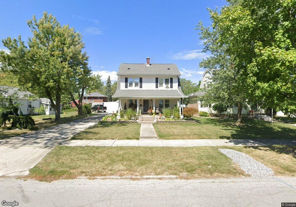
This home is located at 334 W Ashton Ave, Lima, OH 45801 and is currently estimated at $129,149, approximately $80 per square foot. 334 W Ashton Ave is a home located in Allen County with nearby schools including Independence Elementary School, Lima North Middle School, and Lima West Middle School.
Ownership History
Date
Name
Owned For
Owner Type
Purchase Details
Closed on
Jun 26, 2024
Sold by
Fox Michael J and Fox Pamela A
Bought by
Fox Michael J and Fox Pamela A
Current Estimated Value
Purchase Details
Closed on
Apr 19, 1993
Bought by
Fox Michael J and Fox Pamela A
Purchase Details
Closed on
Nov 13, 1992
Bought by
Secretary Of Veterans
Create a Home Valuation Report for This Property
The Home Valuation Report is an in-depth analysis detailing your home's value as well as a comparison with similar homes in the area
Home Values in the Area
Average Home Value in this Area
Purchase History
| Date | Buyer | Sale Price | Title Company |
|---|---|---|---|
| Fox Michael J | -- | None Listed On Document | |
| Fox Michael J | -- | -- | |
| Secretary Of Veterans | -- | -- |
Source: Public Records
Tax History Compared to Growth
Tax History
| Year | Tax Paid | Tax Assessment Tax Assessment Total Assessment is a certain percentage of the fair market value that is determined by local assessors to be the total taxable value of land and additions on the property. | Land | Improvement |
|---|---|---|---|---|
| 2024 | $1,245 | $34,340 | $5,920 | $28,420 |
| 2023 | $1,136 | $27,030 | $4,660 | $22,370 |
| 2022 | $1,136 | $27,030 | $4,660 | $22,370 |
| 2021 | $1,204 | $27,030 | $4,660 | $22,370 |
| 2020 | $1,241 | $24,750 | $4,520 | $20,230 |
| 2019 | $1,241 | $24,750 | $4,520 | $20,230 |
| 2018 | $1,242 | $24,750 | $4,520 | $20,230 |
| 2017 | $1,246 | $24,750 | $4,520 | $20,230 |
| 2016 | $1,260 | $24,750 | $4,520 | $20,230 |
| 2015 | $1,195 | $24,750 | $4,520 | $20,230 |
| 2014 | $1,195 | $23,140 | $4,410 | $18,730 |
| 2013 | $1,163 | $23,140 | $4,410 | $18,730 |
Source: Public Records
Map
Nearby Homes
- 608 W O'Connor Ave
- 340 W Robb Ave
- 645 W O'Connor Ave
- 610 W Robb Ave
- 1200 N Main St
- 123 Flanders Ave
- 416 Hazel Ave
- 812 W Ashton Ave
- 607 W Grand Ave
- 207 W Lane Ave
- 606 N West St
- 735 N Main St
- 616 N Elizabeth St
- 765 Ewing Ave
- 676 Cortlandt Ave
- 128 E Lane Ave
- 638 Hazel Ave
- 648 Hazel Ave
- 631 Hazel Ave
- 400 W Northern Ave