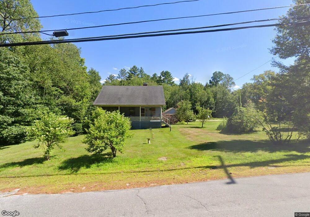
334 W Shore Rd Bristol, NH 03222
Estimated Value: $533,327 - $612,000
3
Beds
2
Baths
1,911
Sq Ft
$299/Sq Ft
Est. Value
About This Home
This home is located at 334 W Shore Rd, Bristol, NH 03222 and is currently estimated at $571,832, approximately $299 per square foot. 334 W Shore Rd is a home with nearby schools including Bristol Elementary School.
Ownership History
Date
Name
Owned For
Owner Type
Purchase Details
Closed on
Jan 8, 2025
Sold by
Parillo Charles M
Bought by
Parillo Ft and Parillo
Current Estimated Value
Purchase Details
Closed on
Jun 5, 2015
Sold by
Friends Of Minot Libra
Bought by
Parillo Charles M and Parillo Genevieve M
Create a Home Valuation Report for This Property
The Home Valuation Report is an in-depth analysis detailing your home's value as well as a comparison with similar homes in the area
Home Values in the Area
Average Home Value in this Area
Purchase History
| Date | Buyer | Sale Price | Title Company |
|---|---|---|---|
| Parillo Ft | -- | None Available | |
| Parillo Ft | -- | None Available | |
| Parillo Charles M | $37,533 | -- | |
| Parillo Charles M | $37,533 | -- |
Source: Public Records
Tax History Compared to Growth
Tax History
| Year | Tax Paid | Tax Assessment Tax Assessment Total Assessment is a certain percentage of the fair market value that is determined by local assessors to be the total taxable value of land and additions on the property. | Land | Improvement |
|---|---|---|---|---|
| 2024 | $6,852 | $290,100 | $106,300 | $183,800 |
| 2023 | $6,584 | $289,400 | $106,300 | $183,100 |
| 2022 | $6,075 | $289,400 | $106,300 | $183,100 |
| 2021 | $5,849 | $289,400 | $106,300 | $183,100 |
| 2020 | $5,977 | $288,900 | $106,300 | $182,600 |
| 2019 | $5,328 | $233,700 | $64,800 | $168,900 |
| 2018 | $4,277 | $196,200 | $64,800 | $131,400 |
| 2017 | $3,616 | $163,400 | $64,800 | $98,600 |
| 2016 | $885 | $42,900 | $42,900 | $0 |
| 2015 | $1,711 | $85,000 | $85,000 | $0 |
Source: Public Records
Map
Nearby Homes
- 383 Wulamat Rd
- 35 Manor Estates Dr Unit 14
- 40 Adams Rd
- 26 Don Gerry Rd
- 199 Cottage City Rd
- 125 Verrill Rd
- 114 Ledgewood Terrace
- 29 Daniels Rd
- 94 Mandi Ln
- 862 Mayhew Turnpike Unit 1
- 333 Lake St
- Lot 7 Hall Rd
- 4 Birchwood Dr Unit A
- 80 Patten Rd
- 301 Perkins Hill Rd
- 00 Ledgewood Cir Unit 7
- 497 W Shore Rd
- 341 Perkins Hill Rd
- 135 Pleasant St
- 30 Beech St Unit 4B
- 00 Upper Birch Dr
- 00 Upper Birch Dr Unit 25
- 342 W Shore Rd
- 17 King Arthur Ln
- 146 Castle Ln
- 35 King Arthur Ln
- 180 Batten Rd
- 7 King Arthur Ln
- 45 King Arthur Ln
- 166 Castle Ln
- 333 W Shore Rd
- 180 Castle Ln
- 136 Castle Ln
- 15 Upper Birch Dr
- 0 King Arthur Ln
- 350 W Shore Rd
- 48 Upper Birch Dr
- 48 King Arthur Ln
- 12 King Arthur Ln
- 196 Castle Ln