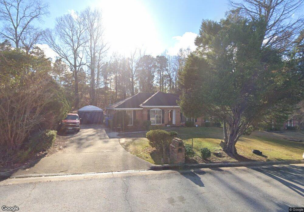
3340 Flintlock Dr Columbus, GA 31907
East Columbus NeighborhoodEstimated Value: $184,000 - $195,000
2
Beds
3
Baths
1,629
Sq Ft
$117/Sq Ft
Est. Value
About This Home
This home is located at 3340 Flintlock Dr, Columbus, GA 31907 and is currently estimated at $190,128, approximately $116 per square foot. 3340 Flintlock Dr is a home located in Muscogee County with nearby schools including Forrest Road Elementary School, Fort Middle School, and Kendrick High School.
Ownership History
Date
Name
Owned For
Owner Type
Purchase Details
Closed on
Jun 29, 2010
Sold by
Peters Renee M
Bought by
Fuller John C
Current Estimated Value
Home Financials for this Owner
Home Financials are based on the most recent Mortgage that was taken out on this home.
Original Mortgage
$98,160
Outstanding Balance
$67,721
Interest Rate
5.5%
Mortgage Type
FHA
Estimated Equity
$122,407
Create a Home Valuation Report for This Property
The Home Valuation Report is an in-depth analysis detailing your home's value as well as a comparison with similar homes in the area
Home Values in the Area
Average Home Value in this Area
Purchase History
| Date | Buyer | Sale Price | Title Company |
|---|---|---|---|
| Fuller John C | $100,000 | None Available |
Source: Public Records
Mortgage History
| Date | Status | Borrower | Loan Amount |
|---|---|---|---|
| Open | Fuller John C | $98,160 |
Source: Public Records
Tax History
| Year | Tax Paid | Tax Assessment Tax Assessment Total Assessment is a certain percentage of the fair market value that is determined by local assessors to be the total taxable value of land and additions on the property. | Land | Improvement |
|---|---|---|---|---|
| 2025 | $2,527 | $64,564 | $12,140 | $52,424 |
| 2024 | $2,527 | $64,564 | $12,140 | $52,424 |
| 2023 | $2,543 | $64,564 | $12,140 | $52,424 |
| 2022 | $2,137 | $52,340 | $12,140 | $40,200 |
| 2021 | $1,878 | $45,984 | $12,140 | $33,844 |
| 2020 | $1,878 | $45,984 | $12,140 | $33,844 |
| 2019 | $1,884 | $45,984 | $12,140 | $33,844 |
| 2018 | $1,884 | $45,984 | $12,140 | $33,844 |
| 2017 | $1,890 | $45,984 | $12,140 | $33,844 |
| 2016 | $1,727 | $41,869 | $7,200 | $34,669 |
| 2015 | $1,729 | $41,869 | $7,200 | $34,669 |
| 2014 | $1,731 | $41,869 | $7,200 | $34,669 |
| 2013 | -- | $30,713 | $7,200 | $23,513 |
Source: Public Records
Map
Nearby Homes
- 3301 Musket Dr
- 2672 Honeysuckle Dr
- 2946 Gleason Ave
- 2942 Poppy Seed Loop
- 3120 Urban Ave
- 6059 Nassau Cir
- 3041 Waddell Dr
- 6366 Lemongrass Dr
- 5923 Nassau Cir
- 2708 Courtland Ave
- 6362 Lemongrass Dr
- 6370 Lemongrass Dr
- 6311 Morning Dew Dr
- 6303 Morning Dew Dr
- 6302 Morning Dew Dr
- 6307 Morning Dew Dr
- 5506 Boby Dr
- 2533 Corineth Dr
- 6636 Foxboro Dr
- 2525 Corineth Dr
- 3334 Flintlock Dr
- 3346 Flintlock Dr
- 3328 Flintlock Dr
- 3352 Flintlock Dr
- 3341 Flintlock Dr
- 3335 Flintlock Dr
- 3118 Crossbow Ct
- 3122 Crossbow Ct
- 3347 Flintlock Dr
- 3329 Flintlock Dr
- 3320 Flintlock Dr
- 3358 Flintlock Dr
- 3110 Crossbow Ct
- 3353 Flintlock Dr
- 3323 Flintlock Dr
- 6107 Crossbow Dr
- 6109 Crossbow Dr
- 3125 Crossbow Ct
- 6111 Crossbow Dr
- 3364 Flintlock Dr