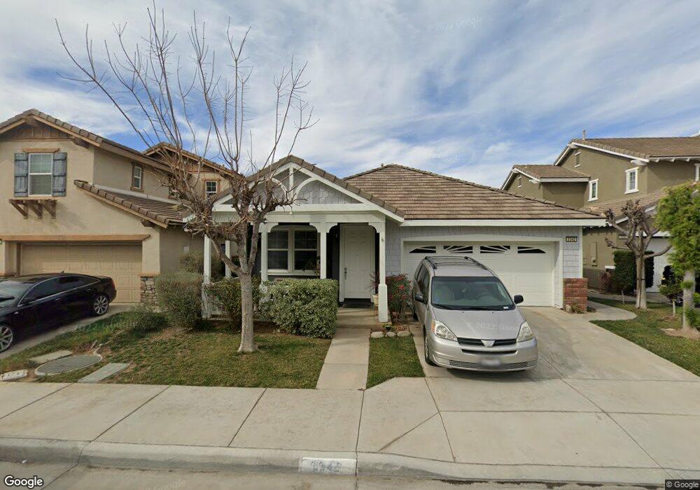
3342 Treehouse Dr Perris, CA 92571
North Perris NeighborhoodEstimated Value: $477,000 - $549,000
3
Beds
2
Baths
2,000
Sq Ft
$259/Sq Ft
Est. Value
About This Home
This home is located at 3342 Treehouse Dr, Perris, CA 92571 and is currently estimated at $518,510, approximately $259 per square foot. 3342 Treehouse Dr is a home located in Riverside County with nearby schools including Avalon Elementary School, Lakeside Middle School, and Rancho Verde High School.
Ownership History
Date
Name
Owned For
Owner Type
Purchase Details
Closed on
Jan 9, 2006
Sold by
Barratt American Inc
Bought by
Lagrada Nestor G and Lagrada Priscila B
Current Estimated Value
Home Financials for this Owner
Home Financials are based on the most recent Mortgage that was taken out on this home.
Original Mortgage
$305,400
Outstanding Balance
$168,903
Interest Rate
6%
Mortgage Type
Fannie Mae Freddie Mac
Estimated Equity
$349,607
Create a Home Valuation Report for This Property
The Home Valuation Report is an in-depth analysis detailing your home's value as well as a comparison with similar homes in the area
Home Values in the Area
Average Home Value in this Area
Purchase History
We collect this data history from publicly available records. To have your information removed, we recommend requesting removal directly through your county’s website.
| Date | Buyer | Sale Price | Title Company |
|---|---|---|---|
| Lagrada Nestor G | $382,000 | Commonwealth Land Title Co |
Source: Public Records
Mortgage History
We collect this data history from publicly available records. To have your information removed, we recommend requesting removal directly through your county’s website.
| Date | Status | Borrower | Loan Amount |
|---|---|---|---|
| Open | Lagrada Nestor G | $305,400 |
Source: Public Records
Tax History
| Year | Tax Paid | Tax Assessment Tax Assessment Total Assessment is a certain percentage of the fair market value that is determined by local assessors to be the total taxable value of land and additions on the property. | Land | Improvement |
|---|---|---|---|---|
| 2025 | $6,194 | $521,691 | $109,312 | $412,379 |
| 2023 | $6,194 | $468,738 | $98,108 | $370,630 |
| 2022 | $5,370 | $426,125 | $89,189 | $336,936 |
| 2021 | $4,505 | $361,123 | $75,584 | $285,539 |
| 2020 | $4,082 | $322,432 | $67,486 | $254,946 |
| 2019 | $3,899 | $313,040 | $65,520 | $247,520 |
| 2018 | $3,800 | $301,000 | $63,000 | $238,000 |
| 2017 | $3,642 | $286,000 | $60,000 | $226,000 |
| 2016 | $4,659 | $256,000 | $54,000 | $202,000 |
| 2015 | $4,497 | $243,000 | $51,000 | $192,000 |
| 2014 | $4,477 | $240,000 | $50,000 | $190,000 |
Source: Public Records
Map
Nearby Homes
- 3424 Cromwell Ct
- 1752 Campanella Dr
- 3957 Coral Haven Ct
- 3968 Barbury Palms Way
- 1666 E Rider St
- 3325 Night Bloom Ln
- 27354 Dunite Dr
- 27330 Dunite Dr
- 27318 Dunite Dr
- 3857 Bella Torre Rd
- 27379 Dunite Dr
- 27365 Dunite Dr
- 27353 Dunite Dr
- 27329 Dunite Dr
- 27341 Dunite Dr
- 27315 Dunite Dr
- 27279 Fossil Cove
- 27344 Fossil Cove
- 27334 Fossil Cove
- 27322 Fossil Cove
- 3350 Treehouse Dr
- 3358 Treehouse Dr
- 3334 Treehouse Dr
- 3366 Treehouse Dr
- 3347 Treehouse Dr
- 3355 Treehouse Dr
- 1939 Mount Verdugo Ln
- 3339 Treehouse Dr
- 1947 Mount Verdugo Ln
- 1955 Mount Verdugo Ln
- 3331 Treehouse Dr
- 3318 Treehouse Dr
- 3363 Treehouse Dr
- 1963 Mount Verdugo Ln
- 3323 Treehouse Dr
- 1907 Mount Verdugo Ln
- 1971 Mount Verdugo Ln
- 3310 Treehouse Dr
- 3315 Treehouse Dr
- 3344 Hammock St
Your Personal Tour Guide
Ask me questions while you tour the home.