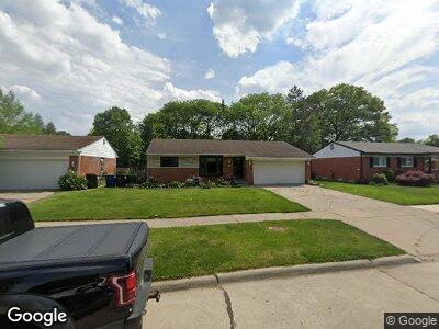
33437 Wexford St Westland, MI 48185
Estimated Value: $227,000 - $257,000
3
Beds
2
Baths
1,218
Sq Ft
$199/Sq Ft
Est. Value
About This Home
This home is located at 33437 Wexford St, Westland, MI 48185 and is currently estimated at $242,012, approximately $198 per square foot. 33437 Wexford St is a home located in Wayne County with nearby schools including Thomas A. Edison Elementary School, Marshall Upper Elementary School, and Adlai Stevenson Middle School.
Ownership History
Date
Name
Owned For
Owner Type
Purchase Details
Closed on
Apr 28, 2017
Sold by
Guziak Gregory and Guziak Patricia A
Bought by
Sanutelli Anthony G
Current Estimated Value
Home Financials for this Owner
Home Financials are based on the most recent Mortgage that was taken out on this home.
Original Mortgage
$136,972
Interest Rate
3.75%
Mortgage Type
FHA
Create a Home Valuation Report for This Property
The Home Valuation Report is an in-depth analysis detailing your home's value as well as a comparison with similar homes in the area
Home Values in the Area
Average Home Value in this Area
Purchase History
| Date | Buyer | Sale Price | Title Company |
|---|---|---|---|
| Sanutelli Anthony G | $139,500 | None Available |
Source: Public Records
Mortgage History
| Date | Status | Borrower | Loan Amount |
|---|---|---|---|
| Open | Sanutelli Anthony G | $130,672 | |
| Closed | Sanutelli Anthony G | $132,550 | |
| Closed | Samutelli Anthony G | $133,044 | |
| Closed | Sanutekl Christine Mae | $136,972 | |
| Previous Owner | Guziak Gregory | $53,000 | |
| Previous Owner | Guziak Gregory | $49,000 |
Source: Public Records
Tax History Compared to Growth
Tax History
| Year | Tax Paid | Tax Assessment Tax Assessment Total Assessment is a certain percentage of the fair market value that is determined by local assessors to be the total taxable value of land and additions on the property. | Land | Improvement |
|---|---|---|---|---|
| 2024 | $3,131 | $106,200 | $0 | $0 |
| 2023 | $2,989 | $94,400 | $0 | $0 |
| 2022 | $3,479 | $87,500 | $0 | $0 |
| 2021 | $3,392 | $84,700 | $0 | $0 |
| 2020 | $3,355 | $77,000 | $0 | $0 |
| 2019 | $3,233 | $72,900 | $0 | $0 |
| 2018 | $2,459 | $62,900 | $0 | $0 |
| 2017 | $923 | $57,600 | $0 | $0 |
| 2016 | $3,251 | $57,400 | $0 | $0 |
| 2015 | $4,629 | $52,410 | $0 | $0 |
| 2013 | $4,484 | $45,810 | $0 | $0 |
| 2012 | $2,281 | $47,250 | $0 | $0 |
Source: Public Records
Map
Nearby Homes
- 7018 Bison St
- 8286 Berwick Dr
- 8433 Berwick Dr
- 33707 Arrowhead St
- 33571 Lancashire St
- 34245 Shawnee St
- 32610 Maplewood St
- 33573 Stacy St
- 7349 Iroquois St
- 6948 Fairfield St
- 6725 N Wildwood St
- 32556 James St
- 32252 Rush St
- 7101 N Wildwood St
- 7339 N Wildwood St
- 6505 Pocahontas St
- 32146 Block St
- 31779 Chester St
- 31780 Rush St
- 0 N Wayne Rd
- 33437 Wexford St
- 33423 Wexford St
- 33451 Wexford St
- 33436 Forest Ct
- 33465 Wexford St
- 33409 Wexford St
- 33422 Forest Ct
- 33450 Forest Ct
- 33438 Wexford St
- 33408 Forest Ct
- 6801 N Farmington Rd
- 33424 Wexford St
- 33452 Wexford St
- 6794 Chirrewa St
- 33466 Wexford St
- 33410 Wexford St
- 6782 Chirrewa St
- 6770 Chirrewa St
- 33462 Forest Ct
- 6816 Chirrewa St