Estimated Value: $195,592 - $216,000
3
Beds
1
Bath
1,995
Sq Ft
$103/Sq Ft
Est. Value
About This Home
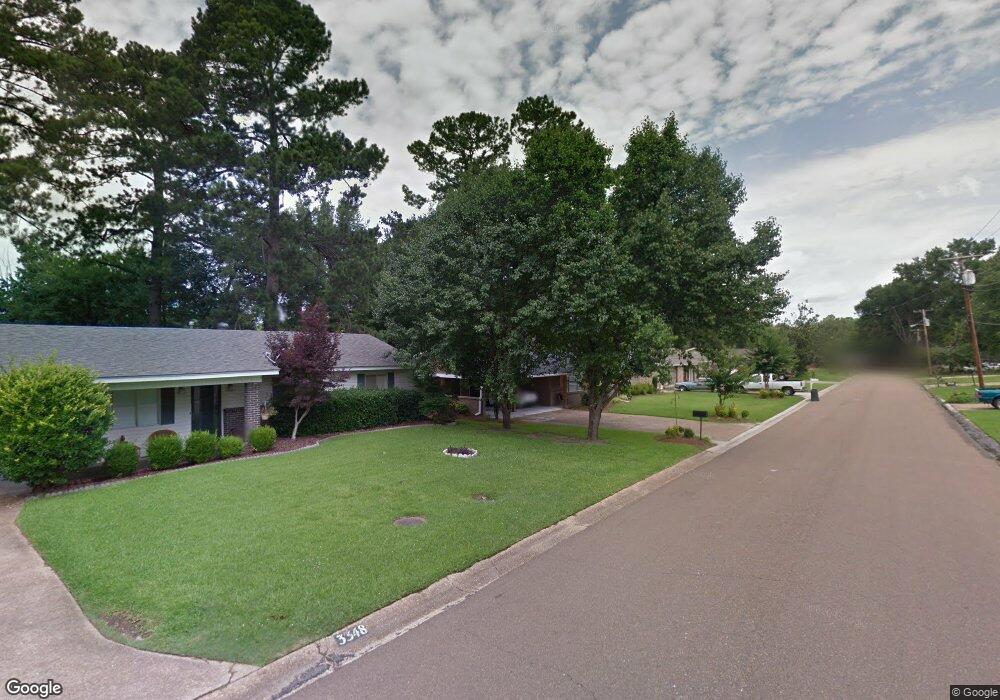
This home is located at 3348 E Lisa Dr, Pearl, MS 39208 and is currently estimated at $204,648, approximately $102 per square foot. 3348 E Lisa Dr is a home located in Rankin County with nearby schools including Pearl Lower Elementary School, Pearl Upper School, and Northside Elementary School.
Ownership History
Date
Name
Owned For
Owner Type
Purchase Details
Closed on
Oct 25, 2024
Sold by
Trueblood Celene and Lowrie Maria Teresa
Bought by
Mills William Wesley
Current Estimated Value
Purchase Details
Closed on
Dec 12, 2023
Sold by
Truer Celene J
Bought by
Trueblood Celene and Lowrie Maria Teresa
Purchase Details
Closed on
Nov 26, 2019
Sold by
Burt Dale F and Burt Gayla A
Bought by
Cline Terrel W and Cline Deborah N
Purchase Details
Closed on
Feb 18, 2011
Sold by
Terrell W Terrell W and Cline Deborah Nell
Bought by
Burt Dale F and Burt Gayla A
Home Financials for this Owner
Home Financials are based on the most recent Mortgage that was taken out on this home.
Original Mortgage
$85,000
Interest Rate
4.01%
Mortgage Type
Purchase Money Mortgage
Create a Home Valuation Report for This Property
The Home Valuation Report is an in-depth analysis detailing your home's value as well as a comparison with similar homes in the area
Home Values in the Area
Average Home Value in this Area
Purchase History
| Date | Buyer | Sale Price | Title Company |
|---|---|---|---|
| Mills William Wesley | -- | None Listed On Document | |
| Trueblood Celene | -- | None Listed On Document | |
| Cline Terrel W | -- | -- | |
| Burt Dale F | -- | -- |
Source: Public Records
Mortgage History
| Date | Status | Borrower | Loan Amount |
|---|---|---|---|
| Previous Owner | Burt Dale F | $85,000 |
Source: Public Records
Tax History
| Year | Tax Paid | Tax Assessment Tax Assessment Total Assessment is a certain percentage of the fair market value that is determined by local assessors to be the total taxable value of land and additions on the property. | Land | Improvement |
|---|---|---|---|---|
| 2024 | $1,113 | $11,089 | $0 | $0 |
| 2023 | $39 | $7,804 | $0 | $0 |
| 2022 | $38 | $7,804 | $0 | $0 |
| 2021 | $38 | $7,804 | $0 | $0 |
| 2020 | $38 | $7,804 | $0 | $0 |
| 2019 | $1,352 | $10,541 | $0 | $0 |
| 2018 | $1,351 | $10,541 | $0 | $0 |
| 2017 | $1,351 | $10,541 | $0 | $0 |
| 2016 | $1,374 | $10,721 | $0 | $0 |
| 2015 | $1,374 | $10,721 | $0 | $0 |
| 2014 | $1,374 | $10,721 | $0 | $0 |
| 2013 | -- | $10,658 | $0 | $0 |
Source: Public Records
Map
Nearby Homes
- 250 Maxine Cir
- 251 Maxine Dr
- 244 Jeffries Dr
- 256 Bruin Ave
- 225 Maxine Dr
- 230 Jeffries Dr
- 191 Chotard Ave
- 180 Pemberton Dr
- 524 Sardis St
- 150 Pemberton Dr
- 118 Hill Cir
- 119 Hill Cir
- 143 Pemberton Dr
- 5204 U S 80
- 2723 Sycamore Cove N
- 469 Robert Michael Dr
- 302 Saint Paul St
- 356 Saint Paul St
- 0 U S 80 Unit 143012
- 204 Charline Dr
- 3342 E Lisa Dr
- 3334 E Lisa Dr
- 3354 E Lisa Dr
- 3353 E Lisa Dr
- 3347 E Lisa Dr
- 146 Bermuda Dr
- 3328 E Lisa Dr
- 3335 E Lisa Dr
- 152 Bermuda Dr
- 3341 E Lisa Dr
- 140 Bermuda Dr
- 3240 Betty Dr
- 3359 E Lisa Dr
- 158 Bermuda Dr
- 134 Bermuda Cir
- 3329 E Lisa Dr
- 159 Bermuda Dr
- 3322 E Lisa Dr
- 128 Bermuda Cir
- 128 Bermuda Cir
Your Personal Tour Guide
Ask me questions while you tour the home.