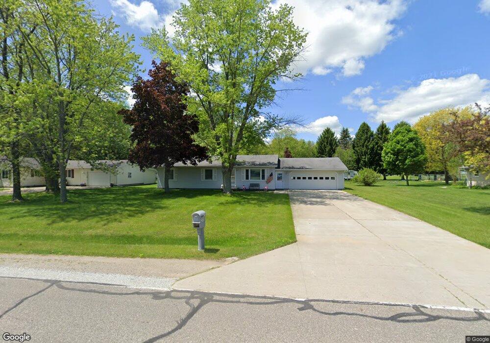
3355 Range Rd Port Huron, MI 48060
Estimated Value: $234,000 - $267,000
3
Beds
1
Bath
1,656
Sq Ft
$153/Sq Ft
Est. Value
About This Home
This home is located at 3355 Range Rd, Port Huron, MI 48060 and is currently estimated at $253,736, approximately $153 per square foot. 3355 Range Rd is a home located in St. Clair County with nearby schools including Michigamme Elementary School, Central Middle School, and Port Huron High School.
Create a Home Valuation Report for This Property
The Home Valuation Report is an in-depth analysis detailing your home's value as well as a comparison with similar homes in the area
Home Values in the Area
Average Home Value in this Area
Tax History
| Year | Tax Paid | Tax Assessment Tax Assessment Total Assessment is a certain percentage of the fair market value that is determined by local assessors to be the total taxable value of land and additions on the property. | Land | Improvement |
|---|---|---|---|---|
| 2025 | $1,159 | $112,800 | $0 | $0 |
| 2024 | $1,124 | $106,300 | $0 | $0 |
| 2023 | $1,038 | $91,400 | $0 | $0 |
| 2022 | $1,917 | $79,700 | $0 | $0 |
| 2020 | $1,755 | $70,800 | $0 | $70,800 |
| 2019 | $1,722 | $62,300 | $0 | $0 |
| 2018 | $1,682 | $62,300 | $0 | $0 |
| 2017 | $1,645 | $60,800 | $0 | $0 |
| 2016 | $852 | $60,800 | $0 | $0 |
| 2015 | -- | $52,700 | $10,000 | $42,700 |
| 2014 | -- | $49,300 | $49,300 | $0 |
| 2013 | -- | $47,200 | $0 | $0 |
Source: Public Records
Map
Nearby Homes
- 000 Atkins Rd Atkins Rd
- 0000 Atkins Atkins Rd
- 4224 Atkins Rd
- 3349 Charmwood Dr
- 4459 Cambridge Dr
- 3115 Spruce Dr
- 4167 N River Rd
- 3345 Beach Rd
- 3971 N River Rd
- 4570 Atkins Rd
- 3625 Angus Rd
- 3639 Teeple Ave
- Lot #9 Thornton Dr
- 3679 Old Farm Ln
- 3559 Lightle Rd
- 3669 Connie Ln
- 4911 Castlewood Dr
- 3075 Westcott Dr
- 3803 Grant Ave
- VL Oxbow Dr
Your Personal Tour Guide
Ask me questions while you tour the home.